Download
1 / 32
470 likes | 1.58k Vues
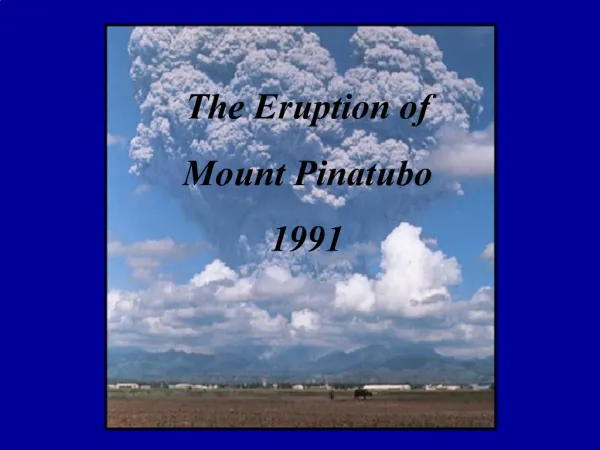
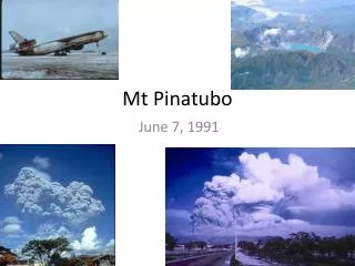
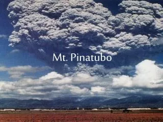
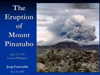
The Eruption of Mount Pinatubo. June 15, 1991 Luzon, Philippines. Jeng Funtanilla Nov. 16, 2005. Philippines. LOCATION: Southeastern Asia, archipelago between the Philippine Sea and the South China Sea, east of Vietnam

E N D
The Eruption ofMount Pinatubo June 15, 1991 Luzon, Philippines Jeng Funtanilla Nov. 16, 2005
Philippines • LOCATION:Southeastern Asia, archipelago between the Philippine Sea and the South China Sea, east of Vietnam • GEOGRAPHY: the Philippine archipelago is made up of 7,107 islands; favorably located in relation to many of Southeast Asia's main water bodies: the South China Sea, Philippine Sea, Sulu Sea, Celebes Sea, and Luzon Strait • TERRAIN: mostly mountains with narrow to extensive coastal lowlands • NATURAL HAZARDS:astride typhoon belt, usually affected by 15 and struck by five to six cyclonic storms per year; landslides; active volcanoes; destructive earthquakes; tsunamis http://www.cia.gov/cia/publications/factbook/geos/rp.html
Major Volcanoes in the Philippines http://vulcan.wr.usgs.gov/Volcanoes/Philippines/Maps/map_philippines_volcanoes.html
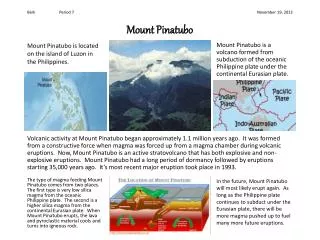
INTRODUCTION • Before April 2, 1991, volcanologists knew Mount Pinatubo as an inconspicuous volcano, active within the past millennium, and the site of an aborted geothermal development. • The Aetas, knew Mount Pinatubo as their home, their hunting ground, and their haven from an The mountain is the home of Apo Namalyari, the Great Protector and Provider. • The people residing in the area, including those in nearby military bases (who received survival training from the Aetas) barely knew of Mount Pinatubo at all. http://volcano.und.nodak.edu/vwdocs/volc_images/southeast_asia/philippines/pinatubo.html
MOUNT PINATUBO • Stratovolcano: A volcano composed of both lava flows and pyroclastic material. • Location: 15.13N, 120.35E • Elevation: • 5725 ft ( 1745 m) above sea level before the June 1991 eruption • 5248 ft (1600 m) above sea level after the June 1991 eruption • almost 500 ft (150 m) of the volcano was blasted away http://volcano.und.nodak.edu/vwdocs/volc_images/southeast_asia/philippines/pinatubo.html
GEOGRAPHIC FEATURES The location of Mount Pinatubo, within the Luzon volcanic arc
TECTONIC SETTING • The plate tectonics in the Philippines is complex and includes plate boundaries that are changing rapidly. Several micro-plates are getting squeezed between two convergent plate margins. • Black triangles = active subduction zones with "teeth" on the over-riding plate, • White triangles = inactive subduction zones with "teeth" on the over-riding plate, arrows = transform or major strike-slip faults, • Red triangles = volcanoes active in the last 10,000 years. http://volcano.und.nodak.edu/vwdocs/volc_images/southeast_asia/philippines/tectonics.html
TECTONIC SETTING In the west, more steeply east-dipping subduction of the Eurasian Plate (South China Sea basin and the transitional oceanic-continental crust of the Palawan block) along the 560 mile (900 km) length of the Manila and Sulu trenches produces a discontinuous line of active volcanoes from Taal in the south to Iraya in the north. Volcanism associated with this subduction zone began about 10 million years ago. http://volcano.und.nodak.edu/vwdocs/volc_images/southeast_asia/philippines/tectonics.html
TECTONIC SETTING In the east, shallow west-dipping subduction of the Philippine Plate at the Philippine Trench produces a line of volcanoes from Balut in the south to Mayon in the north. http://volcano.und.nodak.edu/vwdocs/volc_images/southeast_asia/philippines/tectonics.html
HISTORY Stacked pyroclastic-flow and lahar deposits outside Clark Air Base, testimony to a long history of explosive eruptions.
HISTORY • Largest eruption in the history of the modern Pinatubo occurred over 35,000 years ago. • Distributed over 325 ft (100 m) of pyroclastic flow material on all sides of the volcano. • Marked the birth of the modern volcano. • Ancient Mount Pinatubo • Ancestral Pinatubo was an andesite and dacite stratovolcano whose center was in roughly the same location as the modern Pinatubo. • Today, ancestral Pinatubo is exposed in relict walls of an old 3.5x4.5-km caldera • Modern Mount Pinatubo • Radiocarbon ages suggest that eruptions from the modern Pinatubo have been clustered in at least six and possibly as many as a dozen eruptive periods. http://volcano.und.nodak.edu/vwdocs/volc_images/southeast_asia/philippines/pinatubo.html
ERUPTIVE HISTORY Radiocarbon ages of modern Pinatubo deposits, arranged in chronologic order (not necessarily in stratigraphic order).
1991 VOLCANIC ACTIVITIES • CHRONOLOGICAL ACCOUNT • DESTRUCTIVE AGENTS • ASHFALL • PYROCLASTIC FLOW • LAHAR http://park.org/Philippines/pinatubo/page4.html
CHRONOLOGICAL ACCOUNT • DAY 1: Sunday, June 9, 1991 • 6:00 AM • Eight hours of ash-laden steam clouds ejection ushered. • Followed by pyroclastic flows which flowed down Pinatubo’s gullies into the Maraunot and Moraza rivers. The pyroclastic flows reached some 4-5 kilometers from the center of activity. • 3:15 PM • Philvolcs issued Alert Level 5 at around 3:15 in the afternoon as intermittent occurrences of small pyroclastic flows persisted the whole morning.
CHRONOLOGICAL ACCOUNT • DAY 5: Thursday, June 13, 1991 • DAY 6: Friday, June 14, 1991 • DAY 7: Saturday, June 15, 1991 • DAY 4: Wednesday, June 12, 1991 8:15 AM
BEFORE & AFTER Aircraft hangars at Clark Air Base that collapsed under the weight of rain-saturated ash. (Photograph by E.W. Wolfe, June 29, 1991.)
WARNINGS • Three cornerstones • Interpretation of the origin of the unrest • Simple five-level warning/alert • Hazard map based on the “worst-case” prehistoric eruption. • Warnings were coupled with intensive educational campaign to ensure they are not only received but UNDERSTOOD.
WARNINGS • Five Level Alerts
WARNINGS CREDITS: • Warnings issued by PVO (Pinatubo Volcano Observatory) before the eruption succeeded in saving many lives and property. • Civil Defense and local officials • Mount Pinatubo – followed a remarkable straight and rapid course toward eruption (gave fair warning, no false alarm) • PHILVOCS • USGS
BEFORE Pre-eruption Mount Pinatubo, April 16, 1991.
BEFORE Pre-eruption Mount Pinatubo, April 16, 1991.
DURING Summit caldera, as seen August 1, 1991, from the northeast. The caldera formed by collapse during the June 15, 1991, climactic eruption. A small explosion had just occurred, forming the expanding ash cloud. Throughout the latter half of June and much of July, ash emission kept the caldera obscured; as continuous ash emission changed to intermittent explosions, the caldera became visible.
AFTER Summit caldera and lake, with partly submerged relics (rocky islets) of a dome that grew between July and October, 1992.
BEFORE & AFTER Mount Pinatubo, as seen from near the southwest end of the Clark Air Base runway
BEFORE & AFTER O’Donnell River
BEFORE & AFTER Sacobia Bamban River
BEFORE & AFTER A house by the Sacobia-Bamban River, Bamban, Tarlac, July 23, 1991. Nearly 9 m of sediment were deposited during a single lahar event on August 15, 1991 A house by the Sacobia-Bamban River, Bamban, Tarlac, July 23, 1991.
BEFORE & AFTER Muddy water at the mouth of the Bucao River, October 1, 1991. Massive amounts of sediment were carried from Mount Pinatubo into the Bucao River valley; an unknown but relatively small percentage of that sediment is carried into the South China Sea. Mouth of the Bucao River, April 16, 1991. White-sand beaches of Zambales Province, consisting of pumice and coralline debris, attracted many tourists. The ocean was clear blue; little sediment was carried by the Bucao River. Muddy water at the mouth of the Bucao River, October 1, 1991.
DURING & AFTER Sacobia Bamban River
DURING & AFTER Poonbato bridge was buried (but not swept away) by lahars of 1991 and 1992. Deposits are approximately 25 m thick. Barangay Poonbato (immediately to the right of the field of view) was buried. Bridge to Poonbato, Botolan, Zambales, across the Bucao River, May 28, 1991. Poonbato bridge was buried (but not swept away) by lahars of 1991 and 1992.
Thank You! http://pubs.usgs.gov/pinatubo/contents.html