Download
1 / 30
340 likes | 756 Vues
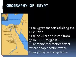
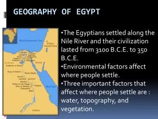
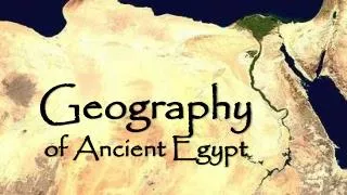
The Geography of Ancient Egypt. Nile River Valley Region. REGION OF ANCIENT EGYPT. REGION OF ANCIENT EGYPT (NEW). 7-YEAR FAMINE IN EGYPT. Legend states this happened under reign of King Djoser (or Zoser ) in the 2600s BCE A period of drought fell over Egypt (“Low Nile”)

E N D
The Geography of Ancient Egypt Nile River Valley Region
7-YEAR FAMINE IN EGYPT • Legend states this happened under reign of King Djoser (or Zoser) in the 2600s BCE • A period of drought fell over Egypt (“Low Nile”) • Sought out the help of Nile River god, Khnum, who eventually ended the drought with “High Nile” floods “I am Khnum. I know the Nile. When it covers the fields, it gives them life. Now the Nile will pour over the land without stopping. Plants will grow, bowing down with fruit. The years of starvation will be over.”
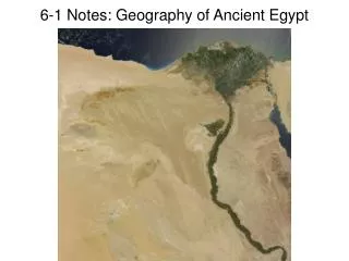
FACTS ABOUT THE NILE • longest river system in world! (4100+ miles) • flows from SOUTH to NORTH -higher land to the south in mountainous Central Africa (gravity!) • drains into Mediterranean Sea -at Nile DELTA (marshland at MOUTH of river) • surrounded by deserts on both sides (natural barriers) -Libyan, Arabian, Nubian • winds blow from north to south -used sails if traveling SOUTHWARD -followed flow of currents if traveling NORTHWARD
IMPORTANCE OF THE NILE • source of FRESH water -drinking, bathing, cleaning, fishing, irrigation, transportation • summer flooding irrigated the narrow fertile valley -left SILT behind (good soil, but clogs irrigation) • fertile plains in valley allowed for FARMING • attracted WILDLIFE (for fishing & hunting) -fish, ducks, geese, hippos, crocodiles, giraffes, ostriches • plentiful VEGETATION (PAPYRUS reeds) -used for making paper, rope, sandals, woven baskets, & huts -main crops = WHEAT (bread) & BARLEY (bread/beer)
CLIMATE • mild winters (Nov. to April); • hot & dry summers (May to Oct.) • hot or warm days; cooler nights • very little rainfall (deserts to east & west) • rainfall in region of central Africa melted snow-capped mountains and rushed up the Nile river (predictable!) -FLOOD season (June to September) -PLANTING season (September to February) -HARVEST season (February to June)
CATARACTS • 6 locations along the Nile River • steep rapids in a river • a very large waterfall • stone cliffs & boulders force river waters to rush through narrow channels • un-navigable (must get boat & goods out of river and walk past these cataracts)