Download
1 / 18
210 likes | 545 Vues
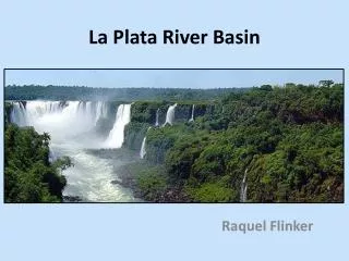
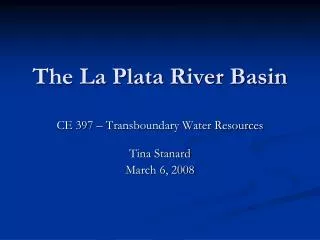
The La Plata River Basin. CE 397 – Transboundary Water Resources Tina Stanard March 6, 2008. La Plata River Basin. 5 countries share the basin: Brazil, Bolivia, Paraguay, Uruguay, and Argentina Area: 3.1 million km 2. Brazil. Bolivia. Paraguay. Argentina. Uruguay. Climate. La Plata.

E N D
The La Plata River Basin CE 397 – Transboundary Water Resources Tina Stanard March 6, 2008
La Plata River Basin • 5 countries share the basin: Brazil, Bolivia, Paraguay, Uruguay, and Argentina • Area: 3.1 million km2 Brazil Bolivia Paraguay Argentina Uruguay
Climate La Plata
History • Long history of mutual distrust • 1967 – Ministers of Foreign Affairs from all 5 countries formed Intergovernmental Coordinating Committee (CIC) • 1969 – CIC forms the La Plata Basin Treaty which establishes the framework for integrated development of the basin • Increasing cooperation, still not integrated management
Hydropower • Cooperation and success of treaty attributed to desire to harness huge hydropower potential in the basin • Bilateral agreements: • 1973 – Itaipu Dam (Brazil and Paraguay) • 1979 – Yacyretá Dam (Argentina and Paraguay) • Top-level agreements did not consider local people or environment
Hydrovia Project • 1989 – proposed to create 3,400 km long waterway • Year-around barge transportation for cheaper transport of goods • Ocean access from land-locked countries • Controversial due to size and environmental impacts
Threats • Water pollution • Due to: • Industrial waste • Lack of sewage treatment • Agriculture • Livestock • Mining operations • Soil erosion • The occasional oil spill • Un-useable water creates water shortages • Severe economic impacts • Adverse health affects
Threats • Infrastructure • Navigation – hydrological alterations • Dams – 27 more proposed dams • Climate change • Over-fishing
Conflicts • Potential and actual conflicts arising from: • Incompatibility between major water works • Energy production vs. river navigation • Exploitation of resources • Lack of environmental protection
Discussion • Among countries with a long history of distrust, how do you inspire cooperation?
Discussion • The WWF proposed solution for the basin: “Assessing whether new infrastructure is the best means of delivering the required service is the first step. If infrastructure is the best option, it should be planned to minimize impacts by: sitting off the river’s main stem and floodplains, mimicking natural water flows, allowing fish passage, controlling thermal pollution, and maintaining sediment and nutrient flows critical to sustaining the health of the rivers. Effective treaties between riparian nations to support integrated river basin management are essential for good governance.” • What incentive do the countries have to follow these environmentally-friendly ideas?
Discussion • What do you think would be the best outcome of the Hydrovia project?