Download
1 / 19
200 likes | 437 Vues
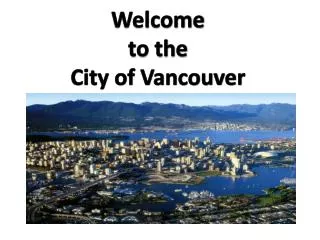
Building the City of Vancouver’s Open Data GIS Infrastructure Platform. Meng Li GIS Systems Analyst City of Vancouver. The New Geospatial Enterprise: Integrating Government, Industry and Research. Presentation Outline:.

E N D
Building the City of Vancouver’s Open Data GIS Infrastructure Platform Meng Li GIS Systems Analyst City of Vancouver The New Geospatial Enterprise: Integrating Government, Industry and Research
Presentation Outline: 1. Why Open Data2. Government as a Platform 3. Open Data Challenges4. Strategy and Platform Building5. Summary The New Geospatial Enterprise: Integrating Government, Industry and Research
1. Why Open Data • Local Government Roles and Data Collected: • transparency and accountability • data collected: legislative, administrative, financial, etc. • public service provision • data collected: GIS data, service (311) & facilities data, etc. • public safety • data collected: crime data, fire/rescue response The New Geospatial Enterprise: Integrating Government, Industry and Research
1. Why Open Data Open Data Objectives:- encourages citizen engagement and participation- promotes transparency and accountability- leads to economic development and innovation The New Geospatial Enterprise: Integrating Government, Industry and Research
1. Why Open Data Local Government Roles and Open Data Objectives Promotes transparency & accountability Government Data Transparency/ accountability Public safety Service provision Leads to economic Development & innovation Encourages citizen engagement & participation The New Geospatial Enterprise: Integrating Government, Industry and Research
2. Government as a Platform What we are now from a e-Government perspective?- Government Being a Service Provider: Human-readable info Online services, applications and portals Government as a service provider Local government roles: Service provision, transparency/accountability, and public safety Technology Business Process People Structured data Unstructured data The New Geospatial Enterprise: Integrating Government, Industry and Research
2. Government as a Platform Why government As a platform?- government as a service provider-vending machine is limited in the new era of open government- government as a platform (Tim O’Really) is to enable the public to participate and innovate: a new level of roles for citizen participation and collaboration- focuses on platform that opens up government data for others to use (Robinson & Yu), not on websites- same platform that empowers public servants and the public to collaborate and innovate The New Geospatial Enterprise: Integrating Government, Industry and Research
2. Government as a Platform What we are moving and building for?- Government As a Platform (Tim O’Reilly): Machine readable Raw data Human-readable info Open data users and drivers Open data benefits Online services, applications and portals Open data Government as a service provider and a platform Expanded roles: Service provision, transparency/accountability, public safety and citizen participation/collaboration Structured data Unstructured data Technology Business Process People The New Geospatial Enterprise: Integrating Government, Industry and Research
2. Government as a Platform Benefits: Citizens Community Programmers professionals Users: Other Application Portals Open Data Portal Front-end Platform: (same for open data & apps) Leverage, improve and build: municipal systems, GIS, 311, SAP, Police, Fire, Parks etc Back-end Technology Platform The New Geospatial Enterprise: Integrating Government, Industry and Research
3. Open Data Challenges What are the major barriers:- legal: license, FOIP - cultural: closed government culture - technological: platform readiness and openness for publishing raw data- data quality issues Structured data Unstructured data Technology Business Process People The New Geospatial Enterprise: Integrating Government, Industry and Research
3. Open Data Challenges Identify who are the user groups?- programmers/developers- professionals (business and community)- interested citizens and general public The New Geospatial Enterprise: Integrating Government, Industry and Research
3. Open Data Challenges Open APIs Professionals/business Raw Data Download Programmers Web Services Citizens/general public Applications Machine readable (XML, CSV) Human readable (HTML, PDF) User Requirements in 2 dimensions (data formats & open accessibility) The New Geospatial Enterprise: Integrating Government, Industry and Research
4. Strategy and Platform Building 4.1 Strategy: quick releases for downloads on ready data sets in open formats, & on simple functionality- data sets: Public VanMap data (150 layers)- formats: csv, Excel, KML, SHP, DWG and XML; ECW/MrSid for imagery.- downloads: via FTP file server, not yet complex APIs The New Geospatial Enterprise: Integrating Government, Industry and Research
4. Strategy and Platform Building 4.2 COV Open Data Technology Platform- front-end web portal: catalogue, metadata,navigation,map visualization and some collaborative features- back-end systems/processes: ETL FME for GIS data extraction & update automation The New Geospatial Enterprise: Integrating Government, Industry and Research
Current Platform > front-end portal: COV open data portal collaboration Feed/live data navigation Catalogue Metadata The New Geospatial Enterprise: Integrating Government, Industry and Research
Current (GIS) Platform > back-end system: Same GIS platform for open GIS data and Public VanMap Public VanMap Other maps WMS Open Data Portal CSV XLS DWG KML SHP XML WebGIS (MapGuide) ETL server/FME Update jobs+live COV GIS Oracle COV SQL Server DB GIS files The New Geospatial Enterprise: Integrating Government, Industry and Research
4.3 Technical Challenges Most existing enterprise systems not designed for open data:- front-end portal still manually maintained - data schema not suitable/meaningful for open data- back-end systems not readily accessible in machine-readable formats and via open APIs- limited automation for data extraction and publishing, resulting in limited live data (e.g. feed)- how to leverage the existing systems, not reinvent the wheel The New Geospatial Enterprise: Integrating Government, Industry and Research
4.4 Future Technology Platform More data, better portal functionality, Open APIs Catalogue Metadata Search Visualization Social functions Open APIs Open Data Portal Public VanMap other maps more web services CSV,XLS,DWG KML,SHP,XML + Open APIs Live data SOA, EAI Semantic Web WebGIS (MapGuide) ETL server/FME Update jobs+live COV GIS Oracle COV SQL Server DB GIS files The New Geospatial Enterprise: Integrating Government, Industry and Research
5. Summary Open Data is about building a platform empowering public servants and the public to collaborate and innovate for fulfilling government roles - COV quick wins started with publishing Public VanMap GIS raw data in open formats for three groups of users (not just programmers)- Our initial success built on the platform of a simple and easy-to-use front-end portal and a flexible/open backend with update automation - Our future innovation lies in a more open and participatory platform readily exposing government data & information to the public The New Geospatial Enterprise: Integrating Government, Industry and Research