Download
1 / 29
290 likes | 440 Vues
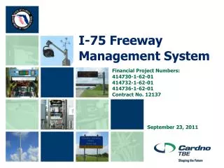
July 29, 2009. Toledo Freeway Management System Public Sector Stakeholder Meeting. George Saylor, PE ODOT Senior ITS Engineer . Toledo FMS Goal. To Utilize State-Of-The-Art Technology To Reduce Congestion & Increase Safety On Toledo Area Roadways. Toledo Regional Systems Map. Devices.

E N D
July 29, 2009 Toledo Freeway Management System Public Sector Stakeholder Meeting George Saylor, PE ODOT Senior ITS Engineer
Toledo FMS Goal To Utilize State-Of-The-Art Technology To Reduce Congestion & Increase Safety On Toledo Area Roadways.
Devices • 10 Dynamic Message Signs • 60 CCTV Cameras • 34 Flow Detectors • 1 (New) Highway Advisory Radio • Currently there are 3 already in place • 60 Miles Of Speed Detection
Dynamic Message Signs (DMS) Definition: Signs that are capable of displaying a variety of messages FMS uses: • Warn motorists of congestion due to incidents • Display travel times for roadway segments
Closed Circuit Television (CCTV) Definition: Cameras that are used to transmit a signal to a specific place, on a limited set of monitors FMS uses: • To detect and confirm incidents on major routes in the Toledo area
Highway Advisory Radio (HAR) Definition: Low powered AM radio stations that provide motorists with traffic information FMS uses: • To provide motorists travel times, incident information, construction activities, and on-going or special events that may impact traffic
Flow Detectors Definition: Devices used to gather real-time speed data FMS uses: • Formulate the speed data to produce travel times • Detect real-time traffic conditions • May provide traffic counts
Device Locations • DMS - in advance of system-to-system interchanges or other primary diversion opportunities • CCTV - continuous coverage if possible; spot locations as necessary • HAR - similar to DMS but anticipate 5-9 mile range • TMC - District 2 office
Typical Construction • Device locations by GPS coordinates • No fiber optics • Leased telecommunications services • Pole-mounted cabinets • Construction sequencing if necessary • ODOT responsible for communications equipment • Contractor tests devices locally • Interim operations possible
Device Map Map taken from 2008 DPP
Freeway Service Patrol The mission of the Freeway Service Patrol (FSP) is to improve traffic safety and maintain traffic flow by assisting with the efficient clearing of freeway travel lanes and shoulders of obstructions and providing traffic control around incidents. Toledo’s FSP is operated from the Northwood Outpost
Traffic Management Center • Consolidates the surveillance, monitoring, and control of a Freeway Management System • Communicates traffic restrictions (incidents), travel time, and travel conditions to the motoring public through the use of various devices. • Works closely with Freeway Service Patrol • Staffed during peak traffic hours
Toledo TMC • Operate FMS and ODOT signal systems • Use existing space in D2/Bowling Green • Central control system is BuckeyeTraffic • Typical TMC about 500 SF • No traditional video wall • Remote operations possible • 911 data coordination • Satellite ops at Lucas Co. EMA
Buckeye Traffic • Central Operating Software • Password protected interface can control CCTV, DMS, and HAR from any computer. • Can display color coded speed maps to detect incidents. • Will be used for Toledo FMS • Website • Repository for incident information, roadway weather conditions, and scheduled construction
Speed Map • Speed data is updated every minute during the day and every 3-5 minutes overnight > 50 MPH 26 - 50 MPH 0 - 25 MPH * Toledo will have a similar map
Public Camera Views * Toledo will have a similar map
Public DMS Views * Toledo will have a similar map