Physical Geography
Physical Geography. US and Canada. The Continent. Canada : Second largest country in the world. The longest non-militarized border in the world (8,900 km). Trade agreement since 1989. Several similarities but different societies. US: Fourth largest country in the world.

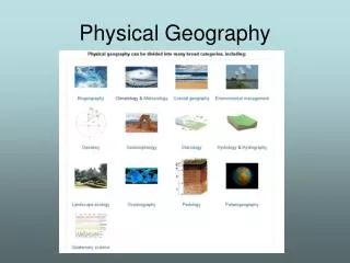
Physical Geography
E N D
Presentation Transcript
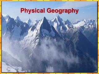
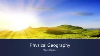
Physical Geography US and Canada
The Continent • Canada: • Second largest country in the world. • The longest non-militarized border in the world (8,900 km). • Trade agreement since 1989. • Several similarities but different societies. • US: • Fourth largest country in the world. • 48 continental (contiguous) statesplus Alaska and Hawaii • Mexico • We’ll do Mexico next unit!
More about the Continent • Rich in natural resources • Major Landforms: • Eastern Lowlands • Flat plain along Gulf of Mexico and East Coast with good harbors • Bordered by Piedmont plateau • Appalachian Highlands • Appalachians extend 1600 miles from Canada to Alabama • Catskills, Blue Ridge, Smoky Mountains are in Appalachians • 400 million years old • Once as tall as Alps and Rockies
More Landforms • Interior Lowlands • Flat land, flattened by glaciers thousands of years ago • Interior Plains, Great Plains and Canadian Shield • Gradually rise from East to Rockies in West • Western Mountains • Rocky Mountains • Series of ranges from Alaska to Mexico • 3000 miles long • Continental Divide in Rockies • Separates rivers flowing east and west • Between Rockies and Coast • Series of ranges: Cascades, Sierra Nevada run from California to Alaska • Part of the Ring of Fire
Islands • North Canada • Near Arctic Circle • Largest Islands: Elsmere, Victoria, and Baffin
More Islands • Archipelagoes of US • Aleutian Islands • Barren, off coast of Alaska • Hawaiian Islands • Not geographically part of NA • Stretches 1500 miles!
Pacific Northwest Midwest New England Regions of the US D.C. Southwest Mountain West Mid Atlantic States South Hawaii and Alaska are not part of a region
Resources • Oceans and Waterways • Three Oceans • Atlantic, Pacific, and Arctic • Large freshwater lakes • Great Lakes; part of St. Lawrence River system • Mississippi-Ohio-Missouri River system • Land • LOTS of land & Fertile soil make US leading food producer in world • Huge forests • Minerals and Fossil Fuels • Canadian Shield and Western Mountains: Iron, Nickel, copper, gold, uranium • Oil and Natural Gas in Plains, Alaska, and Gulf of Mexico • BUT US largest consumer of fossil fuels
Precipitation • East/west gradient in precipitation • Wet air from the Pacific. • When reaching the coastal chain and the Sierra Nevada is forced to gain altitude. • precipitation over the West Side of these mountain chains. • The air becomes dryer as it goes over mountains • Less rain falling over the western part of the Great Plains. • As it moves east, air masses gain in humidity through land evaporation and precipitation levels rise.
Climate • Very diversified, ranging from continental humid to sub tropical. • Relatively simple weather system: • Varies from west to east. • Influenced by air masses moving from the arctic (cold and dry) and from the gulf of Mexico (hot and wet). • The southeast section of the United States: • A high precipitation level. • Result of movements of air masses from the gulf of Mexico. • Subject to tropical storms coming from the South Atlantic
More Climate • Tundra in far north • Treeless, 40˚ is average in July! • Coastal ranges prevent arctic air from entering interior • North Central and northeast • Cold winters, warm summers • Great for agriculture: Breadbasket of US • Pacific Coast • Marine west coast climate; summers warm, winters rainy and mild • Southwest • Desert climate • Tropical • Hawaii and Florida
The Anglo-American cultural space • US and Canada are known as “Anglo-America” • Bound together by geographic, cultural, political and economic ties • As opposed to Latin America (Spanish and Portuguese cultural origin). • Prominence of English Language. • A few exceptions: • French Canada, Hawaii, US/Mexico border regions, southeast Florida, First Nations and the Black population. • Immigration is changing this space. • English remains the language of power and business.
Immigration to the United States, 1820-2002 Latin America Asia Southeast Europe Germany Scandinavia British Isles
Transportation • Overcoming space • Always been a challenge. • Massive transport infrastructure (from trails to railways to highways to the information highway). • Transportation • Supports the economic efficiency of the United States and Canada. • Comes with high energy and infrastructure costs. • Transportation uses 27% of all the energy. • The American consumption of energy is 3 times greater than Europeans.
Interstate Highway System • Built since the 1950s: • Peak construction during the 1960s. • Mainly completed by 1991. • Currently about 45,000 miles of highways. • Trans Canadian highway is the Canadian equivalent. • Interstates have changed urban spaces: • Reduced the dominance of downtown areas • Providing an alternative locational choice - both for commercial and residential activities: the suburbs
Impact of the Interstate System • Impacts on businesses: • Attracted by the lower rents in the suburbs • Availability of parking space. • Near suppliers and customers. • Individual families: • The interstates made commuting much easier (more distance for the same amount of time). • Car ownership increased dramatically • Public transport was relatively neglected in this process. • Suburban America • Made possible by highways and personal mobility. • Reflects American ideals of private ownership and individualism: • Attracted by the more spacious surroundings for housing. • Fled the cities with all of their urban problems. • Increase in the size of housing units. • Automobile dependency
Canada Not Just America’s Hat!
Canada • Climate and location • Similar to Russia: • Continental scale. • Latitude (plus, it’s stoopid cold) • High dependency to the United States: • Trade 75%. • Each other’s largest trading partners • Resources are in the north while population is in the south. • Provinces and territories combined in a federal system (like what the US has)
French Canada • Linguistic and cultural distinctiveness. • Along the St. Lawrence Valley settled in “long lots”. • Montreal is the second largest French-speaking city in the world. • Significant lumber, mining and hydroelectric resources
The Northern Frontier • Most of it in Canada with the exception of Alaska. • Many natural resources, but difficult to access: • Distances. • Permafrost. • Low populations concentrated along extraction sites. • Tar sands of Northern Alberta: • More oil than Saudi Arabia. • Trapped as bitumen (oil shale) in sand formations. • .Released by Hydraulic Fracturing (Fracking)