Mesozoic Era: Landscapes, Dinosaurs & Tectonic Shifts
110 likes | 150 Vues
Explore the Mesozoic Era (66-250 million years ago) and its significance, from dinosaur extinction to tectonic revolutions. Discover the colorful strata and economic importance of this era.

Mesozoic Era: Landscapes, Dinosaurs & Tectonic Shifts
E N D
Presentation Transcript
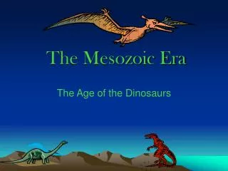
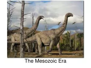
Chapter 14 The Mesozoic Era The Mesozoic Era represent the time between 66 to 250 million years ago. This Era holds special interest because of:- 1. The appearance and extinction of the Dinosaurs. 2. The colorful strata that highlight the stunning landscapes of the canyon and plateau country of the southern USA, Ma’in (Triassic) and Kurnub Sandstone (Cretaceous) Formations in Jordan. 3. The black shales which is important in many continents. 4. Cretaceous strata are especially important economically because they contain the world’s second largest coal reserves and a large share of its petroleum. 5. Global tectonic revolution which cased the breakup of Gondwana, change of climate and nonmarine plants and vertebrates.
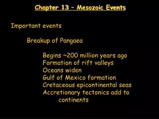
14.1 Opening of the North Atlantic • The breakup of Pangea began near the end of the Triassic • Period between present North America and Africa. • The breakup was caused by change of convection • following a long period of heat accumulation in the mantle, • due to the insulating effect of the super continent. • Fig.14.3. • The breakup proceeded rapidly during later Mesozoic • time with the ultimate separation of Greenland from North • America at the end of the Cretaceous Period. • During the middle Jurassic, the southern margin of North • America began separating from South America to form • Gulf of Mexico basin. Fig. 14.4. • In chapter 7 we noted that such structures typically form • at the triple junction where super continent first breakup.
Fig. 14.3 • Fig.14.3 • Initial breakup of a supercontinent by:- • Heating and doming • rifting and sea-floor • spreading based upon • the North Atlantic and • Gulf of Mexico basin. • block faulting, basaltic • dikes, volcanic • eruptions and non • marine sedimentation. • normal marine passive- • margin deposition • including reefs, tethyan • fauna had become • established in Gulf of • Mexico.
Fig.14.4 Paleotectonic map for middle Jurassic time showing the initial opening of the North Atlantic and Gulf of Mexico ocean basins.
Fig. 14.6 Paleotectonic map for end of Cretaceous time showing the opining of North America Atlantic ocean basin. Note initial separation of Greenland by opening of the Labrador Seaway and separation of Italy from the Iberian Peninsula. The Caribbean plate carrying Cuba also is shown forming between North and South America. Dark color shows new cretaceous sea floor. Late Triassic to Early Jurassic rifting also disrupted the connection between northern Africa and Europe.
14.2 Mesozoic Geology 1. The Sonoman orogeny occurred in Permo-Triassic time. 2. The craton remained above sea level meanwhile, and Triassic non marine red-bed deposition followed that of the late Permian time. 3. Worldwide Cretaceous transgression was the last major flooding of continents. It was caused mainly by rapid sea floor spreading and the resulting enlargment of the ocean ridges, which displaced much sea water onto the continents. 4. Effects of the transgression varied greatly, depending upon topography, climate, and availability of sediments in different regions. 5. The rise of sea level was so great that pelagic sedimentation normally confined to the deep seas spread onto some cratons and produced chalk and black shale deposits.
14.3 Mesozoic Paleoclimate Global paleoclimate was influenced by feedback effects of the transgression. The climate during late Mesozoic was warm and uniform as it indicated from the following points fossils and oxygen isotope data. The warm climate was caused by the enlargement of sea area coupled with location of both poles in oceanic areas and the excess CO2 resulted from volcanic eruption.
Mesozoic Stratified Rocks in Jordan Triassic Formations: from oldest to youngest Main Formation Dardur Formation Ain Musa Formation Hisban Formation Mukeiris Formation Iraq El amir Formation Um Tina Formation Abu Ruweis Formation Jurassic Formations: from oldest to youngest Hihi Claystone formation Nimr Limestone Formation Salil Sandstone Formation Dhahab Limestone Formation Hamam Sandstone Formation and Ramla Formation. Mughanniyya Limestone Formation.
Cretaceous Formationsfrom oldest to youngest Kurnub Sandstone Formation Naur Limestone Formation Fuhays Marl Formation Hummer Limestone Formation Shuayeb Marl Formation Wadi As sir limestone Formation Wadi um Ghudran Formation Amman Silicified Limestone Formation Al Hasa Phosphorite Formation