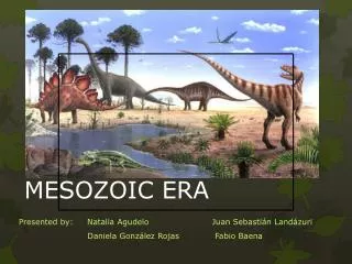
The Mesozoic Era
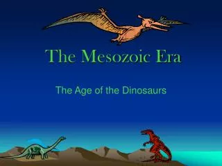
The Mesozoic Era. CHAPTER 11. The Mesozoic (245 to 65 Mya). Beginning and ending with extinctions Spans Three Periods Triassic: 245 to 208 m.y. Jurassic: 208 to 188 m.y. Cretaceous: 144 to 65 m.y. Supercontinent of Pangaea: rifted apart over a span of 150 million years.

The Mesozoic Era
E N D
Presentation Transcript
The Mesozoic Era CHAPTER 11
The Mesozoic (245 to 65 Mya) • Beginning and ending with extinctions • Spans Three Periods • Triassic: 245 to 208 m.y. • Jurassic: 208 to 188 m.y. • Cretaceous: 144 to 65 m.y. • Supercontinent of Pangaea: rifted apart over a span of 150 million years.
Breakup of Pangaea: four stages (three during Mesozoic) Stage One: Triassic • Rifting and volcanism, normal faulting • tensional stresses separated N. America from Gondwanaland • similarly, Mexico from S. America • similarly, eastern N. America from N. Africa • Sea-floor generation during opening of oceans (basaltic volcanism)
Breakup of Pangaea (cont) Stage Two: Triassic-Jurassic • Rifting of narrow oceans between S. Africa and Antarctica, Africa and India • Massive outpouring of basaltic lavas (7 million km2)
Breakup of Pangaea (cont) • Stage Three: Jurassic-Cretaceous • Atlantic Ocean rift extended northward • Clockwise rotation of Eurasia • Closing of eastern Tethys Sea (pre-Mediterranean) • S. America-Africa split apart • Australia-Antarctica remained intact • Eastern N. America-Greenland remained intact
Breakup of Pangaea (cont) Stage Four: post-Mesozoic • Complete N. America-Eurasian split • Antarctica-Australia split
Triassic and Jurassic (eastern and southern areas) • Normal fault-bounded basins developed due to rifting: Nova Scotia to North Carolina • troughs filled with terrestrial sediments and volcanics • Newark Group (Upper Triassic-Lower Jurassic) • Palisades basalts of NJ and NY (190 m.y. ago)
Figure 11-3 (p. 384) Generalized paleogeographic map for the Triassic of North America.
Development of Gulf of Mexico • occupied areas opening south of Appalachian-Ouachita folded mountains • filled with Upper Triassic-Lower Jurassic salts and evaporites (indicating aridity); over 1000 m deposited; origin of Gulf coast salt domes of today
Figure 11-7 (p. 387) Generalized paleogeographic map for the Jurassic of North America.
Early Mesozoic Evaporites • Evaporites accumulated in shallow basins • as Pangaea broke apart during the Early Mesozoic • Water from the Tethys Sea flowed into the Central Atlantic Ocean
Early Mesozoic Evaporites • Water from the Pacific Ocean flowed into the the newly formed Gulf of Mexico • Marine water from the south flowed into the area that would eventually become the southern Atlantic Ocean
Cretaceous (eastern and southern areas) • Flooding of coastal lowlands due to high sea levels • a. Atlantic and Gulf Coastal Plains inundated as they acted as subsiding shelves at this time • b. thick deposits of deltas, barrier islands, shelves, reefs, etc.formed • c. Florida: shallow submarine bank for limestones • d. reefs made of rudistid bivalves rimmed Gulf Coastal area duringthe Early Cretaceous • e. extensive chalk deposits of Cretaceous sea due to massive production of microscopic calcareous plankton (coccoliths); creta = chalk • Rifting and ocean opening on eastern side led to closure and compression on the western side of continent; subduction resulted.
Figure 11-12 (p. 392) Generalized paleogeographic map for the Cretaceous of North America.
Triassic--Western North America • Steeply dipping subduction zone • Volcanic arcs and micro-continents carried to western margin (displaced or allochthonous terranes—as many as 50 now known) • Massive accretion by subduction (including volcanism), and tectonic accretion of displaced terranes • Tectonic collage of displaced terrains may be 70% of total western Cordilleran; termed accretionary tectonics
Map of the larger allochthonous (accreted) terranes of western North America. The rocks in these terranes contain rocks of Paleozoic age, or older. The pink areas may be displaced areas of the North American continent, but the green areas probably originated as parts of other continents.
Triassic--Western North America • Sonoma Orogeny: Permian-Triassic, Nevada • island arc collided with west coast • then a west-dipping subduction zone • added 300 km new area to west
Jurassic-Early Tertiary-Western N. America • Nevadan Orogeny • Formation of convergent mélange deposits • Great volumes of granodiorite intruded: Sierra Nevada, Idaho, and Coast Range batholiths • Sevier Orogeny • basement-involved tectonics: multiple imbricated thrust faults (low-angle décollement structures) • mainly seen in NV and UT, also in MT, BC, Alberta • most famous thrust fault: Lewis Thrust (65 km displacement) • Laramide Oroeny: • Deformation more easterly • Created original Rocky Mountain Landscape • New Mexico, Colorado, Wyoming Mountain
Figure 11-22 (p. 396) Mesozoic batholiths in west-central North America.
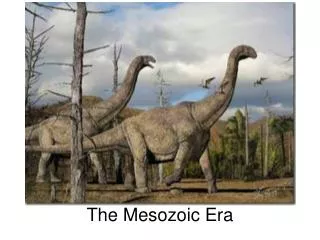
Jurassic Sedimentation • Navajo Sandstone (Lower Jurassic, MT, WY, NV, Alberta): clean recycled eolian sands deposited in coastal dune and shoreline environments • Sundance Formation (Middle) Jurassic, famous for fossil reptiles): deposits of the Sundance Sea • Morrison Formation (Upper Jurassic, famous for dinosaurs): swampy plain deposits formed as Sundance Sea regressed upon rising of Cordilleran highlands to the west
Figure 11-26 (p. 398)Paleogeographic map for the early Jurassic of the western United States, showing general extent of sea and land as well as paleolatitudes.(From Stanley et al. 1971. Bull. Am. Assoc. Petrol. Geol. 55(1): 13.)
Figure 11-27 (p. 398) Region in the western North America inundated by the Middle Jurassic Sundance Sea. (Land areas are shown in tan, marine areas in blue.)
Cretaceous Sedimentation • Early Cretaceous Seaway: marine intrusions leaving deposits south from Arctic Ocean and north from Gulf of Mexico, dry land between two seaways (UT and CO), seas withdrew during Middle Cretaceous regression • Late Cretaceous Seaway: greatest of marine intrusions (transgressions) connected Gulf of Mexico and Arctic Ocean via epicontinental seaway (Western Interior Seaway); flooded area = foreland basin