Download
1 / 11
110 likes | 262 Vues
The Tribal Information Management System (TIMS) integrates environmental data for federally recognized tribes, enabling comprehensive spatial analysis and visualization through a full-function geographic information system (GIS). TIMS bridges core enterprise and geospatial reference information, focusing on partnerships for improved data access. Key features include access to EPA STORET monitors, USGS NWIS monitors, hydrography layers, and regulated facilities data. By being exclusively available to EPA AIEO, tribes, and trusted partners, TIMS offers timely data management while enhancing collaboration.

E N D
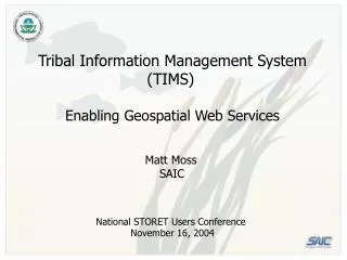
Tribal Information Management System (TIMS) Enabling Geospatial Web Services Matt Moss SAIC National STORET Users Conference November 16, 2004
Tribal Information Management System (TIMS) - About - • Provides an integrated view of environmental concerns in Indian Country (federally recognized tribes). • Full function Geographic Information System (GIS) allows visualization, spatial analysis across a variety of environmental topics (e.g., air, water, land). • Emphasis on integration of geospatial services for greater access to core enterprise and geospatial reference information. • Available only to EPA AIEO, tribes, and trusted partners.
Tribal Information Management System (TIMS)- Data Layers - • Geospatial services - EPA STORET monitors (XML) - USGS NWIS monitors (XML) - TerraService aerial photography (image service) - Geography Network (shaded relief, FEMA flood zones [image service]) • NHD/RAD hydrography layers - Rivers/Streams, water bodies - Impairments • Static Oracle Spatial, ArcSDE layers - Tribal boundaries - AK, OK Allotments - Framework data (roads, political boundaries, etc.) • Regulated Facilities - TRIS, PCS, AFS, CERCLIS, RCRAINFO
Tribal Information Management System (TIMS)- Why Services? - • Advantages - Timely - Latest-and-greatest - No need to manage copies - Emphasis on partnerships, communications - Not proprietary if XML • Disadvantages - No need to manage copies - Emphasis on partnerships, communications - At mercy of access to source site, changes to source configuration
Tribal Information Management System (TIMS)- The STORET Service (at a glance) – XML Modernized STORET Database, Tools Oracle Web Server Application Server HTTP
Tribal Information Management System (TIMS)- The STORET Service (XML product) – <?xml version="1.0" ?> - <!-- Oracle DBXML Version 1.1.10 Query Results at 16-NOV-2004 12:24:24 --> - <!-- SELECT "PkISNIdentifier","StationIdentifier","StationName","OrganizationIdentifier","OrganizationFormalName", "PrimaryTypeName","LatitudeMeasure","LongitudeMeasure","HorizontalReferenceDatumName","HorizontalCollectionMethodText", "CountryName","HydrologicUnitCode","HydrologicUnitName","NativeAmericanLandName","StationSGOIndicator" FROM STORET_STATION_WME_VW WHERE "LatitudeMeasure" <= 46.88325 AND "LatitudeMeasure" >= 46.6636 AND "LongitudeMeasure" <= -92.45975 AND "LongitudeMeasure" >= -92.7524 --> - <STORET_STATION_WME_VWLIST> - <STORET_STATION_WME_VW> <PkISNIdentifier>91139</PkISNIdentifier> <StationIdentifier>09-0032</StationIdentifier> <StationName>LAKE: BIG 9 MI W OF CLOQUET</StationName> <OrganizationIdentifier>MNPCA1</OrganizationIdentifier> <OrganizationFormalName>Minnesota Pollution Control Agency</OrganizationFormalName> <PrimaryTypeName>Lake</PrimaryTypeName> <LatitudeMeasure>46.7</LatitudeMeasure> <LongitudeMeasure>-92.6252778</LongitudeMeasure> <HorizontalReferenceDatumName>World Geodetic System 1984</HorizontalReferenceDatumName> <HorizontalCollectionMethodText>Interpolation-Map</HorizontalCollectionMethodText> <CountryName>UNITED STATES</CountryName> <HydrologicUnitCode>04010201</HydrologicUnitCode> <HydrologicUnitName>St. Louis.</HydrologicUnitName> <NativeAmericanLandName>---</NativeAmericanLandName> <StationSGOIndicator>S</StationSGOIndicator> </STORET_STATION_WME_VW> - <STORET_STATION_WME_VW> <PkISNIdentifier>91111</PkISNIdentifier> <StationIdentifier>09-0036</StationIdentifier> <StationName>LAKE: PERCH 3 MI NW OF SAWYER</StationName> <OrganizationIdentifier>MNPCA1</OrganizationIdentifier> <OrganizationFormalName>Minnesota Pollution Control Agency</OrganizationFormalName> <PrimaryTypeName>Lake</PrimaryTypeName> <LatitudeMeasure>46.6886111</LatitudeMeasure> <LongitudeMeasure>-92.6690833</LongitudeMeasure> <HorizontalReferenceDatumName>World Geodetic System 1984</HorizontalReferenceDatumName> <HorizontalCollectionMethodText>Interpolation-Map</HorizontalCollectionMethodText> <CountryName>UNITED STATES</CountryName> <HydrologicUnitCode>04010201</HydrologicUnitCode> <HydrologicUnitName>St. Louis.</HydrologicUnitName> <NativeAmericanLandName>---</NativeAmericanLandName> <StationSGOIndicator>S</StationSGOIndicator> </STORET_STATION_WME_VW>
Tribal Information Management System (TIMS)- Let’s Talk – If you have (or know of) a data set that would fit well into the TIMS framework, have comments, or would like more information… Ed Liu Environmental Protection Agency American Indian Environmental Office 202-564-0287 liu.ed@epa.gov Matt Moss Science Applications International Corporation Solutions Delivery Center 703-292-6239 mossm@saic-solutions.com