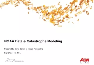
NOAA Data & Catastrophe Modeling
100 likes | 119 Vues
Understand the comprehensive suite of 100+ catastrophe models by Impact Forecasting for hurricanes worldwide. Explore parameters, statistics, and historical data critical for financial loss estimation. Identify the impact of hurricanes on the US, costliest disasters, and population shifts in coastal areas. Access desired data features in the wishlist for improved risk assessment.

NOAA Data & Catastrophe Modeling
E N D
Presentation Transcript
NOAA Data & Catastrophe Modeling Prepared by Steve Bowen of Impact Forecasting September 16, 2015
Catastrophe Modeling Computer simulations that are used to calculate financial losses from different disaster perils Select parameters that each model takes into account include: • Information on site locations (street address, postal code, county, etc.) • Information on the physical characteristics of the exposures (construction, occupancy, year built, number of stories, etc.) • Information on the financial terms of the insurance coverage • Modeled output estimates the financial cost of a particular event • Impact Forecasting has a suite of more than 100 separate catastrophe models for different perils around the world
Hurricane Model Overview Use of full lifecycle of tropical cyclone • Better capture of offshore and immediate coastal wind and storm surge Over 26,000 probabilistic tropical cyclones in event set Accurate and validated wind field model Full set of damage curves • Different combinations of construction types, age of construction, occupancy types, and use of secondary construction modifiers
Stochastic Event Set Statistics 26,081 total full lifecycle tropical systems 1,626,182 unique tropical cyclone positions with unique Rmw, pressure, direction, and forward speed 16,198 make at least one direct landfall • 13,768 make one landfall • 2,430 make multiple landfalls Only contains tropical systems that come within 125 miles of the U.S./Caribbean coastlines • No storms that form far in the eastern Atlantic and turn out to sea without striking any landmasses
Model Source Data 92620 08/16/1992 M=13 2 SNBR= 899 ANDREW XING=1 SSS=5 Card# MM/DD/Year Days YS# Total Storm# Name US Hit US landfall category 92580 04/22*2450610 30 1003*2490615 45 1002*2520620 45 1002*2550624 45 1003* Card# MM/DD*LatLongWindPress*LatLongWindPress* National Hurricane Center’s HURDAT2 database • Spans 1851 to present with nearly 1,500 storms from the Atlantic and Caribbean basins • Two significant updates • 2001: 1851-1885 storms added. • 2002: Upgrade of Hurricane Andrew up to Category 5 at time of landfall. Example of the HURDAT data
U.S. Hurricanes Costliest peril in the United States • …and globally… Since 2000, the U.S. has annually averaged $25 billion in economic losses and $13 billion in insurance losses from tropical cyclones Costliest U.S. Natural Disaster • Hurricane Katrina ($151 billion Economic Loss; $81 billion Insured Loss) Other Costliest U.S. Natural Disasters in Modern Times • Severe Weather: $11 billion (April 22-28, 2011) • Flood: $35 billion (1993 Mississippi River Floods) • Winter Storm: $9 billion (1993 March “Storm of the Century”) • Drought: $82 billion (Summer 1988)
U.S. Population Shifts 39 percent of the U.S. population – 123 million people – currently live in counties along the coast 52 percent of the U.S. population live in counties that drain to coastal watersheds 45 percent increase in coastal population between 1970 and 2010 • Another 8 percent growth expected by 2020 (10 million people) 52 percent of the U.S. population lives in an area that equals less than 20 percent of the continental U.S.
Partial Data Wishlist Higher resolution Lidar& bathymetry data More robust series of data buoys to obtain additional real-time and historical surface conditions Availability of ADCIRC output More detailed NFIP policy data at a more granular level beyond the current city or county level Increased reanalysis dataset for hurricanes that extends beyond 30 years Near real-time shapefile availability for coastal flood or surge inundation
Contact Steve Bowen Associate Director (Meteorologist) Aon Benfield Analytics +1.312.381.5883 steven.bowen@aonbenfield.com
![Data Modeling [Comparison of data modeling techniques ]](https://cdn0.slideserve.com/205866/data-modeling-comparison-of-data-modeling-techniques-dt.jpg)