Habitat Effectiveness Index
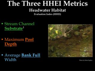
Habitat Effectiveness Index. A model to help evaluate elk winter range in the Blue Mountains of eastern Oregon and Washington. Four Components. HE S -- Size and spacing of cover and forage areas Habitat suitability weighted depending on distance from edge of cover or forage. Four Components.

Habitat Effectiveness Index
E N D
Presentation Transcript
Habitat Effectiveness Index A model to help evaluate elk winter range in the Blue Mountains of eastern Oregon and Washington
Four Components HES -- Size and spacing of cover and forage areas Habitat suitability weighted depending on distance from edge of cover or forage
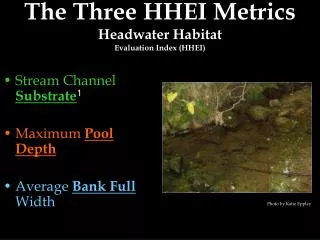
Four Components HER -- Roads open to traffic per unit of area The greater the road density, the less suitable the habitat Photo by Mark Penninger
Four Components HEF -- Quality and quantity of forage Affected by season of year and amount of other grazing Photo by Mark Penninger
Four Components HEC – Cover Quality Affected by relative amounts of satisfactory and marginal cover Photo by Robin Garwood
Habitat Effectiveness Index • The geometric mean of the 4 component values • HESRFC = (HES x HER x HEF x HEC)1/4 • optimum conditions exist only if all values are 1.0
Modeling the HEI ArcInfo Workstation – AML (A. Kramer and M. Braymen, Wallowa-Whitman N.F., 1997) ArcGIS – HEI model (D. Stockdale, 2007) Combination of VBA, Model Builder and Python scripting
The Geoprocessor Object VBA: Dim GP As Object Set GP = CreateObject("esriGeoprocessing.GPDispatch.1") Python: import win32com.client GP = win32com.client.Dispatch("esriGeoprocessing.GPDispatch.1") GP.HEIhes_hei strCoverName ‘runs a Python script GP.TableToTable_conversion strInfraTableName, _ ‘ runs a geoprocessing tool "C:\workspace\hei\hei.mdb", "RoadInfraTable"