Download
1 / 17
170 likes | 187 Vues
Explore the history and advancements of SWOT mission, including SAR interferometry radar altimeter for precise coastal measurements, noise reduction techniques, and challenges in oceanography. Learn about the potential for 1 km resolution sea surface height measurements and improved accuracy in geostrophic current measurements.

E N D
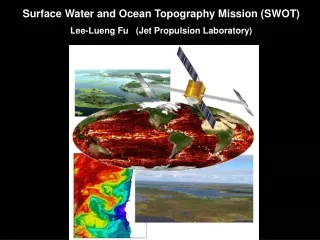
Surface Water and Ocean Topography Mission (SWOT) Lee-Lueng Fu (Jet Propulsion Laboratory)
A brief History • 1998- Wide Swath Ocean Altimeter (WSOA) was selected for NASA’s Instrument Incubator Program (IIP). • 2001 – Workshop on high-resolution ocean topography (chaired by Dudley Chelton). • 2002 – Development of WSOA as a payload for OSTM/Jason-2 began. • 2004 – WSOA was canceled due to budget problems (after spending $ 20 M on the program). • 2005 - Joint US/European hydrology team formed and WatER proposal submitted to ESA(not selected due to programmatic issues) • 2005 – Hydrosphere Mapper and WATER were submitted to the NRC Decadal Survey. • 2007- Decadal Survey recommended SWOT as a combined mission for land hydrology and oceanography applications. • 2007 – A joint informal NASA/CNES Science Working Group for SWOT was formed. • 2008 – “Ka-band SAR Interferometry Studies for the SWOT Mission” was selected for NASA’s IIP. • 2008 – NASA has authorized funding for risk-reduction studies of SWOT. • 2008 – CNES plans to start a phase-A development of SWOT.
Space time sampling of radar altimetry missions 10 100 days 1000 km 100 km WSOA 10 km SWOT
SWOT Measurement Concept A SAR interferometry radar altimeter h= H –r1 cos(Ө ) • Precision timing of the sampling system allows precise ranging of the returned signals. • Interferometry allows the determination of the direction of the signals from phase difference. • Use SAR technique to achieve resolution on the order of 50 m. • Spatial smoothing achieves measurement noise of 1 cm at 1 km resolution.
Radar Interferometry was successfully demonstrated by JPL’s Shuttle Radar Topography Mission (SRTM) 60m
A Jason pass for the analysis of SSH signals and measurement errors Jason Pass 132
SSH wavenumber spectrum 1000 100 10 km Jason pass 132 (147 cycle average) k-3 Instrument noise Power density (cm2/cycle/km) k-2 SWOT noise at 1 km resolution 3 cm noise 30 km 1cm noise 10 km Wavenumber (cycle/km)
Coastal currents have scales ~ 10 km. Velocity accuracy from SWOT is 3 cm/s at 10 km scale or 1 cm/s at 25 km scale. 42.5º N h ~ 5 cm v ~ 50 cm/sec < 10 km < 10 km 41.9º N < 10 km Observations made by ADCP offshore from the US West Coast T. Strub
SWOT Temporal Sampling Temporal sampling is irregular and location dependent. 1st 2nd 3rd 4th
Wavenumber spectra of SSH and measurement errors 1000 100 km SSH iono wet tropo SSB Media errors and sea-state errors have scales larger than 100 km and not affecting submesocale SSH measurement.
Errors in coastal tide models up to 20 cm are revealed from the Jason-T/P Tandem Mission. What is the state of the art in coastal tide modeling? Andersen and Egbert (2005)
Besides the intrinsic science of internal tides, they introduce 2-5 cm/sec error in ocean current velocity. Is predicting internal tides from models feasible ? R. Ray/GSFC
Systematic errors in the SWOT measurement • Look-angle errors due to uncertainly in the roll of the mast • Range errors due to media effects • Phase errors due to electronics • Correction through cross-over calibration using both the nadir altimeter and swath measurements • The spatial scales of the residual errors are in the range of mesoscale to basin scale, depending on the scales of the systematic errors.
Conclusions • SWOT potentially can measure SSH at 1 km resolution with 1 cm precision, revealing ocean signals down to 10 km wavelengths. • Accuracy for surface geostrophic currents is about 3 cm/sec at 10 km wavelength and 1 cm/sec at 25 km wavelength. • Temporal sampling is a challenge: irregularly spaced varying from 2 samples/20 days to more than 5 at mid and high latitudes. • Coastal and internal tides have scales in the range of mesoscale and submesoscale, causing potential interference to ocean circulation studies. • Systematic errors in interferometry pose challenges at mesoscale to basin scale yet to be quantified.
k-11/3 SWOT noise level 20 km Along-track altimeter wavenumber spectrum for the Kuroshio area for TOPEX/Poseidon, Jason-1, ENVISAT and GEOSAT Follow On. Spectral slopes were estimated in the 100 km to 300 km spectral band. A k-11/3 slope is also shown (dashed line). (Le Traon et al, 2008)
KE Spectrum from an OGCM simulation Velocity error at 45º latitude with SSH noise of 1cm at 1 km resolution. 30 km wavelength
Finite-Time Lyapunov Exponent (T=100 days) AVISO data: 1 October 2007