Download
1 / 36
360 likes | 382 Vues
Discover how radar and conventional data enhance cloud-resolving QPF through ensemble Kalman filtering. Learn about error reduction and the impact of radar position error, and strategies for improving QPF at convective scale. Explore the benefits of adaptive radar observation and the significance of proper radar data utilization for better forecast accuracy.

E N D
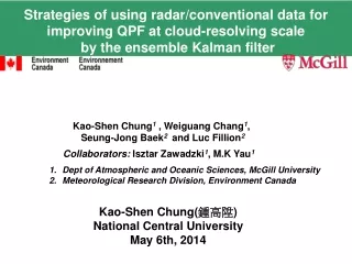
Strategies of using radar/conventional data for improving QPF at cloud-resolving scale by the ensemble Kalman filter Kao-Shen Chung1, Weiguang Chang1, Seung-Jong Baek2and Luc Fillion2 Collaborators:Isztar Zawadzki1, M.K Yau1 • Dept of Atmospheric and Oceanic Sciences, McGill University • Meteorological Research Division, Environment Canada Kao-Shen Chung(鍾高陞) National Central University May 6th, 2014
Outline • Introduction of the Canadian High Resolution Ensemble Kalman Filter (HREnKF) system • 2. Examine the impact of position error with radar • data assimilation • 3. Strategies of improving QPF at convective scale • a) regional assimilation system • b) Adaptive Radar observation • 4. Summary and future works
Add random perturbations (model error) Add random perturbations Perturbed observations Observations Data assimilation Ensemble members Initial guess Analysis step GEnKF (2005 operational system) GEM-LAMforecast for all the members HREnKF Forecast step LAM 1-km (300x300) 1. High Resolution Ensemble Kalman Filter System ( HREnKF ) for radar data assimilation
Features of the system Sequential processing of batches of observations Houtekamer and Mitchell 2001
Sub-ensemble 1 Sub-ensemble 4 Sub-ensemble 2 Sub-ensemble 3 Partitioning the ensemble (to deal with the underestimation of the error structure) Ensemble members (80) Gain matrix K1 Gain matrix K2 Gain matrix K3 Gain matrix K4
Some features of the current set up: For the HREnKF • Control variables: U, V, W, T, HU (specific humidity) • Observations are perturbed according to its variance (no correlation). • Simplified random perturbations to consider the model errors • Localization: 10-km in horizontal; 2 * ln( Pressure levels ) in vertical • 80 members • For the GEM_LAM model at 1-km resolution • Cycling hydrometeor variables • Microphysical scheme: double moment scheme • (Milbrandt and Yau, 2005) • Fixed lateral boundary conditions • Ensemble lateral boundary conditions for all ensemble members
Analysis 30-min QPF Improvement only up to 1-h 60-min 90-min
Position error of precipitation Poor background fields Is it important? (impact of assimilating radar data) Is there any way to improve it?
Increment: Error reduction: 2. Examine the impact of position error with radar data assimilation Experiment designed: In the low elevation angle: Directly update U and V Indirect update W through flow-dependent background error cross-covariance
3. Strategies of improving QPF at convective scale a) conventional observations + regional assimilation system Global EnKF system (GEnKF) 傳統氣象資料 衛星資料 Obtain ensemble members Regional EnKF system (REnKF) 傳統氣象資料 衛星資料 High resolution EnKF (HREnKF) 氣象雷達資料
Impact of Regional EnKF with conventional observations 0000 1200 0000 0600 6-h short-term forecast REnKF_15km 1-day cycling Regional EnKF (ensemble mean) Global EnKF (ensemble mean) Vertical velocity W
Improvement of the background field Precipitation (mean of REnKF) Control run (from DF)
Experiment of the HREnKF with radial wind assimilation Control run: No radar assimilation, from ensemble mean of the REnKF 2.5 h model integration 0230 0000 HREnKF: cycling for 60-min and launch the short-term forecast Radar radial wind (assimilating every 5-min) 0000 0100 1830 UTC Cycling assimilation procedure short-term ensemble forecasts 1.5 hr
Impact of using the ensemble set from REnKF system From random perturbations underestimate From REnKF Converge toward observations Covered the rms of Pf
Verification Analysis 30-min 60-min 90-min
How to optimize using radar observations? Adaptive radar observations
4. Summary and future works • At cloud-resolving scale, if there is any position error of precipitation, • it is important to correct itbefore assimilate radar observations. • Initial ensemble set from the REnKF is better than random perturbations • 1. Capture mesoscale circulation better • 2. Ensemble spread is able to cover forecast errors assimilate more • radar observations • The verification of the radial component shows that • the improvement of short-term forecast is up to 1.5-hr. (Both • bias and root-mean-square errors) • How to use radar observation properly? • Adaptive observation strategy is able to improve the effectiveness of • assimilating radar data
About future work Data assimilation (bridge) Numerical model observations
Forecast skill ( nowcasting versus NWP ) precipitation • The solid line represents the theoretical limit of predictability, the dashed line indicates • NWP models, and the dotted line represents • nowcasting methods (Austin et al., 1987). Berenguer et al. 2012 • 0 - 6 hr QPF • Resolution of NWP • Extra Observations Final goal
Construct regional and mesoscale analysis fields Simulated reflectivity Reflectivity Simulated reflectivity 0000 UTC 0000 UTC 0000 UTC Good background field observations Poor background field Data assimilation Large scale forcing How many cycling of regional EnKF & conventional data? Optimal assimilation window ( 6-h or 3-h ) ?
Extra Observations (other than conventional data) a.Assimilate both radial wind and reflectivity observations
b. Refractivity Apply to a EnKF system (Humidity) (Precipitation) (Feng et al. 2009)
C.Dual-Polarization observations: ( Putnam et al 2013 )
Microphysics versus Dual-Polarization parameters ( Putnam et al 2013 )
Identify error structure in a) observations • Use more complicated observation operator < simplified operator > Consider: proper geometry, accurate propagation Include: the sampling volume, signal and its processing Fabry and Kilambi (2011)
Error correlation of TT profile V.S. Vertical correlation of TT tendency ( Ensemble Forecasts) (stochastic perturbation of SCM) Single column model (SCM) Represent the error structure Microphysics
Identify error structure in B) numerical model 剖風儀 移動雷達車 雨量計 MRR 微波雨量雷達 JWD 雨滴譜儀 2DVD 雨滴譜儀 • Verify QPF (quantitative precipitation forecast) • over Taiwan region Global Precipitation Mission (GPM)
報告完畢 歡迎指教 謝謝!
3. Impact of assimilating radial wind component Is it able to propagate information to other control variables? Temperature Obs Z Humidity V-wind
McGill Algorithm for Precipitation Nowcasting by Lagrangian Extrapolation (MAPLE) Variational Echo Tracking technique (Laroche and Zawadzki 1995 ): Estimate the motion field of precipitation and a modified semi-Lagrangian backward scheme for advection. (capable of stretching and rotation)