World Geography CBA Review
250 likes | 568 Vues
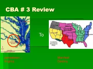
World Geography CBA Review. Fall 2013. Many people have come to the U.S. because of the availability of jobs. This is an example of a: pull factor political characteristic human-environment interaction push factor.

World Geography CBA Review
E N D
Presentation Transcript
World Geography CBA Review Fall 2013
Many people have come to the U.S. because of the availability of jobs. This is an example of a: pull factor political characteristic human-environment interaction push factor 7(B): Explain how political, economic, social, and environmental push and pull factors and physical geography affect the routes and flows of human migration. The Great Irish Famine is an example of a: pull factor location push factor physical characteristic
20(A): Describe the impact of new information technologies such as the Internet, Global Positioning System (GPS), or Geographic Information Systems (GIS). GPS is useful for: travel and navigation. finding urban population statistics. educating students about new areas. distinguishing climate zones.
9(B): Describe different types of regions, including formal, functional, and perceptual regions. A functional region is often organized around a specific focal point. Which of the following is most clearly a functional region with a central focal point? Southwest Asia and North Africa Sub-Saharan Africa Dallas/Ft. Worth Metroplex Asia
Tropical rainforests are found near the equator where ample rain falls. Tall grasses dominate in areas that tend to be drier. Plants that store water exist in areas with temperature extremes and little rainfall Which conclusion can best be drawn from these three examples? Tall grasses grow well in the Great Plains. Climate greatly influences the types of biomes found in different regions. Cacti are usually found in desert areas where it tends to be dry. Rainfall is one cause for the rapid growth of tropical rainforests. 4(C): Explain the influence of climate on the distribution of biomes in different regions. Broadleaf deciduous forests grow best in regions with a -- temperate climates with adequate rainfall Mediterranean climate tropical wet and dry climate arid climate
3(A): Explain weather conditions and climate in relation to annual changes in Earth-Sun relationships. Which best explains why we experience four seasons on Earth? The gravitational pull of the moon The distance between the Earth and the sun The tilt of the Earth on its axis as it revolves around the sun The effect of tectonic plate movement on Earth’s oceans
4(A): Explain how elevation, latitude, wind systems, ocean currents, position on a continent, and mountain barriers influence temperature, precipitation, and distribution of climate regions. Compare Location A and Location B. Based on your knowledge of the factors that affect climate and the map above, which of the following best explains why location A and B have different climates? Altitude Different Latitude Continentality Wind currents
A farmer sees an area he believes will be good for farming because of its rich topsoil. Which process contributed most to forming this rich topsoil? Sand storms Ocean currents Decaying plant life Folding of Earth’s crust 3(B): Describe the physical processes that affect the environments of regions, including weather, tectonic forces, erosion, and soil-building processes. The most common type of mechanical weathering occurs when– acidic water seeps into a crack in a rock. seeds take root in a crack in a rock. water repeatedly freezes and melts in a crack in a rock. rocks collide during subduction. The most frequent cause of major earthquakes is the— pressure from tectonic plate movement. occurrence of landslides. gravitational pull of the moon as it orbits Earth. change in underwater currents.
The Midwest is called “the nation’s breadbasket” because-- millions of loaves of bread are produced there every day. it is the crossroads of the United States. it is the region that produces most of the nation’s grain, dairy products, and hogs. most of the nation’s fruit and vegetables are grown here. 9(A): Identify physical factors such as climate, vegetation [and] river systems that constitute a region. Which of the following terms describes an area that has common landforms, soils, climate, and vegetation? a savannah a physical region a political unit a continent
4(B): Describe different landforms and the physical processes that cause their development. The Mississippi River Delta, which has been formed over centuries by the depositing of silt as the river emptied into the ocean, is a(n): escarpment barrier alluvial plain canyon
7(A): Construct and analyze population pyramids and use other data, graphics, and maps to describe the population characteristics of different societies and to predict future population trends. Based on the chart, which of the following generalizations is most accurate? Population is increasing rapidly within the world and within each region Although world population has increased, the distribution of population has not World population growth and regional distribution are predicted to level out over time World population and world distribution are expected to continue to change dramatically in the future
6(B): Explain the processes that have caused changes in settlement patterns, including urbanization, transportation, access to and availability of resources, and economic activities. On January 24, 1848, gold was discovered in Coloma, California, in the foothills of the Sierra Nevada Mountains. How did this discovery lead to changes in settlement patterns? People fled from these areas to avoid mining operations. Mining towns sprang up almost overnight where gold was discovered. Population in the mountains increased rapidly as farmers arrived to plant crops. San Francisco’s population decreased as people moved inland to the Sierra Nevada
7(C): Describe trends in world population growth and distribution. Using the information in the chart above which is one reason why the population of Europe did not increase as fast as other regions? Most Europeans live in small towns. Europeans began having smaller families. Other regions were involved in a series of major wars. Workers from other places migrated to Europe.
8(C): Evaluate the economic and political relationships between settlements and the environment, including sustainable development and renewable/non-renewable resources. Which human activity would be most likely to have a negative impact on the environment? Using reforestation to control soil erosion Burning non-renewable resources to generate electric power. Preserving endangered species. Investigating the use of biological controls for pets.
11(A): Understand the connections between levels of development and economic activities (primary, secondary, tertiary, and quaternary). A Secondary B Quaternary Which level of economic activity does each of the following represent? In what type of country (level of development) are these likely to be found? C Primary D Tertiary
In which economic system would you expect the widest selection of consumer goods? Explain why. Traditional Free Enterprise Socialist Communist 10(A): Describe the forces that determine the distribution of goods and services in free enterprise, socialist, and communist economic systems. What is a central characteristic of a free market economy? The government owns the means of production All wage earners are paid the same amount Labor unions are prohibited Businesses are driven by the desire for profits
10(C): Compare the ways people satisfy their basic needs through the production of goods and services such as subsistence agriculture versus commercial agriculture or cottage industries versus commercial industries. Which is a major feature of an economy based on subsistence farming? Most adults work outside the home. Farmers compete with each other. Farmers raise just enough crops for their family to survive. The government decides which crops will be grown.
Which statement best describes an aspect of traditional economy? Profit motivates individuals to set up private businesses The interplay of supply and demand regulates prices Tradition and customs greatly influence economic decisions Government directs and controls the means of production 18(C): Identify examples of cultures that maintain traditional ways, including traditional economies.
Which of the following characteristics is currently shared by Switzerland, Canada, and New Zealand, all more developed nations? Low population-growth rates High infant-mortality rates Low literacy rates Most are involved in subsistence farming 5(B): Interpret political, economic, social, and demographic indicators (gross domestic product per capita, life expectancy, literacy, and infant mortality) to determine the level of development and standard of living in nations using the terms Human Development Index, less developed, newly industrialized, and more developed. The literacy rate of any country correlates most closely with which of the following? Per capita income Annual precipitation rates General level of intelligence Population density
One would expect to find this population pyramid structure in – Less developed countries Highly developed countries Countries with a low death rate Countries with a high standard of living 7(A): Construct and analyze population pyramids and use other data, graphics, and maps to describe the population characteristics of different societies and to predict future population trends. What would you expect to find in a country with zero population growth? A high birthrate and a low death rate More or less equal birthrates and death rates A low birthrate and a high death rate Low birthrates and death rates
What type of political system does Country C have? Democracy Monarchy Theocracy Totalitarianism What type of political system does Country Dhave? Democracy Monarchy Theocracy Totalitarianism 14(B): Compare how democracy, dictatorship, monarchy, republic, theocracy, and totalitarian systems operate in specific countries
Christianity, Judaism and Islam and Sikhism are all similar in that each religion: Practices polytheism Practices strict codes of nonviolence Practices monotheism Originated in India Animists generally believe that: Meditation leads the followers to Nirvana After death the soul is reborn in another human form Holy wars must be fought to gain entry into heaven Spirits inhabit both living and nonliving things in nature 17(B): Describe major world religions, including animism, Buddhism, Christianity, Hinduism, Islam, Judaism, and Sikhism, and their spatial distribution.
Why do the majority of people who live in the middle of Canada make their living from harvesting lumber? Outsourcing has led to closure of factories It is too hot and dry to support farming There is an abundance of timber supplied by the subarctic climate Government dictates people’s jobs 11(B): Identify the factors affecting the location of different types of economic activities, including subsistence and commercial agriculture, manufacturing, and service industries.
How does life in a rural village differ from life in an urban setting? Villagers travel more often than urban residents Village residents receive a more formal education than people in cities People in rural villages often engage in subsistence agriculture and cottage industries People in rural villages have greater access to the latest technologies 16(D): Compare life in a variety of urban and rural areas in the world to evaluate political, economic, social, and environmental changes.
Process Skills tested on the CBA • Create and interpret different types of maps to answer geographic questions, infer relationships, and analyze change.[WGS.21C] • Design and draw appropriate graphics such as maps, diagrams, tables, and graphs to communicate geographic features, distributions, and relationships.[WGS.22A] • Generate summaries, generalizations, and thesis statements supported by evidence.[WGS.22B] • Analyze and evaluate the validity and utility of multiple sources of geographic information such as primary and secondary sources, aerial photographs, and maps.[WGS.21A] • Use geographic terminology correctly.[WGS.22C]