Download

1 / 8
80 likes | 105 Vues
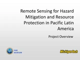
5-year, $2.3 million project by NSF developing remote sensing tools for hazard mitigation and resource protection in Guatemala, El Salvador, Nicaragua, and Ecuador. Goals include building formal linkages, developing educational programs, and collaborating on remote sensing solutions. The project engages in field assignments, water resource development, and interdisciplinary teamwork.

E N D
Remote Sensing for Hazard Mitigation and Resource Protection in Pacific Latin America Overview: This is a 5-year, $2.3 million project supported by NSF, which focuses on developing remote sensing tools and validation methods for hazard mitigation and resource protection in Guatemala, El Salvador, Nicaragua and Ecuador. We are working towards two important goals: to develop formal linkages among MTU and geoscience agencies in Pacific Latin America, focusing on the collaborative development of remote sensing tools for hazard mitigation and water resource development; to build a new educational system of applied research and engineering, using two existing educational programs at MTU: the Peace Corp/Master’s International program in Natural Hazards which features a 2-year field assignment, and an undergraduate “Enterprise” program, which gives teams of civil, environmental, and geological engineering students the opportunity to work on real-world problems over multiple years in a business-like setting.
Peace Corps Master’s International program in Natural Hazards Aqua Terra Tech Enterprise Remote Sensing for Hazard Mitigation and Resource Protection in Pacific Latin America Remote Sensing Minor program with the Remote Sensing Institute Ph.D. and Master’s programs in Geosciences
Remote Sensing for Hazard Mitigation and Resource Protection in Pacific Latin America Project Personnel Gregg Bluth: Project Director, hazard mitigation, remote sensing John Gierke: Hydrogeologicalengineering, water resources, geophysical studies Essa Gross: Wastewater treatment, hydrogeological engineering Bill Rose: volcanology, remote sensing, hazard mitigation For more project information, please see: http://www.geo.mtu.edu/rs4hazards/
Aqua Terra Tech: an MTU Enterprise program in Boaco, Nicaragua Program Contact: John Gierke jsgierke@mtu.edu MTU created the Enterprise Program to allow students a unique curriculum path for developing and practicing technical and business skills in a multidisciplinary setting where an emphasis is placed on projects and business. The Boaco project focuses on water treatment, water supply engineering, watershed resource protection, and development of new sources of clean water. The project uses a combination of ground-based geophysical exploration, satellite-based GPS and land cover analysis, and field engineering. For more information, please see: http://www.enterprise.mtu.edu/att/Home.html
Peace Corp’s Master’s International Program in Natural Hazards A new degree program within the Department of Geological Engineering and Sciences York Lewis El Salvador Armeda VanDam El Salvador Ellen Engberg Ecuador Essa Gross Nicaragua Program Contact: Bill Rose raman@mtu.edu John Lyons Guatemala Kristi Weston Ecuador This new Peace Corps program is the only one of it’s kind in the nation! It features a long-term field assignment in Ecuador, El Salvador, Guatemala, or Nicaragua as both a Peace Corps Volunteer and a Master’s candidate in Natural Hazard Mitigation. Students spend one year in residence at MTU, then two years in the field, returning to MTU to complete their Master’s. This program places highly trained students in key areas in these countries to become the “experts on the ground”, crucial components in developing practical remote sensing applications. For more information, please see: http://www.geohazards.mtu.edu/
Peace Corp’s MI in Natural Hazards, Class of 2005-2006 Adam Blankenbicker University of Rhode Island Marine-related hazards Ingrid Fedde Colorado School of Mines Volcanic hazards Joanne Scott Old Dominion University Volcanic hazards Hans Lechner Humboldt State University Landslide and slope hazards Jemile Erdem Lewis & Clark College Seismic hazards Karinne Knutsen UC Santa Barbara Natural hazards
Remote Sensing Minor: sponsored by MTU’s Remote Sensing Institute Program contact: Gregg Bluth gbluth@mtu.edu The Remote Sensing Minor program builds upon basic theory, and applications, of remote sensing followed by opportunities to specialize in Data and Signal Processing, Data Management, Applications and Special Research Projects. A new aspect of the minor program involves more focused training, specifically in support of the natural science agencies and observatories of Ecuador, El Salvador, Guatemala and Nicaragua. This training culminates in field study in one of these countries, in order to help develop and apply practical applications of remote sensing. For more information, please see: http://www.rsi.mtu.edu/
Graduate Programs in the Department of Geological Engineering and Sciences This project supports 3 Ph.D. and 5-10 Master’s positions each year for travel and study in Ecuador, El Salvador, Guatemala and Nicaragua. These positions are within the main graduate degree programs of Geology, Geological Engineering, and Geophysics. Project specialty areas include: GIS, Remote Sensing, Applied Geophysics, Hydrogeological Engineering, Hazard Mitigation, Volcanology and Seismology. Department Chair: Wayne Pennington wayne@mtu.edu For more information, please see: http://www.geo.mtu.edu