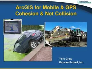
ArcGIS for Mobile & GPS Cohesion & Not Collision
410 likes | 645 Vues
ArcGIS for Mobile & GPS Cohesion & Not Collision. York Grow Duncan-Parnell, Inc. ArcGIS for Mobile & GPS Cohesion & Not Collision. Options for integration into various Esri software applications and associated accuracies . West Va CORS network Trimble Positions – benefits to accuracy.

ArcGIS for Mobile & GPS Cohesion & Not Collision
E N D
Presentation Transcript
ArcGIS for Mobile & GPSCohesion & Not Collision York Grow Duncan-Parnell, Inc.
ArcGIS for Mobile & GPSCohesion & Not Collision • Options for integration into various Esri software applications and associated accuracies. • West Va CORS network • Trimble Positions – benefits to accuracy
NMEA format of GPS/GNSS data – generic format of location information from a receiver.
NMEA format NMEA- National Marine Electronic Association NMEA 0183
GPS/GNSS format • GPS – Global Positioning System (United States) • GNSS – Global Navigation Satellite System • GPS • GLONASS • Galileo • Compass • Etc….
Manufacturers of GNSS Technology • “Generic” - OEM • SiRF • U-BLOX • Recognized Manufacturers • Trimble • Topcon • Carlson • Leica • Spectra
Manufacturers of GNSS Technology • “Generic” - OEM • SiRF • U-BLOX • Recognized Manufacturers • Trimble • Topcon • Carlson • Leica • Spectra
NMEA format of GPS/GNSS data – generic format of location information from a receiver.
NMEA Accuracy: required/available • GNSS • Updating/recording attribute information • Recording location • Tree canopy • Terrain limitations • Building shadow Accuracy ranges: • 30 feet • 6-20 ft (2-5 meter) • 3-10 ft (1-3 meter) • < 3 ft (submeter • < 1 ft (30cm) • <4” (decimeter)
NMEA Accuracy: required/available • GNSS • Updating/recording attribute information • Recording location • Tree canopy • Terrain limitations • Building shadow Accuracy ranges: • 30 feet • 6-20 ft (2-5 meter) • 3-10 ft (1-3 meter) • < 3 ft (submeter • < 1 ft (30cm) • <4” (decimeter)
NMEA Accuracy: required/available • GNSS • Updating/recording attribute information • Recording location • Tree canopy • Terrain limitations • Building shadow Accuracy ranges: • 30 feet • 6-20 ft (2-5 meter) • 3-10 ft (1-3 meter) • < 3 ft (submeter • < 1 ft (30cm) • <4” (decimeter)
Accuracy • Autonomous GNSS 3 ft – 50 ft (1-10 meters) • Differentially Corrected • WAAS enabled 2 ft – 18 ft (submeter to 5 m) • VRS <1 inch to 3 ft (1cm to submeter) • Post-processed <1 inch to 3 ft (1cm to submeter)
Accuracy - NMEA • Autonomous GNSS 3 ft – 50 ft (1-10 meters) • Differentially Corrected • WAAS enabled 2 ft – 18 ft (submeter to 5 m) Only supports GPS not GLONASS • VRS <1 inch to 3 ft (1cm to submeter) • Post-processed <1 inch to 3 ft (1cm to submeter)
GPS Controller Windows Mobile and Windows 7
GPS Controller Windows Mobile and Windows 7
Conclusion: GPS Controller can be used to output a NMEA format position from a Trimble receiver to use in any software application that uses GPS. • Output Options: • Autonomous GNSS • WAAS corrected GPS • VRS corrected GNSS ** Only works with a receiver that supports multiple ports and a user interface that supports multiple connections.
Software choices for the mobile device • ArcPad/GPScorrect • TerraSync • ArcPad/Trimble Positions (NEW!) • ArcGIS for Windows Mobile/Trimble Positions(NEW!)
What is Trimble Positions? Suite of software that all have “Positions” in their names • Trimble Positions ArcPad extension • Alternative to Trimble GPScorrect™ • Trimble Positions Mobile extension • Supports ArcGIS for Windows Mobile • Trimble Positions Desktop add-in • Differentially corrects data for ArcPad OR ArcGIS for Windows Mobile
Supported Platforms & Technologies • Esri • ArcPad 10* • ArcGIS for Desktop 10.1 • Basic for ArcPad • Standard or Advanced editions for ArcGIS for Windows Mobile • ArcGIS for Windows Mobile 3.1 • ArcGIS Mobile Project Center 3.1 • File or enterprise geodatabase • Trimble • GeoExplorer 6000, 5, 3000 series handhelds • Juno 5B/5D, Juno 3B/3D, SB/SC/SD handhelds • Pro 6T/6Hreceivers • GPS Pathfinder ® Pro XT™/XH™/XRT™receivers • Nomad® 900G series handhelds * ArcPad10 running on a Windows Desktop operating system is not supported GeoXH™ 6000 with Centimeter option enabled is not supported GPS Pathfinder ProXRT only supported by Trimble Positions ArcPad extension
What if you have… Licensing Options • What if you want to go to ArcGIS 10.1? • We can convert your GPS Analyst license to: • Trimble Positions Desktop OR • Pathfinder Office • We can convert your GPScorrect to Positions for ArcPad