Download

1 / 22
220 likes | 403 Vues
Capacity Building in Satellite Meteorology in the Asia Pacific Region. B.M. Rao, P.K. Pal, P.C. Joshi Space Applications Centre (ISRO) Ahmedabad. CGMS - 38 November 12, 2010 New Delhi. Background.

E N D
Capacity Building in Satellite Meteorology in the Asia Pacific Region B.M. Rao, P.K. Pal, P.C. Joshi Space Applications Centre (ISRO) Ahmedabad CGMS - 38 November 12, 2010 New Delhi
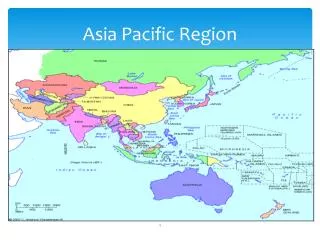
Background • UN activities on Space Technology Applications are dealt with UN – Office on Outer Space Affairs (UN-OOSA) • Member Countries (68) have joined to form UN Committee on Peaceful Uses of Outer Space (UN-COPUOS) • Many resolutions from UNISPACE III, UN-General Assembly and UN-COPUOS have stressed international cooperation in capacity building though regional centres. • Regional Centres are • CSSTEAP :Centre for Space Science & Technology Education in Asia Pacific(Estd 1995) • CRECTEALC :Regional Centre for Space Science and Technology Education for Latin America and the Caribbean(Brazil and Mexico, Estd 1997) • CRASTE-LF :African Centre for Space Science and Technology(Africa – French Language, Morocco, Estd 1998) • ARCSSTE-E :African Regional Centre for Space Science and Technology Education(Africa – English Language, Nigeria, Estd 1998)
Regional Centres for Space Science and Technology Education (Affiliated to the United Nations)
CSSTEAP : Disciplines of Education • CSSTEAP provides training and education in 4 areas: • Remote Sensing and Geographic Information Systems(RS & GIS) • Satellite Meteorology & Global Climate(SATMET) • Satellite Communications and Global Positioning Systems(SATCOM) • Space and Atmospheric Sciences (Space Science)
ADVISORY COMMITTEE • AC is technical arm of GB, an independent body of experts, for • Guiding the technical programme of CSSTEAP • Evaluating the courses & Advise CSSTEAP in setting technical facilities • Address all issues of coordination with other institutions
CSSTEAP SATMET ACTIVITY • Nine Months Post Graduate Diploma CourseSatmet - 1 ( March - November, 1998 ) • 2. Satmet - 2 ( July 2000 - March 2001 ) • 3. Satmet - 3 ( August 2002 - April 2003) • 4. Satmet - 4 ( August 2004 - April 2005) • 5. Satmet – 5 ( August 2006 - April 2007) • Satmet – 6 ( August 2008 – April 2009) • Satmet – 7 (August 2010 – April 2011) • 1- Week Workshop on Emerging Trends in Satellite Meteorology ( March 1998) • 9. 2-Week short Course on “Emerging Trends in SatelliteMeteorological Applications with Special Emphasison Microwave Remote Sensing” ( May 2002 )
Country Name Azerbaijan BangladeshChina DPR Korea IndiaIndonesiaIranKazakhstanKyrgyz Republic Malaysia Maldives MyanmarMongoliaNepalPapua New Guinea PhilippinesRepublic of KoreaSri Lanka TajikistanThailandUzbekistanVietnam No. of Participants Year 1998 - 17 Year 2000 - 21 Year 2002 - 19 Year 2004 - 15 Year 2006 - 18 Year 2008 - 16 Year 2010 - 14_________________ Total - 120 from 22 Countries
Background of the Participants • Forecasters Working in National • Meteorological Organisation • Researchers • Academic (University)
Course Structure • Theory Lectures (First half) • Practicals (Second half) • 3. Pilot Projects (Full day)
Table 1: Course at a Glance : SATMET Module 1 : Fundamentals of Meteorology, Climatology And Remote Sensing (Three Months)
Table 1: Course at a Glance : SATMET Module 2 : Advanced Concepts In Satellite Meteorology and Global Climate (Three Months) Module 3: PILOT PROJECTS (Three Months)
List of Practicals Module I : Operational Meteorological Satellite Data Handling & Applications • Total Practiclas – 9 • Computer Orientation - 3 • Data Handling - 3 INSAT-VHRR, NOAA-AVHRR • Applications - 3
List of Practicals Module II : Remote Sensing of Geophysical Parameters & Numerical Modelling Applications • Total Practiclas – 10 • Parameter Extraction and Validation - 5 • Model Analysis - 2 • Demonstrations - 2
Weather Discussions : Ever increasing availability of Satellite data (image, value added finish products) model outputs etc on Internet on real time basis Weekly weather discussions using satellite images, analysed charts and other conventional data from various web sites.
The Pilot Project Broad Themes: • Tropical cyclone and storm surge studies using TRMM Data and model • Ozone / CO studies using satellite data sets and their validation • Meso-scale studies using MM5 & WRF models • Validation of merged Rainfall products • MODIS data utilization and validation • Temperature/Moisture profiles using AIRS data • Crop and pest disease monitoring using RS data
Faculty Core Faculty – SAC/ISRO Foreign Faculty • Japan Met Agency (JMA) – (Dr. Masami Tokuno) • EuMetSat – (Dr. Volker Gaertner, Jose Prieto) • DLR, Germany – (Dr. J. Schultz) • NOAA (Dr. Paul Meuzel, Dr. Allen Huang) • Bureau of Meteorology, Australia – (Dr. John Le Marshall) • Korea Met Administration – (Dr. Ae – Sook Suh)
EVALUATION PROCESS • Periodic Tests : At the end of every month tests are conducted on the topics covered during the month. • One Practical test is also conducted • Examinations : At the end of each module 3 exams in theory and one Practical exam are conducted. • Tutorials : • Pilot Project Evaluation: At the end of the three month module, participants are required to make a presentation on the Pilot project. This is evaluated in two stages, at CSSTEAP by committee of experts and at A U by AU Faculty. • SEMINARS :
Thank You www.cssteap.org