Combining WFD data with other WISE datasets
Combining WFD data with other WISE datasets. Peter Kristensen European Environment Agency. 2012 EEA water report.
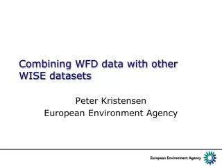

Combining WFD data with other WISE datasets
E N D
Presentation Transcript
Combining WFD data with other WISE datasets Peter Kristensen European Environment Agency
2012 EEA water report • The knowledge base to classify the ecological and chemical status, pressures and impacts was not optimal for the first RBMPs. However, compared to the situation before the WFD, there has been a significant improvement of the knowledge base and increased transparency by bringing together information on all characteristics, pressures and impacts on water bodies at basin level. • The quality of the EEA’s assessments relies on the quality of the Member States’ reports and data delivery. There are examples of very good, high-quality reporting. However, there are also cases where reporting contains gaps or contradictions. Bad or incomplete reporting can lead to wrong and/or incomplete assessments. • The WFD implementation report required by Article 18 of the WFD states that the report shall include among others “a review of the status of surface water and groundwater in the Community undertaken in coordination with the European Environment Agency”. • In the first implementation report this review was based on both the State of Environment (SoE) information provided by EEA Member Countries through the EIONET reporting and the status and pressure results reported at water body level. To obtain the best benefit out of this two level approach a better streamlining between WFD and SoE reporting is still needed.
Linking the different databases WISE system development – using and developing EEA infrastructure from the content perspective WaterbaseSpatialdatasets SoE Marine MSFD data SoE Rivers WFD data SoELakes Common codes, reference system Other directives SoE GW SoEEmissions Wateraccounting, ECRINS Event/ date: WISE SG Brussels 2014/03/31 Author: Olaf Büttner, Beate Werner
Combining WFD data with other WISE datasets BWD database 21000 sites BW quality (years) • Common codes • WFD Water body code • Monitoring station codes • Coordinates • Names (e.g. Lake name) UWWTD database Aggomerations WWT plants Compliance WFD database 130 000 Water bodies Ecological status Pressures Water quality database Stations (rivers, lakes, coastal) Water quality (years)
Not a WFD_Monitoring station - a WFD_Monitoring station Blank information on WFD station – Total river stations of which WFD stations Station information WISE-SoE rivers +71
Waterbase Rivers - 15000 stations WFD Monitoring Stations ~67200 stations Match by WFD(EU_CD station_code) – WaterbaseRivers (WFD_EU_CD) 4875 stations: AT (27), BE (290), BG (90), CY (31), CZ (56), DE (259), EE (93), FI (178), FR (1590), IE (26), IT (217), LT (85), LV (36), NL (5), PL (765), PT (60), RO (108), SE (94), SI (29), SK (112), UK (724), No match: DK, ES, GR, HR, HU, MT, NO
Combining WFD water bodies and WISE SoE data WFD database 130 000 Water bodies Ecological status Pressures Ecological status Water body code Water quality database Stations (rivers, lakes, coastal) Water quality (years) Total phosphorus
Rivers: Concentration range (1st quartile, median and 3rd quartile) of annual average nutrient concentrations in river water bodies in different classes of ecological status or potential (high to bad)
Pollution reduction from point sources Source: EEA 2012
Pollution reduction from diffuse sources Source: EEA 2012
Combining Bathing water data with other WISE datasets Bathing water Quality BWD database In 2012 MS have reported WBID for 14464 bathing waters (out of 22397) - Many BW could be matched with WFD water bodies – but not all 21000 sites BW quality (years) Water body code WFD database 130 000 Water bodies Ecological status Pressures Ecological status WFD Water bodies Bathing waters
Bathing waters with WBID (EUSWBCode) Match between WBID & EUSWBCode
Ecological status of lake bathing waters according to bathing water quality 1595 lake BW had mathing ecological status (87% Excellent quality) BWs with excellent quality had better ecological status than BWs with good or sufficient quality
Bathing water sites and WFD water bodies Several bathing waters are not WFD water bodies Often lakes (one WFD water body) have many bathing waters
Urban Waste Water Treatment Discharge points – with SWBcode (SWBID) UWWT discharge point WBID WFD SWBs 20100 of 28500 discharge points had SWBcode In some case WFD and UWWT codes have a good match
Combining WFD Water Bodies and stations with Waterbase Stations
Summary • The stations in the different WISE-databases will be linked to WaterBodies • Common stations in WFD monitoring and WISE-SoE will be identified • Common station description for all databases • Hierarchical system will enable different aggregation of information – tomorrows discussion of geographical information • EEA will during the next year provide country fiches and probably RBD fiches
Country Fiche • Overviews of what countries have reported by the different reporting streams/databases: WISE-SoE, WFD, other directives • Comments for clarification to countries • Aim to improve the quality of the different databases • http://www.tcvode.si/wise_soe_country_fiche/ • To be further discused at the Eionet freshwater workshop end June
First RBMPs reported 210 river water bodies- 10 with shape files – 210 with centroid coordinates
Corsica Sub-basins (Streams) Channels Standing waters Transitional waters Coastal waters Groundwater Accès par département Accès par territoire SDAGE Accès par entité milieu Accès par moteur de recherche Link - http://www.corse.eaufrance.fr/geo-sdage/index.php
Sub-basins (Streams) Fiche de synthèse sous bassins (masses d'eau cours d'eau) : FiumAlbino Généralités Caractéristiques des masses d'eau du sous bassin Qualité / État du milieu Pressions importantes Mesures complémentaires au titre du programme de mesures 2010 - 2015 Paysage socio-économique Existence de zones protégées DCE et autres réglementations Existence de démarches locales Milieux associés Documents annexes
Fium Albino Généralités Caractéristiques des masses d'eau du sous bassin Généralités Code du sous-bassin : CR_22_33 Superficie (km2) : 48.7 Territoire SDAGE : Cap Corse Département(s) : 2B Région(s) : CORS Caractéristiques des masses d'eau du sous bassin
Monitoring stations (Aliso river) Physico-chemical water quality Micropollutants Biology Link
Monitoring stations - rivers Link - http://carmen.carmencarto.fr/80/siecorse.map