Download
1 / 32
320 likes | 600 Vues
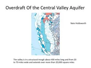
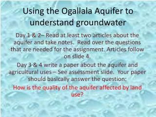
Development of a Preliminary Groundwater Flow Model for the Mahomet Valley Aquifer. By: M. Heidari, A. Wehrmann, G. Roadcap, and S. Wilson December 2000. Geology-- location map for COGEOMAP. Iroquois Co. Vermilion Co. Ford Co. Champaign Co. McLean Co. Piatt Co. DeWitt Co. Macon Co.

E N D
Development of a Preliminary Groundwater Flow Model for the Mahomet Valley Aquifer By: M. Heidari, A. Wehrmann, G. Roadcap, and S. Wilson December 2000
Geology--location map for COGEOMAP • Iroquois Co. • Vermilion Co. • Ford Co. • Champaign Co. • McLean Co. • Piatt Co. • DeWitt Co. • Macon Co. • Tazewell Co. • Logan Co. • Sangamon Co.
Hydrogeology of the Mahomet Aquifer System Glasford aquifers Mahomet Sand aquifer North
Where: is the vector of the observed hydraulic head is the vector of parameters such as: and Pumpage (Q), Leakage (L), Recharge ( R), Hydraulic conductivity (K), Specific storage (Ss), and Boundary conditions (BC)
Adopted boundaries of the recharge zones in the Mahomet Aquifer
Adopted coarse linear quadrilateral finite element mesh for the preliminary model
Assumed constant head zones and river stage for the preliminary model
Assumed recharge zones for the preliminary model. Zones 5, 6, 8, 9 and 10 are prior information zones.
Assumed hydraulic conductivity zones for the preliminary mode and the values of hydraulic conductivity [ft/day] from pumping tests.
Estimated mean hydraulic conductivities [ft/day] for the assumed zones by GPEM2
Estimated mean recharge [in/yr] for the assumed zones by GPEM2
Estimated mean water level [ft] for each stream stage zone by GPEM2
Contours of residual errors between observed and simulated hydraulic heads [ft]
Uncertainty analysis: Assuming homoscedasticity (constant variance of errors) and uncorrelated errors among parameters, sensitivity analysis and Student’s t-test may be used to calculate the confidence intervals of the estimated parameters.
Groundwater Management Models: 1. A model for least cost pumping from an existing well field. 2. A model for capacity expansion of a well field. 3. A model for safe yield groundwater management. 4. A model for containment of pollution in a contaminated aquifer. 5. An economically based model for water resources planning for a multi-basin and multi-component system.