Download
1 / 24
240 likes | 633 Vues
An Improved Algorithm of Wildfire Detection and a Method of Wildfire Observation for Validation. Koji Nakau Ph.D (JAXA/EORC) Masami Fukuda Ph.D (Fukuyama City Univ.) Hiroki Eto (Japan Airlines Co., Ltd.) nakau.koji@jaxa.jp. Importance of Satellite Infomation on Wildfire.

E N D
An Improved Algorithm of Wildfire Detection and a Method of Wildfire Observation for Validation Koji Nakau Ph.D (JAXA/EORC) Masami Fukuda Ph.D (Fukuyama City Univ.) Hiroki Eto (Japan Airlines Co., Ltd.) nakau.koji@jaxa.jp
Importance of Satellite Infomation on Wildfire • Importance of Wildfire • Environment: Severe impact on ecology, Soil or Peat • Climate: Non-negligible GHGs emission • Disaster: Needs for saving life, welth and society • Roles of Satellite imagery for Wildfire • Information for Fire Service for Efficient activity • High resolution is demanded for judge accessbility. • Map or image are not distributable in developping countries. • More verbal information is demanded. • Fire is small and rare event • Getting ground based validation data is not so easy • Especially comparison with observation by human eyes
Aim of This Research • Improve fire detection algorithm • To improve, not detected fire is important • Observe wildfire from cockpit • Air carrier can ovserve wide area everyday • Utilization of future sensors • SGLI (Second generation Global Imager) • CIRC(Compact InfraRed Camera)
JAXA’s Activity Related to this Research Observ. Algorithm System Social Impr. Validation Data Fire Detection Data Providing Fire Suppression AFS Fire Info GCOM-C MODIS AFS Fire Locationin AK Fire Suppression in AK Fire Detection Algorithm Wild Fire Monitor System JICA-JST JICA-JST Fire Locationin INA Fire Suppression in Indonesia JAL Fire Obs. Sentinel Asia Astronaut ? Distribute Disaster Infomation CIRC@ISS/ALOS2 Observation by human eye JASMES High res. Thermal IR sensor Global Wildfire Detection Throughout from Algorithm to Social Implementation
Approach to Detect Fire We need to estimate radiation from fire to detect fire. Total Radiance of Satellite Observation Rad4mm What we need is Radiation from Fire RadBG.Ref RadBG.Ems RadFire Radiation from Fire Emission from Background Reflectance of Background Estimated by SWIR Estimated by Thermal Infrared
Result of Fire Detection • Algorithm developed • Reflection from background land cover considered • Ancillary algorithms are improved ; Cloud cover, Snow mask • Doubled S/N ratio (comparing to MOD14) • 80% more HS & 10% less False Alarm (2004 AK day MODIS) • Smoldering, small fire or slush and burn • Different Geographical Distribution • Next Step • Validation • Detect Smoldering (smoldering is not detected)
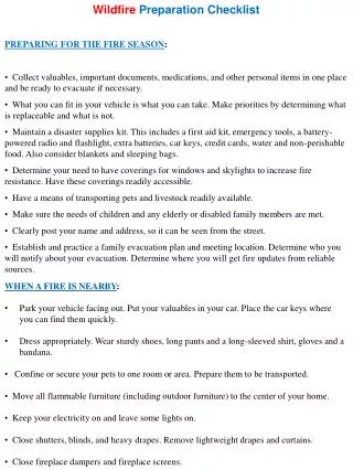
Ground staff input on the web form A pilot send a report to ground staff Data base Validation Procedure of wildfire observation by JAL pilots • When finding a wildfire, a pilot send a report to ground staff. This report is stored in database. • Including locationof aircraft, distance to wildfire and others. Authors estimated the location of wildfire using this report. • However, utilization of these report does not go straight. • location is not so relyable • Extraction of relyable location from reports needed.
Wildfire reports in 2010 Wildfire observation in 2011 in Russia
Result of wildfire observation • Total 990 reports are submitted from pilots in these 8 years. • We needed trial and error to utilize this data. Therefore, analysis is still undergoing.
Wildfire on 07 Aug(with RGB=MODIS:4mm/2.2mm/1.2mm on 07 Aug)
Wildfire on 07 Aug(with RGB=MODIS:4mm/2.2mm/1.2mm on 07 Aug)
Fraction of detection by satellite for observed fire • Location of observation is not so accurate. • # of fail to detect may include such an error • Overwrapped fire location might be relatively reliable. • previous slide is an example
Summary • Proposed algorithm performed better • For the observed fire by JAL • Reliable observed fire location extracted • Observed fire pixel failed to detect by satellite will be extracte based on this method.
SGLI (Second generation Global Imager)CIRC(Compact InfraRed Camera) Utilization of future sensors
JAXA’s sensors to be available for wildfire CIRC/CALET on JEM/ISS FY2013 SGLI on GCOM-C1 FY2015 CIRC on ALOS-2 FY2013 Swath: 1150km Resolution: 250m Swath: 80km Resolution: 115m Swath: 130km Resolution: 200m Collaboration with UNIFORM Integrative Analysis of middle-high resolution IR sensor datasets. Submitting the latest fire fighting aid data
SGLI(250m)+CIRC(115m)for accurate fire location Locations of burning fire can be identifiedas . MODIS 2009-09-26 現在主流のMODISでは、 場所が1km単位でしか 分からない Hotspot by MODIS CIRC (simulated from TM)2009-09-26
Summary • Importance of Wildfire Management • Fire emit ¼ to ½ as much as GHG by human • JAXA Wildfire Monitoring • JAXA will launch several sensors available for wildfire monitoring from FY2013 • Algorithm with better performance • Wildfire observation by JAL • 990 ovservation has reported. • Reliability of location is improving • Identified fire pixels failed to detect fire