Download
1 / 25
270 likes | 426 Vues
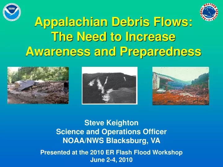
Appalachian Debris Flows: The Need to Increase Awareness and Preparedness. Steve Keighton Science and Operations Officer NOAA/NWS Blacksburg, VA Presented at the 2010 ER Flash Flood Workshop June 2-4, 2010. Acknowledgements. Larry Lee and WFO GSP (sharing presentations and local policy)

E N D
Appalachian Debris Flows:TheNeed to Increase Awareness and Preparedness Steve KeightonScience and Operations OfficerNOAA/NWS Blacksburg, VA Presented at the 2010 ER Flash Flood WorkshopJune 2-4, 2010
Acknowledgements • Larry Lee and WFO GSP (sharing presentations and local policy) • Rick Wooten, NCGS (slides from several presentations) • Barbara Watson (Camille anniversary slides) • Peter Corrigan, WFO RNK (for review of this presentation)
Background/Motivation • Recent events in wrn NC, and 40th anniversary of Camille in wrn VA serve as reminders to the threat • Rapid increase in population/construction in prone areas – next major disaster just a matter of time • Recent USGS (Wieczorek) and NCGS (Wooten) research, including digitized mapping • WFO GSP collaboration with NCGS, event reviews, and specific policy (Lee and others) • Can we do more to be prepared?
Terminology • Landslide:general term encompassing many varieties of earth/slope movements: “the movement of a mass of rock, debris, or earth down a slope” • Debris flow:(also known as mudslides) relatively fast-moving landslide, usually comprised of mix of water and fine sediments as well as larger rocks and other debris (typically the most damaging kind of landslide) • Rock slide:several to numerous rocks or boulders breaking loose from steep banks, often at cuts in natural slopes, typically caused more by freezing-thawing then heavy rainfall • Others terms include: debris slides, earth slides, rock falls, debris fans, slope movements, and others. Source: http://landslides.usgs.gov
Susceptibility Source: USGS
Historical debris flows in Appalachians Source: USGS Fact Sheet 2008-3070 (Wieczorek and Morgan)
Recurrence Intervals Historical Landslide Events in Western NC • ~ 3 years, a storm of high-intensity rainfall occurs over the mountains of the eastern US, posing a high debris flow hazard (Wieczorek et al. 2004) • ~ 9 years, a landslide event occurs in western NC (Gillion et al. 2007) • Major debris flow events happen in western NC every 20 – 30 years (Clark 1987) • ~ 15 years for Virginia (Wieczorek et al. 2009) • For local areas the interval is much longer (ex: Madison Co VA ~3,000 yrs) Rick Wooten, NCGS
CamilleAugust 19-20, 1969 • Up to 27” of rain, most fell in 8-hrs (overnight) • Thousands of debris flows • Severe flash flooding and river flooding • 153 dead or missing (>100 injured) • 313 homes destroyed • 133 bridges wiped out • 25 mi primary roads, 175 mi secondary roads washed away
Macon Co NC(Peeks Creek)Sept 17-18, 2004 Remnants of Frances and Ivan X
Macon Co NC(Peeks Creek)Sept 17-18, 2004 • Significant debris flow during Ivan rainfall raced down Peeks Creek • 4 deaths, several injuries • 15-20 homes destroyed or damaged Photo courtesy of David Phillips Photo: Brian Campbell, NWS
Macon Co NC(Peeks Creek)Sept 17-18, 2004 Photo: Jonathan Lamb, NWS
A Debris Flow Problem… • Debris flows and flash floods are NOT the same thing (although NWS uses debris flows to verify flash flood warnings) • We have no way of knowing what slopes are in immediate danger of failing, or if one has failed • A specific debris flow warning would be nearly impossible to issue • The best we can do right now is to mention the threat in a statement or warning • However, this could change Top photo Brian Campbell (NWS), bottom photo Jonathan Lamb (NWS)
Landslide ThreatIncreased Public Awareness • NCGS Asheville Regional Office mapping locations of known landslides and potential threat areas • Slope movements/deposits • Stability Index Map • Downslope hazards • All 19 Mountain and Foothill counties will be mapped • Macon, Watauga, Buncombe complete • Henderson (2010?) Both images NCGS
Landslide ThreatIncreased Public Awareness GIS mapping by NCGS (Gillon et al 2007) • Slope Movements / Deposits –where landslides occurred • Slow Moving Landslides –where landslides are occurring • Stability INdex Map (SINMAP) Results -where debris flows-slides might start • Downslope Hazards –where debris flows/slides might go • Bedrock Geology –mapped problematic rock units
Landslide ThreatIncreased Public Awareness • Maps and data intended as planning tools • Public education • Local government land use planning and permitting • Emergency management Maggie Valley, NC. Photo by Rick Wooten, NCGS
Landslide ThreatIncreased Public Awareness • Understanding high threat locations Slope properties Slope modification
Development of rainfall intensity–duration curves(USGS) Source: Wieczorek et al, 2009
General rules of thumb (NCGS and USGS) • High antecedent moisture conditions followed by high rainfall rates • 5” of rain in <24 hours: reasonable threshold for localized slope movement events • 10” of rain in <24 hours: widespread slope movements • 3.5 - 4” per hour rainfall rates dramatically increase threat Still could use more rain gages in prone areas
WFO GSP local policy • Specific section of SDM on landslides • Background info including threshold guidelines • Includes some example Call-to-Actions to be included in flash flood warnings: • THIS FLASH FLOOD WILL INCREASE THE RISK OF LANDSLIDES AND ROCKSLIDES… ESPECIALLY IN AREAS WHERE SLIDES HAVE OCCURRED IN THE PAST. BE ESPECIALLY ALERT IF YOU ARE NEAR A MOUNTAINSIDE STREAM… A STREAM AT THE BASE OF A MOUNTAIN… OR A STREAM IN A MOUNTAIN COVE. WATCH FOR LOOSE OR MOVING SOIL AND ROCKS OR AN ABRUPT INCREASE IN STREAMFLOW… AND LEAVE THE AREA QUICKLY IF OBSERVED. IF YOU ARE DRIVING ON MOUNTAIN ROADS… WATCH AND LISTEN CAREFULLY FOR THE DANGERS OF FALLING ROCKS… MUD… TREES… AND DEBRIS. • RESIDENTS AND MOTORISTS IN AND BELOW RECENTLY BURNED OR CUT OVER AREAS SHOULD BE ALERT TO HEAVY MUD AND DEBRIS FLOWS WHICH MAY BLOCK ROADS AND CULVERTS. DANGEROUS FLOODING AND PROPERTY LOSS COULD RESULT IN AREAS WHERE RUNOFF IS RESTRICTED OR BLOCKED.
WFO GSP local policy cont… • …and example Call-to-Actions for flood watches (this one for more than 10” rainfall): • RAINFALL OF MORE THAN 10 INCHES FREQUENTLY TRIGGERS WIDESPREAD AND DAMAGING LANDSLIDES AND ROCKSLIDES. IF YOU LIVE ON A MOUNTAINSIDE OR IN A COVE AT THE BASE OF A MOUNTAIN… ESPECIALLY NEAR A STREAM… CONSIDER MOVING TO ANOTHER LOCATION FOR THE DURATION OF THIS WATCH. AVOID TRAVEL ALONG MOUNTAIN ROADS DURING THE BRUNT OF THE STORM.
Landslide Advisory ProcessExample of increased coordination • NCGS evaluates antecedent moisture and NWS QPF • Coordination among agencies through NCEM conference call • NCGS issues Landslide Advisory through DENR and NC EOC • NWS include calls-to-action in Flash Flood Watch/Warning products T.S. Ivan 1620 UTC 16 September 2004 Terra MODIS image from SSEC, Univ. of Wisconsin
SummaryCan we better protect lives/property from Appalachian debris flows? • Increase our own awareness • Increase public awareness (educational and safety campaigns – USGS “fact sheets”) • Increase coordination with USGS and state geological agencies (additional GIS mapping) • WFO GSP policy greatstarting point to consider
References • landslides.usgs.gov • www.geology.enr.state.nc.us/Landslide_Info/Landslides_main.htm • Clark, G.M., 1987: Debris slide and debris flow historical events in the Appalachians south of the glacial border. Reviews in Engineering Geology, Volume VII, Debris Flows/Avalanches: Processes, Recognition, and Mitigation. J. E. Costa and G. F. Wieczorek, Eds., The Geological Society of America, Boulder, CO, 125-138. • Gillon, K., R. Wooten, R. Latham, A. Witt, T. Douglas, S. Fuemmeler, J. Bauer, J. Nickerson, 2007: Current results of landslide hazard mapping in western North Carolina. Presentation at Geohazards Technical Forum, Marshall Univ. • Wieczorek, G.F., Eaton, L.S., Morgan, B.A., Wooten, R.M., and Morrissey, M., 2009: An examination of selected historical rainfall-induced debris-flow events within the central and southern Appalachian Mountains of the Eastern United States: U.S. Geological Survey Open-File Report 2009–1155, 25 p. • Wieczorek, G.F., Mossa, G.S., and Morgan, B.A., 2004: Regional debris-flow distribution and preliminary risk assessment from severe storm events in the Appalachian Blue Ridge province, USA: Landslides, v. 1, p. 53-59, available at: www.springerlink.com/content/atmj2qx90yh24q0q/fulltext.html. • Wieczoreck, G.F., Morgan, B.A., and Campbell, R.H., 2000: Debris-flow hazards in the Blue Ridge of central Virginia: Environmental & Engineering Geoscience, v. 6, no. 1, p. 3-23. • Wooten, R.M., Gillon, K.A., Witt, A.C., Latham, R.S., Douglas, T.J., Bauer, J.B., Fuemmeler, S.J., and Lee, L.G., 2008, Geologic, geomorphic, and meteorological aspects of debris flows triggered by Hurricanes Frances and Ivan during September 2004 in the Southern Appalachians of Macon County, North Carolina: Landslides, v. 5, no. 1, p. 31–44. Also available online at www.springerlink.com/ index/2705hw84480m5420.pdf.