IJC LO-SL Water Levels-Flows Study: Fish Performance Indicators Framework
IJC LO-SL Water Levels-Flows Study: Fish Performance Indicators Framework. Ken Minns, Susan Doka and Carolyn Bakelaar GLLFAS, DFO Science Burlington. Outline. Review Integration - Environment Model & SVM Fish Habitat Indicators Framework Fish Population Indicators Framework Next Steps.

IJC LO-SL Water Levels-Flows Study: Fish Performance Indicators Framework
E N D
Presentation Transcript
IJC LO-SL Water Levels-Flows Study:Fish Performance Indicators Framework Ken Minns, Susan Doka and Carolyn Bakelaar GLLFAS, DFO Science Burlington
Outline • Review • Integration - Environment Model & SVM • Fish Habitat Indicators Framework • Fish Population Indicators Framework • Next Steps
Review • Our purpose is • to develop an assessment framework for fish and their habitats, spanning Lake Ontario and the St. Lawrence River, • to evaluate alternate regulation schemes under current and potential future climates • Our methodology uses the best available and defensible science
Review - continued • Fish sub-group is part of Environment WG • Other WGs are either providing • assessments (data, relationships) for other sectors or • common inputs (other WGs) or • integration (PFEG) for all WGs
ETWG Objectives • Simplistically • Generate a set of “interest satisfaction curves” which can be weighed against over curves representing the complete spectrum of sectors • Realistically • Generate a series of models that can evaluate between regulation options where environmental gains and losses can be described
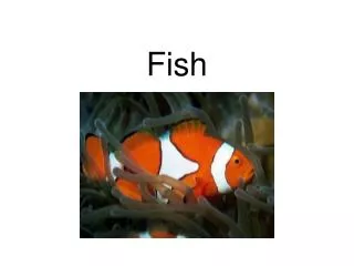
Fish Performance Indicators • Habitat • Between years • Stranding risk within years • Fish Populations • Recruitment success • Population size / productivity • Fish Assemblages • Fish Species-at-risk
Workshop Tasks We need to agree on: • Which inputs are needed to estimate fish sub-group performance indicators • An integrated spatial-temporal framework for assessing fish habitat indicators given inputs • A common approach for modelling fish population indicators linked to the habitat supply assessments • Which fish species to use as indicators
H&H WG Env WG Coastal WG IM WG Hydrology & Thermal Scenarios GIS Maps LO-SL Area Coastal Scenarios Wetland Scenarios Habitat Supply Analyses Fish Habitat Indicators Shared Vision Model Fish Population Analyses Fish Population Indicators Fish Community & SAR Indicators Fish-Eye View of “Integration” Framework
Fish Habitat Indicators Framework • Habitat Supply Indicators • Spatial Hierarchy of Habitat Mapping • Species Indicators • Habitat Suitability Index Models • Integrated Fish Habitat Indicators
Spatial Hierarchy of Habitat Mapping • Representation of all fish habitat • in all L Ont - St Law R. ecosystem • selected areas of whole ecosystem • Mixture of data sources & resolutions • Shoreline geomorphology of system • Coastal Wetlands (ETWG) • Sites from Coastal WG (not wetlands) • Whole lake
Shorelines Geomorphic Classification 1. High (>15m) Bluff 2. High (>15m) Bluff with Beach 3. Low (<15m) Bluff 4. Low (<15m) Bluff with Beach 5. Sandy/Silty Banks 6. Clay Banks 7. Sandy Beach/Dunes 8. Coarse Beaches 9. Baymouth Barrier Beaches 12. Low Riverine/Coastal Plain 13. Open Shoreline Wetlands 14. Semi Protected Wetlands 10. Bedrock (Resistant) 11. Bedrock (Non resistant) 15. Composite 16. U.S. Shore: Unclassified 16. Canadian Shore: Artificial 17. U.S. Shore: Artificial 17. Canadian Shore: Unclassified 99. Unclassified (coded by the compiler) wetland associations
% US shoreline 2 1 1 1 95 Shoreline Breakdown (Length) % Total Shoreline % Lake % River % Canadian shoreline 4.6 Barrier beach 9 0 3 Riverine /coastal plain 23.9 6 15 9 Open shoreline wetland 10.4 4 6 4 Protected shoreline wetland 4.9 10 38 23 Other 56.2 72 40 62
Baymouth Barrier Beaches Low Riverine/Coastal Plain Open Shoreline Wetlands Semi Protected Wetlands Wetland Type: Exposed Bay Shoreline Type: Open Shoreline Wetland Upper St. Lawrence Bay of Quinte Wetland Type: Barrier Beach Shoreline Type: Baymouth-Barrier Beach Eastern Lake Ontario
Wetland Habitat Attributes and Areas Wetland Type: Exposed Bay Wetland Type: Barrier Beach
Wetland Type: Barrier Beach Attributes: < 0.5m Emergents Floating Veg Submergent Veg Cattail Marsh Considerations: Substrate? Area of Inundation? (resid, trees)
Wetland Type: Exposed Bay Attributes: < 1m Submergent Veg Emergent Veg Cattail Marsh Floating & Submergent Veg Considerations: Substrate? Area of Inundation? (agr.)
Limit model by elevation • Upper elevation extent • 100 year flood (75.8m) • high water mark • Lower elevation extent • IGLD85 (74.2m)
5m Suitable Areas Wetland/Veg Substrate Depth/Elevation Model suitabilities Buffer shoreline types to 5m contour Map habitat combinations
Habitat Suitability Index Models • Must apply same HSI models to all areas • Consistency • No a priori reason to think different models are needed for different locations • Different models may generate misleading results • Review alternatives available • Thermal Reproductive Guild approach used in L Ontario • Species Probabilistic approach used in Lac St Francis • Evaluate options and make choice • run all models side by side – how different are they?
Low Med High Suitability Map of Lake Ontario ShorelineBased on earlier work with Env’t Canada (Emergency Response Division)
Integrated Fish Habitat Indicators • Estimate indicators (WSA) by location-type patch • How to define the patch size for populations? • Weighted sums for regions (LO, USL, LSL) • Several Sub-regions? • Normalization between regions?
Fish Population Indicators Framework • Common Fish Population Model Structure (Inputs, Relationships) • Spatial Contexts for Assessments? • Fish Population Performance Indicators (Outputs)
Fish Population Model Structure • Simple age-stage structured models • Life history rate processes tied to habitat supply and climatological-hydrological variables • Pike model of Hamilton Harbour provides starting point • One model for each species, applied to all locations
Population Model Structure Suitable Area Estimates Habitat Suitability Indices Habitat Mapping Growth Planktonic Larva Demersal YOY Juvenile Adult Egg Mortality
COVER DEPTH SUBSTRATE Linking water levels to northern pike population dynamicsin the Bay of Quinte WSA
Without Stranding Fry Density [with & without catastrophic stranding events] Water level (m) Fry density (no./m2) With Stranding Plan 58D Unregulated
Population Size Without Stranding [with & without catastrophic stranding events] Water level (m) With Stranding Number of fish (age 1+) Plan 58D Unregulated
Spatial Contexts for Assessments • Nested, hierarchical structure for representing spatial information • We know for most fish that a single shoreline unit is an insufficient scale • e.g. wetlands cannot stand-alone • We know that running a pike or pumpkinseed model using the habitat supply for Lake Ontario equally makes no sense • May have to game with level of spatial aggregation for population modelling purposes
Aggregate shoreline types with buffer to 5m contour • Increase number of shore segments for greater representation • Scale: based on size of patch not pop dynamics; use many sizes • Include adult range +5m don’t artificially limit them
Spatial modelling proposal • Repeated analyses across whole region at different spatial scales • Find resolution / scale that balances between site-specific and sub-regional scale in relation to spatial variations in water level regimes • Requires gaming before final choices can be made and comparative indices derived
# # # Lac St. Pierre Pointe Claire Summerstown Lake Ontario
# # # Lac St. Pierre Pointe Claire Summerstown Lake Ontario
Population Performance Indicators • Derived from time-series analyses based on model runs where water levels (habitat supply) are tied to specific regulation and climate combinations • Will involve both mean & variance measures • Candidates?: • Mean annual recruitment per unit area • One+ or mature population size per unit area • Production rate per unit area
Next Steps • Build detailed consensus about spatial framework for whole region • Agree on: • habitat suitability analysis for whole region • approach for fish population modelling and species to be targeted across whole region • population metrics to be assessed • Community and SAR/SOC assessment?
Fish Assemblages • Indicator values flow from habitat and population indicators • Can population model species be used as surrogates for assessing all members of different thermal and reproductive guilds? • What metrics should we use?
Species At Risk / Species of Concern • Which species are in the system? • Which are most sensitive to water level change? • How do we assess or model the impact of water level changes on these species? • What has been done already?