Download
1 / 39
390 likes | 549 Vues
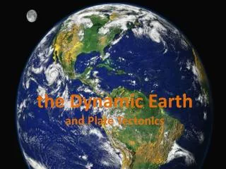
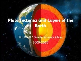
Plate Tectonics and Layers of the Earth. Mr. K’s 8 th Grade Science Class 2009-2010. Introduction. Plate Tectonics.

E N D
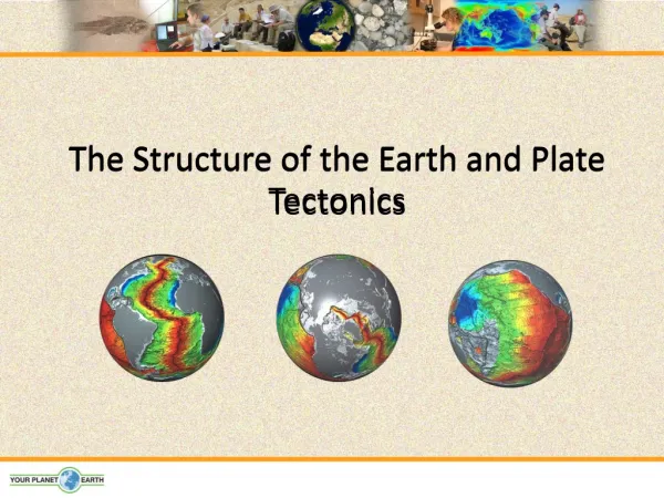
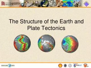
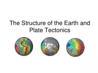
Plate Tectonics and Layers of the Earth Mr. K’s 8th Grade Science Class 2009-2010
Introduction Plate Tectonics ______________________________ is a relatively new theory that has revolutionized the way geologists think about the _____________. According to the theory, the ________________ of the Earth is broken into large _________________. The ____________ and ___________________ of these plates change over ____________. The _____________ of these plates, where they move _________________ each other, are sites of intense geologic activity, such as __________________, ____________________, and ___________________ building. Earth surface plates size position time edges against earthquakes volcanoes mountain
continental drift Plate tectonics is a combination of two earlier ideas, ______________________________ and _____________________________________. Continental drift is the movement of _____________________ over the Earth’s surface and their change in __________________ relative to each other. Sea-floor spreading is the creation of new oceanic crust at ______________________________ and movement of the crust ____________ from the mid-ocean ridges. sea-floor spreading continents position mid ocean ridges away
Layers of the Earth:The Core The Earth is divided into ________ chemical layers: the ____________, the ________________ and the ______________. The core is composed of mostly ___________ and ____________ and remains very hot, even after 4.5 billion years of cooling. The core is divided into two layers: a solid _______________ core and a liquid _______________ core. three core mantle crust iron nickel inner outer
Inner Core 3,200 – 3,960 miles The inner core is _________________________ (5,150-6,370 km) below the earth's surface and mainly consists of iron, nickel, and some ________________ elements (probably ______________, ______________, _______________, ______________ and __________________). The temperature in the inner core is about __________________________ (5000-6000 ºC). Because of the high __________________, the core is ___________. lighter sulfur carbon oxygen silicon potassium 9032 - 10832 ºF pressure solid
Outer Core The outer core is at _________________________(2,890-5,150 km) below the earth's surface. The outer core is _____________ and mainly consists of iron, some nickel and about 10% ___________ and ______________. The temperature in the outer core is about ____________________________ (4000-5000ºC). The outer core and inner core together cause the earth's __________________. 1,800-3,200 miles liquid sulfur oxygen 7200 - 9032 ºF magnetism
Upper Mantle Lower Mantle
The Mantle middle The ______________ part of the Earth, the mantle, is composed of two layers also, the ______________ mantle and the _____________ mantle. The mantle is _____________ and _____________________. This is because of the _______________ points of the different layers and the increase in ___________________ and _______________ as one moves _____________ into the Earth. As the upper mantle is both _________ and under relatively _____________ pressure, the rock in the upper mantle has a relatively low __________________, which means it is relatively fluid. In contrast, the lower mantle is under ___________________ pressure and therefore has a _____________ viscosity than the upper mantle. upper lower solid plastic-like melting temperature pressure deeper hot little viscosity very high higher
The Crust There are two types of crust. The first is called _____________________ crust and is made of relatively dense rock called __________________. The second is _________________________ crust and is made of lower density rocks, such as ___________________ and ___________________. Both continental and oceanic crust ______________ on the ________________. Because the continental crust is __________________, it extends both above and below the oceanic crust, much like a large iceberg floating next to smaller one. oceanic basalt continental andesite granite float mantle very thick
Evidence of Continental Drift When you look at a ___________ of Earth’s surface, one thing is very obvious. You can notice that the ______________ of some _______________________ look as if they would fit together like a _________________. In the early ________________, as accurate maps of Earth’s surface were first being developed, other people also noticed this fact. map edges continents puzzle 1800’s
Pangaea Alfred Wegener ____________________________ thought that the _________ of the ______________________ wasn’t just a coincidence. He believed that all the continents were ______________ together at some point in the past, and in a ____________ lecture, he proposed the idea of continental drift. Wegener believed that all continents were once connected as ________ large landmass that broke apart about ___________________ years ago. When the continents broke apart, they ________________ to their present positions. He called this large landmass __________________, which means all land. fit continents joined 1912 one 200 million drifted Pangaea
Fossil Clues Besides the puzzle-like fit of the continents, other clues were found from ____________. Fossils of the reptile ___________________ have been found in ___________________________ and _________________. This swimming reptile lived in _____________________ and on ____________. But how could fossils of the Mesosaurus have been found so far apart? It’s very unlikely that it could have swum between ________________. Wegener thought this reptile lived on ________ continents when the continents were ___________________. fossils Mesosaurus South America Africa fresh water land continents both connected
Climate Clues plants Fossils of warm-weather ______________ were found on the island of ______________________ in the Arctic Ocean. Wegener believed that Spitzbergen drifted from the _____________ regions. He also used ________________ clues to support his theory. Glacial ______________ and grooved ________________ found in southern areas of _________________________, ________________, _______________, and _____________________ indicated that these continents were once covered with __________________. Wegener thought that these continents were all __________________ and covered with _________ near Earth’s _______________________ at one time. Spitzbergen tropic glacial deposits bedrock South America Africa India Australia glaciers connected ice South Pole
Rock Clues If the continents were connected at one time, then ___________ that make up the continents should be the _____________. Similar rock _________________ are found on different continents. Parts of the ____________________ Mountains of the eastern United States are similar to those found in ___________________ and western _______________. If you were to travel to ___________________________and western _______________, you would find rock structures that are very similar. These clues, found in rocks, support the idea that the continents were connected when these rock structures formed. rocks same structures Appalachian Greenland Europe South America Africa
Plate Tectonics 1960’s The new hypothesis of the early _____________ explained several puzzling sets of observations. All that remained was a _________________ of these hypotheses. The synthesis began in 1965 when ____________________ introduced the term ____________ for the broken pieces of the Earth’s lithosphere. In 1967, ______________________ proposed that the Earth’s surface consists of __________________________ that move relative to each other. Two months later, _____________________________ published a synthesis showing the ____________________ and _____________ of plate boundaries and their ___________________ of movement. Since the mid 1960’s, the plate tectonic model has been rigorously tested. Because the model has been _________________ tested by numerous methods, it is now called the plate tectonic ___________ and is accepted by almost all geologists. synthesis Tuzo Wilson plate James Morgan 12 rigid plates Xavier Le Pichon location type direction successfully theory
Earthquakes ______________________ and ____________________, evidence of unrest in the Earth, help locate the ____________ of plates. Earthquakes are distributed in _____________, ______________ belts that circle the Earth. Some of these belts have only ______________ (0-20 miles) earthquakes, like the ______________________ and east _______________ ridges. In contrast, earthquakes in other belts, like _______________ South America and ________________________ Asia, are at shallow, ____________________ (20-45 miles), and _____________ (45-450 miles) levels. volcanoes edges narrow linear shallow Mid-Atlantic Pacific western southcentral intermediate deep
___________________ are also distributed in ___________ belts that circle the Earth. A dramatic example is the line of volcanoes that circle most of the _______________ Ocean. This belt is known as the _________________________ because it is the site of frequent volcanic eruptions. Volcanoes long Pacific “Ring of Fire”
earthquakes The distribution of ___________________ and _____________________ coincides at most locations. The _________________________ is an excellent example. Geologists believe that areas of _________________ geologic activity, indicated by earthquakes, volcanoes, and/or ______________________________, mark the boundaries between ______________________ plates. The distribution of earthquakes, volcanoes, and mountain ranges define _____________ plates and __________________ plates. volcanoes “Ring of Fire” intense mountain building lithospheric 7 large 20 smaller
Plate Boundaries The ways that plates interact depend on their relative _______________ and whether ___________________ or ______________________ crust is at the edge of the lithospheric plate. Plates move _____________________, _______________, or ________________________ each other. Geologists call these __________________, ___________________, and ___________________ plate boundaries. motion continental oceanic away from toward slide past divergent convergent transform
Divergent Plate Boundaries Divergent plate boundaries are locations where plates are moving _____________________ one another. This occurs above rising ____________________ currents. The rising current ______________________ on the bottom of the lithosphere, _________________ it and flowing laterally beneath it. This lateral flow causes the plate material above to be _________________ along in the direction of flow. At the crest of the uplift, the overlying plate is stretched _____________, breaks and _________________________. away from convection pushes up lifting dragged thin pulls apart
Mid-Atlanic The ________________________ Ridge is a classic example of this type of plate boundary. The Ridge is a ____________ area compared to the surrounding __________________ because of the lift from the ___________________ current below. (A frequent misconception is that the Ridge is a build-up of __________________ materials, however, the ____________ that fills the depression does not flood extensively over the ___________ floor and stack up to form a topographic high. Instead, it ____________ the depression and solidifies. high seafloor convection volcanic magma ocean fills
Hot Spots Geologists believe that some areas in the mantle are _______________ than other areas. These hotter places in the mantle form areas called ____________________. The hot spots ___________ rock, which is then forced _________________ toward the crust as _______________. The _____________________ Islands sit on top of a hot spot under the ____________________ Plate. _______________ from deep in Earth’s mantle has melted through the crust to form several ____________________________. hotter hotspots melt upward magma Hawaiian Pacific Magma volcanic islands
Hawaiian Islands The Hawaiian Islands are also all in a ___________. This is because the _________________ Plate is moving over the ____________________ hot spot. The island of Kauai is the _______________ Hawaiian island and was located where the big island of Hawaii is today. As the plate _____________, Kauai moved ____________________ the hot spot and became ________________. Continued movement of the Pacific Plate has formed ______________, __________________, ____________, and _________________ over a period of about ___________________________. line Pacific stationary oldest moves away from dormant Oahu Molokai Maui Hawaii 5 million years
Convergent Plate Boundaries Convergent plate boundaries are locations where lithospheric plates are moving ____________ one another. The plate collisions that occur in these areas can produce ___________________, __________________ activity and ______________ deformation. toward earthquakes volcanic crustal
Subduction When continental and oceanic plates _____________ the thinner and denser __________________ plate is overridden by the thicker and less dense ______________________ plate. The oceanic plate is forced ___________ into the _______________ in a process known as ___________________. As the oceanic plate descends it is forced into ____________ temperature environments. At a depth of about _________________ materials in the subducting plate begin to approach their _______________ temperatures and a process of partial melting begins. collide oceanic continental down mantle subduction higher 100 miles melting
Examples of Convergent Plate Boundaries Appalachian Mountains Himalayan Mountains Andes Mountains
Transform Plate Boundaries We have learned that crust is _____________ at a divergent boundary and ________________ or ____________________ at a convergent boundary. However, at a _________________ boundary, crust is neither formed nor destroyed. Here, two plates ______________________ each other in __________________ directions. As the plates move, their edges ______________ and ___________ against each other. formed folded destroyed transform slide past opposite scrape grind
Transform boundaries occur mostly on the ___________________ near mid-ocean ridges. They also occur on ___________, where some are clearly visible as long ______________ in the Earth’s surface. The _____________________ Fault in _____________________ is a transform boundary that runs from the Gulf of California through the __________________________ area. It marks where the _________________ Plate and part of the ____________________________ Plate are moving in opposite directions. sea floor land cracks San Andreas California San Francisco Pacific North American