Download
1 / 91
930 likes | 1.26k Vues
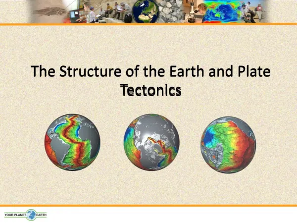
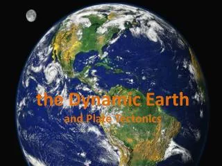
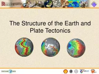
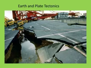
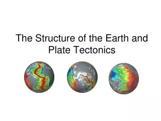
The Structure of the Earth and Plate Tectonics. Structure of the Earth. The Earth is made up of 3 main layers: Core the Centrosphere Mantle Upper - Asthenosphere Lower - Mesosphere Crust Lithosphere. Mantle. Outer core. Inner core. Crust. The Earth’s Layers.

E N D
Structure of the Earth • The Earth is made up of 3 main layers: • Core • the Centrosphere • Mantle • Upper - Asthenosphere • Lower - Mesosphere • Crust • Lithosphere Mantle Outer core Inner core Crust
The interior of the Earth is divided into layers based on chemical and physical properties. • The Earth has an outer silica-rich, solid crust, a highly viscous mantle, and a core comprising a liquid outer core that is much less viscous than the mantle, and a solid inner core. • Working from the centre of the Earth out we have: • The inner core is a primarily solid sphere about 1220 km in radius situated at Earth's center. • Based on the abundance of chemical elements in the solar system, their physical properties, and other chemical constraints regarding the remainder of Earth's volume, the inner core is believed to be composed primarily of a nickel-iron alloy, with small amounts of some unknown elements. • The temperature is estimated at 5,000-6,000 degrees Celsius and the pressure to be about 330 to 360 GPa (which is over 3,000,000 times that of the atmosphere!) • The liquid outer core is 2300 km thick and like the inner core composed of a nickel-iron alloy (but with less iron than the solid inner core). • Iseismic and other geophysical evidence indicates that the outer core is so hot that the metals are in a liquid state. • The mantle is approximately 2,900 km thick and comprises 70% of Earth's volume. (the core makes up about 30% of Earth's volume, with the outer crust [where we live] <1%!!). • The mantle is divided into sections based upon changes in its elastic properties with depth. • In the mantle, temperatures range between 500-900 degrees Celsius at the upper boundary with the crust to over 4,000 degrees Celsius at the boundary with the core. • Due to the temperature difference between the Earth's surface and outer core, and the ability of the crystalline rocks at high pressure and temperature to undergo slow, creeping, viscous-like deformation over millions of years, there is a convective material circulation in the mantle (mantle convection cells). Hot material rises up as mantle plumes (like a lava lamp!), while cooler (and heavier) material sinks downward to be reheated and rise up again. • The outer most layer is the crust - this is the most familiar to us as it is where we live. • The distinction between crust and mantle is based on chemistry, rock types and seismic characteristics. • Guess what the most abundant element in the earth’s crust is… • it is actually Oxygen (46.6% Oxygen; 27.7% Silica; 8.1% Aluminum; 5.0% Iron; 3.6% Calcium; 2.8% Sodium; 2.6% Potassium; 2.1% Magnesium; plus trace elements)
The Crust • This is where we live! • The Earth’s crust is made of: • Continental Crust • thick (10-70km)- buoyant (less dense than oceanic crust) - mostly old Oceanic Crust - thin (~7 km)- dense (sinks under continental crust)- young
How do we know what the Earth is made of? • Geophysical surveys: seismic, gravity, magnetics, electrical, geodesy • Acquisition: land, air, sea and satellite • Geological surveys: fieldwork, boreholes, mines
https://www.youtube.com/watch?v=1-HwPR_4mP4 • https://www.youtube.com/watch?v=1B4nRGFHzXs
If you look at a map of the world, you may notice that some of the continents could fit together like pieces of a puzzle.
Plate Tectonics • The Earth’s crust is divided into 12 major plates which are moved in various directions. • This plate motion causes them to collide, pull apart, or scrape against each other. • Each type of interaction causes a characteristic set of Earth structures or “tectonic” features. • The word, tectonic, refers to the deformation of the crust as a consequence of plate interaction.
What are tectonic plates made of? • Plates are made of rigid lithosphere. The lithosphere is made up of the crust and the upper part of the mantle.
What lies beneath the tectonic plates? • Below the lithosphere (which makes up the tectonic plates) is the asthenosphere.
Plate Movement • “Plates” of lithosphere are moved around by the underlying hot mantle convection cells
Divergent Convergent Transform Three types of plate boundary
Spreading ridges As plates move apart new material is erupted to fill the gap Divergent Boundaries
Age of Oceanic Crust Courtesy of www.ngdc.noaa.gov
Iceland: An example of continental rifting • Iceland has a divergent plate boundary running through its middle
Convergent Boundaries • There are three styles of convergent plate boundaries • Continent-continent collision • Continent-oceanic crust collision • Ocean-ocean collision
Continent-Continent Collision • Forms mountains,e.g. European Alps, Himalayas
Continent-Oceanic Crust Collision • Called SUBDUCTION
Subduction • Oceanic lithosphere subducts underneath the continental lithosphere • Oceanic lithosphere heats and dehydrates as it subsides • The melt rises forming volcanism • E.g. The Andes
Ocean-Ocean Plate Collision • When two oceanic plates collide, one runs over the other which causes it to sink into the mantle forming a subduction zone. • The subducting plate is bent downward to form a very deep depression in the ocean floor called a trench. • The worlds deepest parts of the ocean are found along trenches. • E.g. The Mariana Trench is 11 km deep!
Transform Boundaries • Where plates slide past each other Above: View of the San Andreas transform fault
Volcanoes and Plate Tectonics… …what’s the connection?
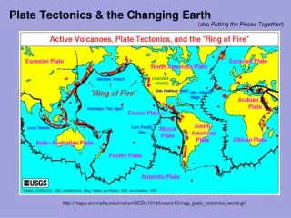
Pacific Ring of Fire Volcanism is mostly focused at plate margins
- Subduction - Rifting - Hotspots Volcanoes are formed by:
Volcanoes Not just one type
Composite Cone Mt St Helens - USA The volcano is built up of alternate layers of LAVA and ASH. They can explode with great violence. Crater Pyroclastic Flow Ash layer Dyke Lava Layer Flank eruption Conelet Lava Flow Crust Tom Abbott, Biddulph High School and made available through www.sln.org.uk/geography and only for non commercial use in schools
Shield ( Basic) Cone Mauna Loa Hawaii -USA Shield Volcanoes are enormous features built up only from layers of lava. They produce lots of lava but they tent not to erupt violently. Layers of Lava Lava Flow 10,000m 250 miles Composite volcano to scale
Ash and Cinder Cone Paracutin - Mexico The volcano is built up of layers of ASH. When it erupts it is normally with great explosive force. Volcanic Bombs Layers of Ash and Cinder 3,000m Pipe
Prediction of Volcanic Eruptions Long Term Prediction Identify volcanoes and the frequency and style of their eruptions (a geological problem). Establish probabilities of eruption, style and location for individual volcanoes. Establish the level of risk based on historic and geologic record. E.g., for individual volcanoes: determine most likely routes for lahars, nuees ardentes, lava flows, etc., and avoid construction in those areas.
Short-term prediction Based on the recognition of a pattern of events prior to previous eruptions. Gas emissions: rates of emission and type of gas changes in some volcanoes. Important gases include sulfur dioxide (SO2) and carbon dioxide (CO2) Changes in concentration may reflect movement of the magma up the vent.
Surface tilting: recognition of changes in the land surface due to building pressure in the conduit. April 8, 1980 May 2 April 26 A surface bulge appeared on Mt. St. Helens prior to its eruption.
Earthquakes: generated as the magma moves up the feeder conduit to the vent. When viscous magma becomes stuck in the conduit strain energy builds as more magma tries to push out. Movement takes place in a series of “jerks” as the rock material breaks. Each “jerk” produces an earthquake. Magnitudes generally less than 5 M. The more earthquakes the further the magma has moved.
Mount Spurr, Alaska: The 1992 Eruption of Crater Peak Vent USGS Black bars: earthquake frequency. Red lines: volcanic eruptions.
A combination of approaches is likely the key to short-term prediction.
Volcanic Hazards Lava flows Commonly destroy property in Hawaii and Iceland. Damage limited to the vicinity in the immediate area of the volcano. Fatalities rare due to slow speed of advancing lava flow.
Ash fall Mt. St. Helens’ ash cloud Extensive property damage and fatalities can result from heavy ash falls. Significant ash in the upper atmosphere can circle the globe in a matter of weeks. More than 80 commercial jets have been damaged by flying through volcanic ash clouds.
Pyroclastic flows Lahars are fast moving mudflows that can inundate urban areas that are nearby the eruption. Lahars can also dam rivers and which can lead to extensive flooding.
Lahars can be the most devastating outcome of many volcanoes. A relatively small eruption of Nevada del Ruiz, Columbia, in 1985, generated a lahar when the volcano melted a 2.5 km2 area of snow and ice. Water and debris rushed down the slopes, picking up more debris along the way.
A 5 metre wall of water and debris slammed into the town of Amero, 72 km from the volcano. The lahar killed 28,700 people and destroyed over 5,000 structures in the city.
Nuée ardentes destroy life and property in their paths. It is a rapidly moving turbulent incandescent cloud of gas, ash, and rock fragments flowing close to the ground after violent ejection from a volcano. 60 people, thousands of animals and fish, and hundreds of acres of lumber were destroyed by ash flows from Mt. St. Helens. A Nuée Ardent killed 20,000 people when Mt. Vesuvius exploded and shed a pyroclastic flow across the village of Pompeii in 79 AD.
People and animals died instantly from the rushing cloud of hot gas and ash.
Landslides Landslides can be generated when a volcano collapses during an eruption. During the Mt. St. Helens eruption 2.3 km3 of debris slid down the mountain at speeds up to 240 km/hr. The slide traveled over 24 km and left a 45 m deep deposit. 350,000 years ago Mt. Shasta experienced a similar eruption and landslide that was 20 times greater than that of Mt. St. Helens.