Download
1 / 34
340 likes | 524 Vues
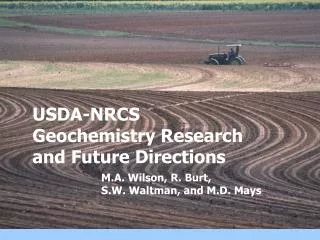
USDA-NRCS Geochemistry Research and Future Directions. M.A. Wilson, R. Burt, S.W. Waltman, and M.D. Mays. OBJECTIVES. Discuss:. Pedon characterization data at USDA-NRCS Soil Survey Laboratory(SSL) Current and future trace element work in NRCS

E N D
USDA-NRCSGeochemistry Research and Future Directions M.A. Wilson, R. Burt, S.W. Waltman, and M.D. Mays
OBJECTIVES Discuss: • Pedon characterization data at USDA-NRCS Soil Survey Laboratory(SSL) • Current and future trace element work in NRCS • Soil mapping/representative pedon approach to trace element distribution in soils
USDA-NRCSSoil Survey Laboratory • Located in the National Soil Survey Center, Lincoln, NE • Performs a wide variety of soil analyses for research, characterization, classification, and interpretations • Analyses performed on each soil horizon in a pedon
Soil Observation and Measurement • USDA NRCS manages the National Soil Survey Laboratory Characterization Database • 1940’s through the present • Contains about 30,000 soil sampling sites, or pedons • Many have morphological (profile descriptions) • About 1,000 pedons from other countries • About 75 percent are geo-referenced
These pedons are regarded as representing the properties and behavior of the series/mapping unit.
STATUS - NRCS TRACE ELEMENT PROGRAM • 513 pedons (Benchmark, anthropogenic, other important soils) • 2105 samples (major horizons, satellite samples) • 50 states, Puerto Rico, Virgin Islands, Guam • Morphological description, characterization data, georeference location • Two digestions/sample: Major, Trace
GEOCHEMISTRY PROJECTS • Agricultural Waste - KS, CO, UT, NE, VA, OH • Mining - Emissions (MT) Surface Mine (KS) • Urban - MD, NY, CT, ME, NJ, CA • Munitions Disposal - NV • Native - OR, WY, NV
Reported Elements • HF+HNO3+HCl (EPA Method 3052):Si, Al, Fe, Mn, Ca, Mg, Na, P, K, Zr, Ti • HNO3+HCl (EPA Method 3051A):Cu, Zn, Cd, Pb, Ni, Cr, Co, Hg, Mn, P, Fe, Ba, Be, Sr, Sb, Ag, As, Se, (Mo, V, Sn, Tl, W)
DIGESTION FOR TRACE ELEMENTS • 500 mg soil (<200 mesh) • 9 ml HNO3 + 3 ml HCl • Microwave digestion (175C for 4.5 min) • Cold Vapor AA - Hg • Flow-through hydride AA - As, Se • ICP-AES- Other elements
Pedon Locations for Trace Element Data
SAMPLING/ANALYSIS OF MAJOR PEDOGENIC HORIZONS • Evaluate pedogenic redistribution (e.g., biocycling, mobility via organo-metallic complexes, solubilization) • Evidence of anthropogenic accumulation in surficial horizons • Maximize data utility
Fractionation by Selective Dissolution SPECIATION IN SELECTED SMELTER-CONTAMINATED SOILS IN ANACONDA AND DEER LODGE VALLEY, MONTANA, USA
Benchmark pedon samples Available (red)
MINIMUM FIELD DATA SET(based on current approach) • Choose representative site • Identify soil type • Georeference location • Sample (minimum) 3 major horizons; possibly satellites • Site and Morphological documentation
MINIMUM LABORATORY DATA SET • Major and Trace elements • pH • Particle Size Analysis • Total C • Selective dissolution (e.g., citr. dith, acid ox.) • Cation exchange capacity • Bulk density
Soil Survey and Useof Representative Pedons (RP)Important factors • Mapping scale • Mapping/classification (stratification) criteria • Purity and uniformity of mapping units • Property transitions (boundary) between units Effective classification is more important than choosing representative pedons for improving prediction (Leenhardt et al., 1994)
Fine, mixed, semiactive, thermic Typic Paleaquults Fine, mixed, semiactive, thermic Plinthic Paleaquults
CONCLUSIONS • SSL performs geochemical analysis on a pedon/horizon basis for background and anthropogenic accumulations. • Use of Representative Pedons (RP) is a likely approach for documenting soil geochemistry across landscapes.
CONCLUSIONS • RP’s will assures best incorporation of data into existing NRCS soil survey data structure. • Merging a scheme of soil/landscape models with geostatistics may be viable.