Download
1 / 21
220 likes | 238 Vues
Summary of day 2 in the training session including the concepts of master lists, health facility data for Cambodia, and QGIS installation. Understanding public health functions, risk assessment, policy formulation, and GIS in public health. Introduction to QGIS and thematic mapping.

E N D
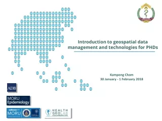
Introduction to geospatial data management and technologies for PHDs Kampong Cham 30 January - 1 February 2018
?? Summary of day 2 • We went through the concepts of master lists and common geo-registry • We talked about health facility and operational districts master lists for Cambodia • We worked at improving the content of both of these master lists • We looked at the proposed updating mechanism for both master list as well and discuss the role of the PHDs • We installed QGIS on the laptops Any questions?
Agenda for day 3 Introduce QGIS and learn how to prepare simple thematic maps with it
Session 10 – Introduction to QGIS Sokna Sek – MOH/DPHI Leng Ing – MOH/DPHI Sat Chab – MOH/DPHI Steeve Ebener – HGLC Izay Pantanilla – HGLC
Public health “All organized measures (whether public or private) to prevent disease, promote health, and prolong life among the population as a whole.“ 1 • The three main public health functions are: • The assessment and monitoring of the health of communities and populations at risk to identify health problems and priorities. • To assure that all populations have access to appropriate and cost-effective care, including health promotion and disease prevention services. • The formulation of public policies designed to solve identified local and national health problems and priorities. 1 http://www.who.int/topics/en/ 6
Risk assessment Biological Population Technological Natural Infrastructures Societal Services The highest risk occurs in areas where the hazard and vulnerability levels are at their highest and the capacity at its lowest There is a strong geographic dimension to risk and its assessment 7
Risk assessment At the origin of modern Epidemiology “The study of the distribution and determinants of health-related states or events (including disease), and the application of this study to the control of diseases and other health problems.“ 1 Original map by John Snow showing the clusters of cholera cases in the London epidemic of 1854. 1 www.who.int/topics/epidemiology/en/ 8
Accessibility to health care Geography Physical accessibility to health care is influenced by the location of the health services, the spatial distribution of the population and the environment between the two Once again a strong geographic dimension Allows for a more comprehensive and systemic approach to Universal Health Coverage (UHC) 9
Policy formulation A map is a powerful media to visualize and analyze the spatial distribution of public health related issues at this at all levels Support informed decision making and policy formulation Focus of this week training 10
GIS - Definition “An integrated collection of computer software and data used to view and manage information about geographic places, analyze spatial relationships, and model spatial processes.” It is not only about software! Data Software Hardware People Methods 11
Essential elements of a GIS Data - The content at the center! Garbage in – Garbage out ! Need for good data management practices Mendis K. (2009) Spatial technology & malaria control. Indian J Med Res 130, November 2009, pp 498-500 12
Complexity Data Quality Nbr of users What can you do with a GIS in public health? Spatial Modeling Spatial Analysis Thematic Mapping + Creation/Management of Geospatial data 13
What can you do with a GIS in public health? Spatial Modeling Spatial Analysis 1 hour Thematic Mapping Context/relationship Distance Travel time 14
Example of application in Public Health Thematicmapping Story Map Web mapping Cartogram Hospital management 15
Travelling Time Example of application in Public Health Spatial analysis • Location (e.g. altitude) • Distance 16
Vulnerability Mapping Link between Natural disaster (floods and hurricanes) and epidemics Example of application in Public Health Spatial modeling Physical Accessibility Distribution of health inequalities Poverty Mapping 17
Example of application in Public Health Spatial modeling Hazard modeling and geographicaly based risk assesment VRAM WHO eAtlas for Europe: http://data.euro.who.int/e-atlas/europe/ VRAM KAZ: http://www.gaia-geosystems.org/PROJECTS/VRAM/KAZ/vram_kaz_home.htm 18
Not everything is a GIS software! Database managers with a thematic mapping interface • ArcGISwww.arcgis.com • Most comprehensive and versatile • Complete GIS ecosystem: maps, analyses, web apps, servers, mobile, coding in Python, integration with R… • Expensive • QGISwww.qgis.org • Good for thematic maps, limited for analyses • Free Statistical packages allowing to conduct geostatistical analysis Thematic mapping applications These are real GIS software Used by DPHI at the central level Shared with you this week
What is QGIS? QGIS (also known as Quantum GIS) is a free, and open-source cross platform desktop geographic information system (GIS) application that supports viewing, editing, and analysis of geospatial data. Version 2.14 Why are we using QGIS version 2.14? Version 2.14 is the most stable version of QGIS at the moment which means that it has fewer bugs and less likely to crash.
QGIS (interface, main functionalities) Let’s have a look together!