Geospatial Data Management in Facilities: FMGIS Updates & Innovations
Explore the latest in Facilities Management GeoSpatial Information Systems (FMGIS) including new federal employees, PFMD liaison appointments, geospatial data utilization in FRPP and FMSS, buildings enterprise initiatives, and NPMap Facilities Management applications. Learn about enhanced reporting requirements and enhanced geospatial tools for effective resource management. Stay updated on access to FMSS V6.2 data and the integration with NPS Focus for robust data analysis and decision-making.

Geospatial Data Management in Facilities: FMGIS Updates & Innovations
E N D
Presentation Transcript
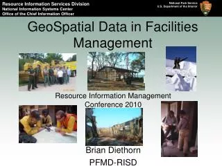
GeoSpatial Data in Facilities Management Resource Information Management Conference 2010 Brian Diethorn PFMD-RISD
Overview • What’s New in FMGIS! • New federal employee. • New PFMD Liaison. • Geospatial data in FRPP and FMSS. • The Buildings Enterprise Effort • Percent complete by region and unit. • Buildings statistics on Sharepoint. • EGIS buildings in action. • NPMap Facilities Management Application Demo • What is new. • Access to FMSS V6.2 (Maximo) • FMSS and NPSFocus • Park Trails Mobile Condition Assessment Project Petrified Forest
Catoctin Mountain What’s New in FMGIS:New federal employee Brian Diethorn is now a National Park Service employee as of August 2009! If you don’t know me I fill out your Virtual Campus requests.
What’s New in FMGIS: New GIS PFMD Liaison! • Jack Roberts retired after 35 years in the NPS. He was the champion of FMGIS in PFMD. • Dan Lemay is the new guy. • Former AKRO Facilities Manager. • Has a good understanding of GIS from working with the AKRO GIS office. • Currently Dan is a Facilities Management Specialist with WASO. He is responsible for the Federal Real Property Program (FRPP) for NPS. This is great for FMGIS! Buffalo River
What’s New in FMGIS: Geospatial Data In FRPP USS Arizona • Real Property Reporting: • Executive Order 13327: Which…”requires agencies to report all owned, leased, and otherwise managed Federal real property assets within and outside the United States, including improvements on Federal land.” • For owned real property (for which the United States holds title), the Federal agency that exercises real property accountability is responsible for reporting the asset. • This is reported up to DOI. • Geospatial attributes are required.
The Buildings Enterprise Effort:Percent complete by region. The number of Buildings collected / The number buildings in FMSS Alaska Region – 47% Intermountain Region – 54% Midwest Region – 39% National Capitol Region – 57% Northeast Region – 42% Pacific West Region – 64% Southeast Region – 74%
The Buildings Enterprise Effort:Buidings statistics in sharepoint
The Buildings Enterprise Effort:Buidings statistics in sharepoint
National Register NPMap Facilities Management application:What’s new? • Location and Asset hierachy in FMSS Export view. • Linking to geotagged JPEGS in NPS Focus • Demonstration.
Gettysburg Access to FMSS V6.2 data (Maximo) • FMSS has migrated from Maximo V4.1 to V6.2 at the end to FY2009. • The FMGIS program area resources are based off of old data . • FMGIS has submitted a request for access in April 2010. • Work order information has been targeted.
FMSS and NPS Focus http://image1.nps.gov/lizardtech/iserv/getimage?cat=BISC&item=FacMgt/BISC-b69ef42f8b394ff796a9cd31669732c3.sid&hei=1000&wid=1000&oif=jpeg
Manassas Park Trails Mobile Condition Assessment Project • Currently the process was run by contractors. • FMGIS is involved with the Development of procedures for park service personnel to run trail condition assessments. • Testing new Mobile Maximo for V6.2. • Also using ArcPad to collect GeoSpatial information and to geotag photos.
Thank You! Brian Diethorn PFMD – RISD 303-987-6976 Brian_Diethorn@nps.gov Channel Islands <Event Name &/or Date – Edit in Slide Master View>