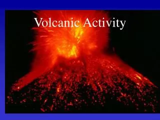
Volcanic Activity
Volcanic Activity. Year 10 Geography. Volcanic Activity. Volcanic activity is important right across the earth’s surface. There are over 500 active volcanoes which still erupt from time to time. Each year there are about 30 or 40 eruptions.

Volcanic Activity
E N D
Presentation Transcript
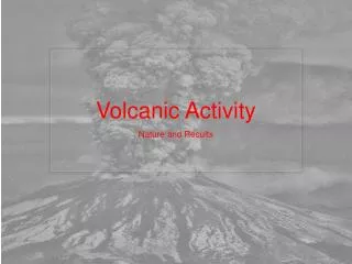
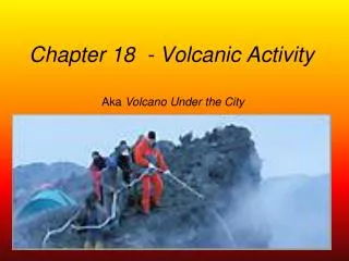
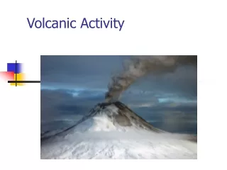
Volcanic Activity Year 10 Geography
Volcanic Activity • Volcanic activity is important right across the earth’s surface. • There are over 500 active volcanoes which still erupt from time to time. • Each year there are about 30 or 40 eruptions. • Some are slight, some are serious causing loss of life and damage to land and property.
The majority of the active volcanoes are found at destructive plate margins, where one tectonic plate is sliding down, or subducting, beneath another one. Although not all of them are – what other kind of plates has volcanoes along it Can you think of a pace that has one?
Many volcanoes are found around the edge of the Pacific Ocean – down the west coast of North and South America, through the Philippines, Indonesia and Japan. • This circle of active volcanoes is called the Pacific Ring of Fire.
Parts of a volcano • A volcano is a crack in the earth’s surface which provides an outlet for lava, steam and ash. • The lava passes through a pipe called a vent from inside the earth’s surface where it erupts. • After the eruption a crater is left on the surface. Lava which has erupted hardens on the surface.
Acidic Cone Volcanoes • These are usually found at destructive boundaries. • Cone volcanoes are tall and steep-sided. • Cone volcanoes are formed by eruptions of thick, viscous (sticky) lava. • Viscous lava tends to be acidic. • The thick lava moves relatively slowly and hardens quickly to form new rock - this explains the formation of a cone shape. • Eruptions tend to be violent.
Shield Volcanoes • These are usually found at constructive boundaries. • They are low, with gently sloping sides. • Shield volcanoes are formed by eruptions of thin, runny lava which is not so acidic, and therefore are often referred to a basic lava • Eruptions here tend to be frequent but relatively gentle.
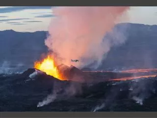
Composite Volcanoes These volcanoes are composed (made up) of alternating layers of lava and ash (other volcanoes just consist of lava). The eruptions from these volcanoes may be a pyroclastic flow rather than a lava flow. A pyroclastic flow is a mixture of hot steam, ash, rock and dust. A pyroclastic flow can roll down the sides of a volcano at very high speeds and with temperatures of over 400° C.
Direct measurements of pyroclastic flows are extremely dangerous!!! • A truck carrying volcanologists and a film crew attempting to out run a pyroclastic flow …. • the pyroclastic flow was traveling at about 25-30 meters per second….. • they made it…. • just!
Tectonic hazards in LEDCs • Mount Pinatubo • Introduction • Where: Mount Pinatubo, Philippines, Asia • When: June 12th-15th, 1991 • Type of volcano: composite volcano • Type of eruption: Explosive - the second biggest eruption this century • Deaths: 300 people died, 1000's were evacuated
Mount Pinatuba is 110km NW of Manila, the capital of the Philippines. In 1991, the volcano had been dormant for 600 years. During this time, the ash and lava had weathered to become fertile soil where rice was grown. But then things began to happen ….. Clark Air base
What happened? • Steam on April 2nd 1991 • Quakes from April 6th – June 7th • Ash Ejections from June 3rd • Dome Formation was seen from an ariel survey
Then it really began to happen! • Day One, Sunday, 9 June 1991 • Eight hours of ash-laden steam clouds ejection ushered one of the world’s most violent and destructive eruptions of the century, beginning at around 6 AM. • This was followed by pyroclastic flows which flowed down Pinatubo’s gullies. These pyroclastic flows reached some 4-5 kilometres from the centre of activity. • Philvolcs (Philippine Institute of Volcanology and Seismology ) issued Alert Level 5 at around 3:15
What happened • Day Four, Wednesday, 12 June 1991 • At around 8:51 on Independence Day morning, intense seismic activity was followed by three major explosions, the most powerful of which ejected a "huge, grey, mushroom-shaped cloud" that reached 20 kilometres above the vent. Ash, pumice, and other larger volcanic fragments were also ejected by Pinatubo. • Major rivers and tributaries radiating from the volcano overflowed with cascading pyroclastic flows. • A second series of strong explosions hurled clouds of ash and pyroclastic materials 25 kilometres into the air.
Pyroclastic flow 2 weeks later • It was still too hot to go near
What happened • Day Five, Thursday, 13 June 1991 • Only 24 hours after the first major explosions, another violent eruption occurred triggering heavy ashfalls that blanketed most of surrounding area. Prevailing winds also blew the ash hundreds of kilometres in all directions. • Day Six, Friday, 14 June 1991 • The fourth major eruption occurred ejecting another vertical ash column that reached a maximum height of 25 kilometres above the vent. • Later, a much bigger eruption produced a cauliflower-shaped column that ejected volcanic debris to a maximum height of 30 kilometres. • Pyroclastic flows ran down reaching 15 kilometres from the source.
What happened • Day Seven, Saturday, 15 June 1991 • Two explosions occurred at dawn accompanied by incandescent pyroclastic flows that moved at speeds between 70 kph to 80 kph. • These were followed by seven more eruptions lasting up to midmorning, producing ash columns from 15-18 kilometres wide at the base and heights of up to 25 kilometres above sea level. This time, pyroclastic flows advanced to areas as far as 16 kilometres away from the centre of activity. • Then a violent eruption ejected a 40 kilometre high eruption column. • This was followed by five similarly strong explosions in such close succession that they appeared to be one continuous activity. • Philvolcs recorded a total of 19 eruptions that day. • After June 16 • After June 16, Pinatubo’s activities declined both in frequency and magnitude where only minor eruptions were recorded.
But it was not half so bad as it could have been • Before the cataclysmic eruption, about 1,000,000 people lived in the region around Mount Pinatubo, including about 20,000 American military personnel and their dependents were evacuated • The slopes of the volcano and the adjacent hills and valleys were home to thousands of villagers. • Despite the great number of people at risk, there were few casualties in the June 15 eruption. • This was not due to good luck but rather was the result of intensive monitoring of Mount Pinatubo by scientists with the Philippine Institute of Volcanology and Seismology (PHIVOLCS) and the U.S. Geological Survey (USGS).
But it was not half so bad as it could have been • From early April scientists from PHIVOLCS immediately began on-site monitoring and soon declared a 10-kilometer radius danger zone around the volcano. • They were joined in a few weeks by American scientists who brought with them specially designed, portable instruments, which the joint Philippine-American team used to quickly set up monitoring networks on and around Mount Pinatubo. • The team also conducted intensive studies of the volcano's past eruptive history. • When the data from these efforts indicated that a huge eruption of the volcano was imminent, the joint team issued urgent warnings. • These timely forecasts enabled civil and military authorities to arrange the evacuation of people and equipment to safe areas before Mount Pinatubo exploded on June 15.
But it was not half so bad as it could have been • They estimate that their forecasts saved at least 5,000 lives and perhaps as many as 20,000. • The people living in the lowlands around Mount Pinatubo were alerted to the impending eruption and many fled to towns at safer distances from the volcano or took shelter in buildings with strong roofs. • The American Clark Air Base was fully evacuated. • In the eruption, thousands of weaker roofs, including some on Clark, collapsed under the weight of ash made wet by heavy rains, yet only about 250 lowland residents were killed. • Of the 20,000 indigenous Aeta highlanders who lived on the slopes of Mount Pinatubo, all but about 20 were safely evacuated before the eruption completely devastated their villages. • Property worth hundreds of millions of dollars was protected from damage or destruction in the eruption. Civil and military aircraft were also evacuated saving millions of dollars. Stopping flights over the area, also saved many lives.
The results • Pinatubo unleashed three major destructive agents, namely: ashfall, pyroclastic flow and lahar that caused destruction to Central Luzon's infrastructure and rendered its vast agricultural lands into virtual wastelands. • Ash fell over an area of 600km radius • More than 86,000 hectares of agricultural lands and fishponds were affected by ashfalls and lahars. • Irrigation systems, water service facilities, power transmission and lateral lines, roads bridges and other infrastructures were damaged mainly by lahars
Houses and public buildings collapsed from the weight of accumulated ash deposits. Commercial and industrial operations were suspended while more than 650,000 workers were forced out of work because of the destruction of their farms, shops, factories and work places. The Americans were forced to evacuate Clark Air Base after volcanic dust, ashfall and lahar rendered its runways useless and endangered the operations of its planes. The Ninoy Aquino International Airport was also closed for four days Public buildings were converted into evacuation centres to accommodate the increasing number of refugees from the devastated areas. But more than the destruction of buildings and infrastructure, Pinatubo's eruption affected more than 249,000 families or about 1.18 million people, including 847 deaths, 184 injuries and 23 missing.
What is a Lahar? • Explosive eruptions can deposit huge amounts ash and other volcanic debris on a volcano's slopes. • Lahars form when water from intense rainfall, melting snow and ice, or the sudden failure of a natural dam, mixes with this loose volcanic material, creating mudflows that can be particularly dangerous and destructive. • Although lahars contain a lot of volcanic ash and rock fragments–making them dense and viscous like wet concrete–they actually flow faster than clear-water streams. • These mudflows can rush down the flanks of a volcano at speeds as great as 65 kilometres per hour and can travel more than 80 kilometres. Lahars that contain the most debris move the fastest and are the most destructive.
Why were Lahars a problem for Pinatubo? • Annual rainfall on Mount Pinatubo ranges from 2,000 – 4000 mm. • Nearly all of this rain falls during the time of the southwest monsoon between June and October • Ash and other deposits from Mount Pinatubo's 1991 eruption destroyed or buried much of the lush vegetation that had covered the volcano. • When heavy rain fell on Pinatubo rapid runoff down the still bare slopes quickly grew into torrents that became lahars by eroding these deposits.
Why were Lahars a problem for Pinatubo? • But volcanic debris is very fertile and quite quickly the vegetation regenerated, so each year this is less of a problem. • However, in the first few years following the 1991 eruption, lahars have deposited more than 3 km3 - equivalent to 300 million dump-truck loads - of debris on the lowlands surrounding the volcano, burying hundreds of square miles of land. • They can carry large boulders, cars, or even bridges and can destroy or bury almost anything in their paths. • When lahars reach low-lying areas, they spread out, slow down, and deposit their vast loads of debris over many square miles.
Lahar Warnings • Radio-telemetric rain gauges provide data on rainfall in lahar source regions, acoustic flow monitors on stream banks detect ground vibration as lahars pass, and manned watch points further confirm that lahars are rushing down Pinatubo's slopes. • This system has enabled warnings to be sounded for most but not all major lahars at Pinatubo, saving hundreds of lives.