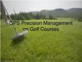
Precision GPS Management on Golf Courses: Advancing Turfgrass Performance
110 likes | 143 Vues
Explore the aspects of GPS precision management on golf courses, enhancing spatial and temporal management for optimum performance with minimal resources. Learn about GPS management systems, hot zone alerts, utility layouts, chemical & fertilizer applications, satellite imagery for disease detection, and mobile technology integration to streamline course operations.

Precision GPS Management on Golf Courses: Advancing Turfgrass Performance
E N D
Presentation Transcript
What are the aspects of GPS precision management on golf courses? • The PACE Turfgrass Research Institute says, “the goal of Precision Turfgrass Management (PTM) is to carefully observe, document, map, and manage golf courses on the smallest reasonable scale to provide optimum performance for the entire golf course environment with the minimum human, natural, mechanical and chemical resources. In addition to improving management for different locations throughout the course (spatial), precision management will help improve management through time (temporal).”
GPS Management Systems • RAMS reports (pace of play, course load, cart usage, ect.) • On Cart Advertising • Hot Zone Alerts/Messaging ( warnings on weather or restricted areas) • Food and Drink orders
Mapping Using Global Positioning Systems (GPS) Utility Line Layouts Irrigation Layouts Cart Path Layouts Drainage Layouts
Allows location of utility, drainage, and irrigation lines before construction and digging • Programmable for irrigation head, pipe, valve and control line location
Chemical & Fertilizer Application • Programs allow for individual costs on tee boxes, fairways and greens How is this possible?
Chemical & Fertilizer Applications • Points on each location are calculated and the square feet of the are is determined • This is what allows for better fertilizer and chemical application requirements
Satellite Imagery for Disease Detection • Information Combines hyperspectral reflectance information between 450 & 900 nm and fluorescence imaging • obtained is used with device mounted on spray rig for site specific pesticide application (seen more in farming practice) • receiver that has both WAAS and Beacon differential GPS capabilities and sub-meter resolution • Most popular receiver made by Trimble Navigation
Going Mobile • Personal Digital Assistant (PDA) • Cell Phones • Hand-held Radios
Weather and Climate Information • Available current weather conditions • Forecast Information • High/Low Temperature, Precipitation, Degree Days, Wind Speed/Direction, Soil Temperature