Download
1 / 22
220 likes | 516 Vues
INTRODUCTION TO GROUND WATER MONITORING. ‘Hydrographic Basics’ Training Course No. 27743 November 2010. WHY ?. Monitoring the status and trends in the availability of the Nation’s ground-water supplies is important to scientists, planners, water managers, and the general public.

E N D
INTRODUCTION TO GROUND WATER MONITORING ‘Hydrographic Basics’ Training Course No. 27743 November 2010
WHY ? Monitoring the status and trends in the availability of the Nation’s ground-water supplies is important to scientists, planners, water managers, and the general public. This is especially true in the semi-arid to arid regions of Australia where population growth and limited surface-water resources have led to increased use of ground-water supplies.
WHERE ? Macro Purpose Flow characteristics Water quality considerations Micro Occupational Health and Safety Vandalism / Damage / Corrosion Power / Telemetry requirements Permissive occupancy /Accessibility
Terminology • Piezometer • Another name for a bore • A screened tube sunk into the ground so as to allow water to ingress at the level of the present water table • Annular space • The void between the bore hole itself and the casing in which the monitoring takes place • To be filled with a filter medium • Aquifer • A rock, soil or substrate that allows water to be stored or travel through it • Artesian / Sub-artesian • Ground water under pressure / not under pressure • Isotope • Different types of atoms of the same element, each having a different number of neutrons. (Protons remain constant to the element) • These impurities in ground water are time signatures and used in flow calculations across aquifers
Modern Australian History • Inland Sea – 1800s – 1880s • Leichhardt * • Bourke & Wills * • Stuart • T.J Maslen’s Desired Blessing • Great artesian basin – 1880s – 1990s • “unlimited resource” • Covers 23% of Australia • Ground Water appreciated -1990s – onwards
MAJOR STAKEHOLDERS • Water Authorities • For resource management – modelling with rainfall data • Mines • Licence agreements – aquifer management • Agriculture • Water table indication - irrigation • Forestry • Water table indication - salinity • Governments • Politically expedient solutions to infrastructure / health issues • Interest groups • Governments interference – Environmental interests
Water Table • The water table is the level at which the groundwater pressure is equal to atmospheric pressure. • As water infiltrates through pore spaces in the soil, it first passes through the zone of aeration, where the soil is unsaturated. At increasing depths water fills in more spaces, until the zone of saturation is reached. The relatively horizontal plane atop this zone constitutes the water table. • A sustainable amount of water within a unit of sediment or rock, below the water table, in called an aquifer. • The ability of the aquifer to store water is dependent on the porosity • The ability of the aquifer to transfer water depends on its permeability.
WHAT PARAMETERS ARE MEASURED ? • Water level • Via pressure • Gauge • Submersible • Gas purge • Absolute • to be adjusted for barometric conditions • Shaft encoder • Water quality • pH, EC, Redox, • Sampling
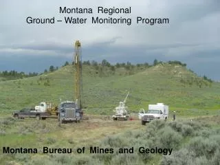
HOW ? • Bores • Drilled bores 40 mm to 200 mm • Licensed drillers • Datum • Establish a reference point • Similar to gauge zero on a surface monitoring situation • Registration • Some circumstances • Identification • Manual Recording • Dips • Instrumentation • Industry standards • Sampling • Grab sampling • Pumped
Installation Considerations • Artesian or sub-artesian • Temperature • Geology • Float v Strain-gauge type level sensors • Sampling required
Grouting the Annular Space • The annular space between the casing and the borehole wall should be filled with a suitable grout to: • Seal the space between the casing and the borehole between high and low standing water level aquifers thus preventing the transfer of water between the two. • Seal off aquifers with poor water quality. • Protect the casing from corrosive soils and/or waters and • Prevent surface runoff or shallow subsoil contamination or pollution from reaching the aquifer.
Data considerations • Individual bore observations may only represent aquifer conditions in a limited area, and bores may be screened over single or multiple aquifers, further complicating single-bore interpretations. • Changes in ground-water conditions may involve time scales ranging from days to many decades, depending on the timing of recharge, soil and aquifer properties, and depth to the water table. • There are several ways of presenting ground-water levels • Water level at AHD or RL • Water depletion from the top of the bore • Water level above a give datum
Water Quality Considerations • Representative location • Corrosion • Sacrificial anodes • On submerged equipment • Sheathing • Materials • Delrin • Stainless Steel not always best • Depth and diameter of bore has influence on equipment used • Size of equipment • SDI 12 v’s 4-20 mA / signal run • Sampling required? • Pumps used and limits • Hand held field testing units
Maintenance Considerations • External • Clear / clean / safe • Instrumentation • Battery – Solar • Logger • Telemetry • Internal • Casing inspections • De-silting • Bailer • Air • Surcharging
Other Considerations • Flow • The groundwater flow equation is the relationship which is used to describe the flow of ground-water through an aquifer. The transient flow of groundwater is described by a form of the diffusion equation, similar to that used in salt gauging to describe the flow of salt in a liquid can be determined by changes in the fluids conductivity. The steady-state flow of groundwater is described by a form of the Laplace equation. • The groundwater flow equation is often derived for a small representative elemental volume (REV), where the properties of the medium are assumed to be effectively constant. (usually radio active isotopes are used here) • A mass balance is done on the water flowing in and out of this small volume, the flux terms in the relationship being expressed in terms of head by using Darcy's law. • Recharge rates • Simpler to determine at the individual bore site • The time for the bore water levels to return to their base levels after the bore has been pumped “dry”
Conclusion • Ground water is the source of water for people, livestock, crops and the natural environment. • Unlike surface-water indicators such as stage or discharge, ground-water conditions are more difficult to assess and present. Individual ground-water levels in bores are an illustrative measure of an aquifer system • Methods have been developed to explore ways of utilizing existing water-level databases for the analysis and presentation of ground-water conditions. • Trend analyses take into account anthropogenic and climatic impacts on aquifers and allow insight into systems where lengthy historical records are unavailable. A simple but informative analysis and presentation of ground water in bores provides easy to understand information on local aquifer conditions. • Ground-water levels and water quality are one good measure of the health of an aquifer system. • Consistent indicators of ground-water conditions are of growing importance in an area where increasing population, unsustainable agricultural practices and potential climate change put increased stress on this valuable but unseen resource.
References OTEN: Hydrographic Course Tilman, Leake, Flyn, Cordova & Schonauer: USGS Wikipedia: http://www.connectedwater.gov.au/framework/hydrometric_piezometer.php QLD Dept of Resources and Mining: Roslyn Haynes: Adjunct Associate Professor of English at the University of New South Wales and a Fellow of the Australian Academy of the Humanities. Michael Cathcart: Water Dreamers (2009)