Science Data Systems for Satellite and Airborne LiDAR Data
10 likes | 219 Vues
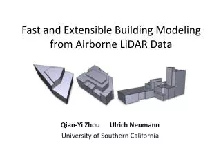
Science Data Systems for Satellite and Airborne LiDAR Data. PI: Charles Meertens, UNAVCO. Insert an eye-catching yet meaningful picture ere. If possible, show the scale of an instrument.

Science Data Systems for Satellite and Airborne LiDAR Data
E N D
Presentation Transcript
Science Data Systems for Satellite and Airborne LiDAR Data PI: Charles Meertens, UNAVCO Insert an eye-catching yet meaningful picture ere. If possible, show the scale of an instrument. • Provide an integrated system (NLAS) for web services-based access to distributed NASA airborne (LVIS) and satellite (ICESAT/GLAS) LiDAR data archives using OpenTopography (OT) technologies. • Define enhanced quality control (QC) metrics and a standard data format to improve evaluation of data quality, data usability, and compatibility with commercial LiDAR software packages. • Provide users access to point cloud and waveform LiDAR data, on-demand digital elevation models (DEMs) generation, and derivative products and visualizations. Open Topography interface to sample LVIS data • Project teams fully staffed and actively participating in development. • Public Open Topography website established and internal project wiki created. • Demonstrated an NLAS/RAMADDA LVIS->LAS conversion and ingest into Open Topography Portal. • - Subsetted point cloud and on-demand DEMs can be extracted from sample LVIS dataset. • - By taking advantage of UNIDATA’s existing RAMADDA data repository framework aspects of the NLAS development are ahead of schedule. A suite of NLAS data format translation software has been developed and the demonstration OT file set was transferred from the UNAVCO/LVIS repository using actual prototype NLAS/RAMADDA web service calls. Development of full data definitions and web service APIs is underway. • NLAS/RAMADDA supports LVIS, LAS, GLAS14 and ATM data formats as well as aggregations of those files. S-J. S.Khalsa, NSIDC/CU; C.Baru, SDSC/UCSD; D.Harding, B.Blair, NASA/GSFC; and M.Hofton, U.MD. TRLout= 5 TRLin= 5 1 Oct2010