Modeling Asian Population Environment Dynamics in Faisalabad and Other Key Cities
460 likes | 554 Vues
Explore the sustainability of arid agricultural practices in Faisalabad, Pakistan, considering population growth scenarios and environmental impacts. Study the unique dynamics of Khon Kaen, Thailand, Cebu City, Pusan, and Kobe in balancing urban development with environmental conservation. Gain insights into the challenges and opportunities faced by these diverse cities through population-environment modeling. Understand the impact of wealth, population growth, and urban planning on the quality of life in these regions.

Modeling Asian Population Environment Dynamics in Faisalabad and Other Key Cities
E N D
Presentation Transcript
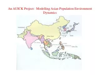
An AUICK Project: Modelling Asian Population Environment Dynamics
Faisalabad Pakistan is a great arid plain lying between India and Afghanistan. Though rainfall is a mere 2-3 inches per year, the country is well watered by the great Indus river system that brings huge amounts of waters from the high Himalayas through the plain, to debouche into the Arabian sea near Karachi. Under British colonial and independent Pakistani governments, canals and dams have brought these waters to vast expanses of land, making Pakistan one of the world’s most irrigated countries. The waters produce grains, fruits and cottons, bringing considerable wealth to the country. Is it sustainable??
Faisalabad: the life-giving Chenab Canal: is irrigated agricultural sustainable in an arid climate?
Here is a STELLA Model of Faisalabad’s Population with three scenarios: Agricultural collapse produces a HIGH; business as usual produces a MEDIUM; substantial social reform and progress of services produces a LOW population growth.
Khon Kaen, Thailand Khon Kaen lies in the center of Thailand’s Northeast region. It rests on a rolling plateau, served by three rivers that drain into the mighty Mekong River. It is know as the “Heart of the Northeast.”
Because the main road system provides bypasses around major towns
Crude Birth and Death Rates for Khon Kaen. Do they look strange?
They are very divergent from the overall Thai rates. What is happening?
To get around the problem, we modeled the population, which everyone agrees gives a more accurate picture.
That vehicle growth raises questions about….. Air Quality
There is an Asian Monsoon Machine that produces specific patterns of rainfall in different countries. Look at Khon Kaen’s location. (Also consider the location of Vietnam and other countries)
A dramatic seasonal variation in air quality, that comes from…
Dramatic seasonal variation on rainfall. Population environment dynamics are location-specific.
Modeling helped us smooth out questionable official data and suggest strategies for the city government. The extra school population is rural kids coming to town for better education.
Water quantity posed no problem (though measures of quality were found grossly deficient).
Cebu City Major Problems: Fragmented urban administrations weaken regional planning. Receding fresh-salt water line; acquifer depletion; no control of private wells. Increasing water pollution from inadequate sewage Deteriorating air quality: weak transportation planning class differences in consumption and pollution Education is the one bright picture.
Pusan is South Korea’s major seaport It is a modern, well developed cities that has emerged like a phoenix from recent near total destruction. It provides a high quality of life for its people, but has some problems lurking in the future. Is it SUSTAINABLE?
Kobe is Japan’s major seaport. It lies on the north edge of Osaka Bay. The Japanese current runs outside the bay from SW to NE, pulling pollutants out of the bay into the sea. An effective government at national and city levels helped turn environmental challenges and advantages into high quality of life for Kobe’s citizens.
Kobe’s favorable winds move air pollution away. Again specific locations bring challenges and advantages
Kobe’s geographic limitations led to the great innovation the of “mountains to the sea” project, creating new islands for ports.
We modeled vehicle growth for the future, showing how it would increase air pollution. It is easy to calculate the human costs of this rise in air pollution. If vehicles and air pollution do increase as modeled. Kobe will experience 10,000 more deaths over the next 20 years that it would have without that increase.
In Kobe’s age structure we see the emerging aging problem of all wealthy countries with low fertility. Kobe’s dependency ratio will grow and the burden on the working age population will increase substantially.
General Lessons from the Five Cities Wealth pollutes, but also promises environmental protection; Slowing population growth pays large dividends; Quality of life is the major outcome Wealth is the major determinant But something like political culture plays a role SPECS vary, affecting the capacity of a city to transform wealth into welfare. All population-environment dynamics are location specific. Analyses and action must be done at the local level One size does not fit all!