Download
1 / 30
300 likes | 423 Vues
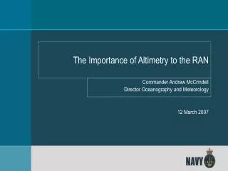
The Importance of Altimetry to the RAN. Commander Andrew McCrindell Director Oceanography and Meteorology 12 March 2007. SCOPE. Why Navies need altimetry data; Climatological applications; Ocean modelling. Mission.

E N D
The Importance of Altimetry to the RAN Commander Andrew McCrindell Director Oceanography and Meteorology 12 March 2007
SCOPE • Why Navies need altimetry data; • Climatological applications; • Ocean modelling.
Mission To enable the ADF maritime community to exploit the above and below water physical operating environments for strategic, operational and tactical advantage and for safety purposes, and to support the collection and effective management of marine data in the national interest.
Rapid Environmental Assessment Command Decisions Smart Knowledge Systems People Networks Computers Pictures Models Data Data Data Data Data Data Data Data
CEMG METOC Impacts SWBTA Safety Land Air Ops (RW/FW) Maritime TOWNSVILLE Safety Land Air Ops (RW/FW) Safety Maritime Land DARWIN Maritime Air Ops (RW/FW) Timeline (Hrs) No Impacts Marginal Impacts Significant Impacts 26 AUG 27 AUG 28 AUG 29 AUG 24 Hour 48 Hour 72 Hour 96 Hour 6 12 18 24 6 12 18 24 6 12 18 24 6 12 18 24
REA METOC PERSPECTIVE • Generate forecasts in the littoral from T-7days. • Make measurements to improve forecasts. • Reliant on modelling capability and remote sensing.
Satellite Data - Wind Speed • Quikscat microwave scatterometer on Quikbird (NASA) and Midori II (JSA) + Lat= 15.50 Long=115.50 Beaufort Direction Scale N NE E SE S SW W NW Total 0 0 0 0 0 0 0 0 0 0 1 0 1 1 1 0 0 1 1 5 2 1 4 3 3 2 2 1 0 16 3 4 13 9 4 6 3 1 1 41 4 1 8 1 1 5 10 2 0 28 5 0 2 0 1 2 5 0 0 10 6 0 0 0 0 0 1 0 0 1 7 0 0 0 0 0 0 0 0 0 8 0 0 0 0 0 0 0 0 0 9 0 0 0 0 0 0 0 0 0 10 0 0 0 0 0 0 0 0 0 11 0 0 0 0 0 0 0 0 0 12 0 0 0 0 0 0 0 0 0 Total 6 28 14 10 15 21 5 2 Mean Speed= 10.7 Maximum Speed= 25.0 Direction of Maximum Speed 238 Number of records 2826
Satellite Data – Sig. Wave Height Various altimeters: ERS1, ERS2, ENVISAT (ESA), GEOSAT, GFO (USN), TOPEX POSEIDON, JASON (NOAA) Lat , Long , Mean ,Max , Nobs,0-1m,1-2m,2-3m,3-4m,4-5m,>5m 15.50,115.50,1.15, 4.60, 1058, 48, 43, 7, 2, 0, 0
Wave Modelling • Uses • global wave models • a GIS application • Coastal applications using altimetry could improve these forecasts.
Project BLUE LINK - Oceanic & Atmospheric Modelling • $15 Million Project with 3 Partners: • Defence • CSIRO • Commonwealth Bureau of Meteorology • BLUElink> will deliver oceanic forecasts for the Australian Region for: • Defence Applications • Climate Studies • Operational Weather Forecasting • Ecological Applications • Commercial Applications
Example shows ROAM oceanic model over NW Shelf Diagram shows 10km resolution, but will have 2km resolution Output shows sea surface temperature and currents Other outputs include 3-dimensional Temperature and Salinity structure ROAM Oceanic Forecast Example
Concluding Remarks • Operational oceanography requires greater coverage and reliability of altimetry data. • We need to use altimeters to derive oceanic structures on the continental shelf and in coastal regions. • The users do not always realise the importance of altimetry because they are often using derived products. • Thank you for all of the activities and research that have contributed to our understanding of the world’s oceans.