Download

1 / 13
130 likes | 149 Vues
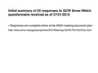
Initial summary of 25 responses to GCW Snow-Watch questionnaire received as of 27/01/2013 Responses are compiled online at the WMO meeting document plan http://www.wmo.int/pages/prog/www/OSY/Meetings/GCW-PS1/DocPlan.html.

E N D
Initial summary of 25 responses to GCW Snow-Watch questionnaire received as of 27/01/2013 • Responses are compiled online at the WMO meeting document plan • http://www.wmo.int/pages/prog/www/OSY/Meetings/GCW-PS1/DocPlan.html
Q1. What snow products/information do you generate and who are the main users of your snow products? • Global/Hemispheric Real-time Products: • NOAA OSPO: global daily 4km SE from IMS, global daily SWE from PMW • CMC: global daily snow depth analysis; RPN CalDAS global daily SWE, density, albedo • ECMWF: global daily SWE, density • NASA MODIS: daily global fractional snow cover @ 500m to 5 km (2000-) • ESA/FMI GlobSnow: NH gridded daily Snow Extent @ 1 km and SWE @ 25 km • national in situ snow depth observations transmitted over GTS • Specialized National or Regional Real-time Products: • - NOHRSC: hourly 1 km gridded SWE over US, southern Canada and central Asia • USDA National Water and Climate Center: SNOTEL daily local to basin-scale monitoring of in situ SWE and snow depth • Stefan Wunderle: Near real-time snow extent monitoring based on NOAA/Metop-AVHRR for avalanche prediction in Switzerland
Research / Climate Data and Products: • NCDC: Global Summary of the Day (in situ daily snow depth and snowfall); GHCN-Daily global in situ snow depth and snowfall from late-1800s to present; US Snow Climatology, Regional Snowfall Index • NSIDC: central repository for numerous snow datasets (MODIS, SNODAS, IMS, NH EASE-grid snow cover and SWE, AMSR-E snow products, FSU snow surveys, CMC daily snow depth analyses etc) • Historical gridded analyses e.g. Brown et al. (2003) NA AMIP2 gridded daily snow depth (1979-1997); Dyer and Mote (2006) interpolated sfce snow depth obs over NA (1900-2006); CMC daily snow depth analysis (1998-) • CCRS: 5 km NH daily snow cover NH > 43N (1981-2004) • NOAA CDR: NH weekly SE @ 190.5 km (1966-) • GlobSnow CDR: NH daily SWE @ 25 km (1982-), NH daily SE @ 1 km (1995-) • MODIS 8-day and monthly composite products • PMW-derived SWE and snow cover e.g. Brodzik et al. (2007), Tedesco et al (2011), Takala et al (2012) • Reanalyses e.g. ERA-40 (1957-2002), ERA-interim (1979-), MERRA (1980-) • Reanalysis driven e.g. MERRA-driven NH snow cover reconstruction of Liston and Hiemstra (2011)
Operational snow analyses (1998- Reanalyses and reanalysis-driven snow cover simulations (1948- Satellites (1966- Dendrochronologies and proxy information Snow surveys (~1950- Ruler snow depths (~1950- 1600 1900 Present Data sources for documenting variability and change in Arctic snow cover Only have multiple sources of hemispheric snow cover information from ~1970
Users: • Operations: (real-time) • Numerical Weather Prediction • hydro-power and water resource management (e.g. irrigation) • flood forecasting • forest fire risk • avalanche risk • recreation (skiing, snowmobiling) • transportation • R & D: (continuous, homogeneous, long term) • climate monitoring • climate model evaluation • risk analysis e.g. building snow loads • habitat and biodiversity assessment
Q2. What are the main knowledge gaps / issues (if any) that affect your ability to provide “authoritative, understandable, and useable” snow-related data, products and information? • In situ observations: • Sustained, consistent (across networks), well documented and freely available ground-based measurements (quality and homogeneity) • Develop standard procedures for gap filling snow depth and snowfall data • Improve and standardize training material for observers • Improve the availability of real-time in situ snow depth data on the GTS; no information available from large portions of the globe e.g. Asia • Lack of independent reference (ground) measurements for evaluation of gridded snow products (reanalysis, satellite derived, model generated etc.) over key regions where the agreement between different snow cover datasets is low. Obs should ideally cover a range of scales • Availability of regular, consistent, well calibrated long-term time series of ground-based measurements of snow depth/SWE • Reliable precipitation analyses for driving snow models used in operational assimilation and for historical snow cover reconstructions • Quality control of observed data in extreme environments • Technological limitations for measuring solid precipitation in harsh, remote environments • Homogeneity of observations • More emphasis on SWE measurements (over snow depth) • Lack of resources for data rescue of historical hard copy data • Obtaining the metadata required for data QC is difficult
Satellite observations: • Void in global high frequency satellite observations with the ability to determine snow coverage and water content • Accurate and reliable cloud-snow discrimination under all seasonal and climate zone conditions. • accurate satellite retrievals of snow water equivalent • reliable global-scale information on snow density or snow grain size • well intercalibrated fundamental instrument data series (e.g. for AVHRR-series) that could be used within various existing retrieval approaches • Tech transfer: • - lack of resources placed in tech transfer from snow monitoring and modeling R&D to operations • Snow data assimilation: • Better snow modeling and forward modeling for the assimilation of microwave data • Snow depth estimates from future satellites (e.g. CoreH2O) will be very valuable • Data Access: • No single point access for snow cover data and products with consistent formatting and quality information • restrictions for disseminating snow products outside member and cooperating states at ECMWF
Consistency and quality of snow products: • - Data quality of satellite based products due to temporal gaps, data quality of in-situ based approaches due to spatial gaps – especially reporting quality in a dynamic rather than overall manner. • Understanding the sources of uncertainty in gridded snow products (SCE; SWE) and how they vary between approaches (reanalysis, satellite derived, model generated etc.) and in space and time • Quality of products with subpixel water (e.g. snow versus ice on water) not well understood • lack of consistency in different snow cover algorithms • no coordination for assessing product quality and consistency • uncertainty estimates not usually provided with snow cover fraction products • Thematic Knowledge Gaps: • snow on sea ice • snow cover mapping in mountainous regions (especially large remote areas such as Canada where SAR imagery has not been well tested as in Europe) • spatial and temporal variability in snow sublimation losses • large uncertainty in our ability to provide reliable global estimates of the volume of water stored in seasonal snowpack
Q3. Priority ranking exercise for potential GCW Snow-Watch activities (24 responses) * Ranking based on H=3, M=2, L=1, ?=0
Q3. Feasibility ranking exercise for potential GCW Snow-Watch acitivites
Q4. Recommendations for potential GCW Snow-Watch projects • improve access, documentation of in situ snow data and related ancillary data (temp, precip); develop global snow data archive; promote data rescue and filling • get more data onto the GTS in NRT (expand coop programs, convert obs to BUFR format, take advantage of new BUFR format) BUFR=Binary Universal Form for data Representation • coordinate efforts to improve, harmonize and standardise snow observations (e.g. with CryoNet team); publish standards and best practices for measurement and QC • develop snow product intercomparison protocol similar to LAI and land cover (with benchmark validation datasets) to establish confidence limits for individual products (e.g. visible; microwave; station); determine realistic expectations for satellite SWE estimates • ffusion of snow products over terrestrial, sea ice, and ice sheets • provide NRT best-estimate of Global snow cover, depth and swe from multiple products (start with regional test beds) • develop baseline high resolution gridded Global SE and SWE climatologies for satellite era for algorithm development and validation, anomaly tracking and climate model validation • near real time online tracking of hemispheric SE and SWE anomalies (“Snow-Watch Trackers”); must be authoritative and peer reviewed with clear caveats
Q4. Recommendations for potential GCW Snow-Watch projects contd. • facilitate development of high-quality time series of global or regional snow observations for climate monitoring (e.g. state of global snow cover) • snow cover reanalysis projects designed to exploit the best available information (conventional, satellite, model, etc.) compiled by an international team • intercomparison of snow products e.g. compare standard MODIS snow-cover maps with Rutgers snow-cover maps and new VIIRS snow-cover maps • take advantage of "data sets of opportunity" (e.g. GPS antenna snow depth measurements) and new data sources such as LiDAR (useful sub-grid information for upscaling work). WMO initiative to create a centralized repository for specialized snow data sets? • expand cooperative measurement programs? Development of intelligent “app” for smart-phone snow depth measurements? • Confusion between definitions of SE and snow cover fraction needs to be taken into account in dataset comparisons i.e. is there 100% snow coverage present if the snow is on the ground but not over the tree canopy? • develop a WMO international snow service and working group with regional sub-groups; the WMO snow service can establish a virtual headquarters and provide input to EC-PORS. The International Ice Charting Working Group (IICWG), North American Ice Services (NAIS), and European Ice Services (EIS) serve as models to how this service could work. • help update space-based snow measurement requirements
Q5. What could you or your organization contribute to the implementation of a GCW Snow-Watch project(s)? • Strong willingness to contribute expertise and data to GCW Snow-Watch evident in all responses – we are not flogging a dead horse! • Contributions of data and expertise for global snow archive and product comparisons most frequently mentioned • General willingness to participate in WGs to promote international snow monitoring services and products • The challenge is to focus the expertise and provide the necessary resources to make sure some real progress is made on some of the identified priority areas • Offer to host one of the next GCW-WS in combination with the EARSeL (European Association of Remote Sensing Laboratories) snow and ice workshop in Bern (Feb. 2014) Stefan Wunderle. U.Bern • Offer to host NA snow monitoring WG meeting at NOAA-NIC (S.Helfrich) Date TBC