An Introduction to ArcMap : Making simple maps
An Introduction to ArcMap : Making simple maps. An Introduction to ArcMap. Presented by Eva Dodsworth and Scott MacFarlane. An Introduction to ArcMap : Making simple maps. Agenda Brief overview of GIS and ArcMap Data from the University Map Library

An Introduction to ArcMap : Making simple maps
E N D
Presentation Transcript
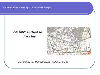
An Introduction to ArcMap : Making simple maps An Introduction to ArcMap Presented by Eva Dodsworth and Scott MacFarlane
An Introduction to ArcMap : Making simple maps Agenda • Brief overview of GIS and ArcMap • Data from the University Map Library • ArcMap Demonstration : Making a simple map • Hands-on Exercise
GIS Overview : What is GIS? • A GIS is much more than a mapping program • Geodatabase : A unique database structured in geographic terms • Geovisualization : The Map component. Maps are created by using the spatial information present in the database
GIS Overview : What is GIS? 3. Geoprocessor : A set of information transformation tools that derive new datasets from existing datasets
Common GIS data Formats • Shapefile : Points, Lines, or Polygons that hold tabular data and spatial location • Shapefiles can only be opened and used in programs that support this format • ESRI GIS software; many proprietary and open source programs available on the web • There are many ‘readers’ available that will create simple maps and not much more See list of recommended softwarehttp://www.lib.uwaterloo.ca/locations/umd/digital/gissoftware.html
Common GIS Data Formats • MrSid : a compressed image file that produces a file size roughly 20x smaller than a .tiff. Commonly used for orthoimages. • Special software required to view, manipulate and to convert to an alternative format (tiff, jpg). • Lizardtech.com provides free trials of software. The Library is using GeoExpress View and free viewer TatukGIS. But there are LOTS of options on the web (Google keyword : MrSid software)
What kinds of data does UW have? • Accessible from the Map Library • Large collection of local and national data • Includes orthoimagery, topographical, hydrological, geological, census data, street data, soils, land use, parcels, and more • Our webpage outlines and describes every dataset : http://www.lib.uwaterloo.ca/locations/umd/geospatial_data.html