Download
1 / 22
230 likes | 440 Vues
National Geo-data Centre of The Netherlands - DINO. TNO DINO Key register Subsurface (BRO) Current situation. Contents. Spatial planning. Archeology. Safety and security. Min Agriculture and Nature. Min Housing and Environment. Environmental quality. Agriculture. Ground

E N D
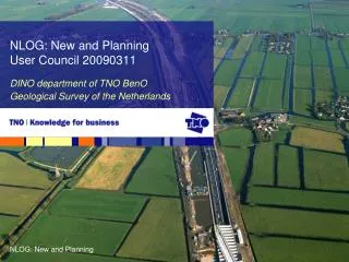
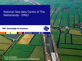
National Geo-data Centre of The Netherlands - DINO Tirza van Daalen, head of Geo-Data and Information Department
TNO DINO Key register Subsurface (BRO) Current situation Contents
Spatial planning Archeology Safety and security Min Agriculture and Nature Min Housing and Environment Environmental quality Agriculture Ground pollution Nature conservation DINO information Water management Min Science and Education Infrastructures Min Traffic and Water Energy policy Economic Affairs Internal Affairs
National Spatial Data Infrastructure GIDEON • Geo information is the corner stone of the e-government programme • Development of 6 geo key registers • Implementation of INSPIRE in laws, infrastructure and standards • Capacity building, education, (re)use of geo information 5 Workshop 4.5 SDI in national government. Dutch geographic key registers
Programme Andere Overheid • 65% of government services on internet • One-stop shop: no ‘wrong counter’ for business and citizen • One-time data delivery from the individual citizen and businesses • Government obliged to re-use this data • Digital identity, electronic signature • Administrative burden reduced by 25% • Better internal organisation of the government • Better prevention and reduction of fraud
Adresses (BRA) en buildings (BGR) • Cadaster (BRK) en topography (BRT) • Large scale base map (GBKN) • Cables and wires • Digging activities (grondroerdersregeling) • Registration of cables • Key register Subsurface (BRO) • Geology en Soil • Environmental Quality • Archeology
Design stage Implementation stage 01/09 07/09 01/12 01/13 01/11 Realisation stage Completion stage
Data-providers Users I N • BRO O U T
Key register Subsurface requirements • Requirements defined in the key register framework • Automated processes using webservices • BRO requirements to dataproviders • All data providers are connected • One exchange format per data type • Exchange format is conform IMBOD/IMMetingen
Ideal situation • BRO webservices integrated in client processes • Changes at the source are updated real-time (atomic level data exchange instead of mass) • The content of the files is disseminated to the outer world using all levels of detail (complete extraction) • All mandated data providers are connected
Authentic P P o r s e Descriptive t l l a Source documents a w w Notification models Content Key register Subsurface • Pre(date) law and post (date) law • Authentic • “Descriptive” • Source documents • Notification models
Koppelvlak met OSB • WUS protocol WUS = Webservices using UDDI and SOAPClient waits for result, comparable with phone call (synchrone). • ebMS protocol ebMS = ebXml Messaging ServiceReliable messaging mechanism, processing is garanteed.Result is sent later on, comparable with SMS (asynchrone). • Both protected using https in combination with PKI-Overheid certificates. • Compliance test available as service using OSB.
Objecttypes BRO • ExplorationA location in the Netherlands or part of the Dutch part of the continental shelf, of waar de opbouw van de ondergrond verkend is door middel van een waarneming op een punt, langs een lijn of in een vlak. • Model Schematisation of the composition of the subsurface. • Infrastructure (Supportive) construction in the subsurface developed by hand (not cables and wires)(some are virtual). • Rights of use A right mandated by an entitled authority for use of the subsurface for a specific purpose
Explorations EXPLORATIONS • Geomechanical cone penetration tests • Geo-electrical exploration • Seismic recording • Side-scan sonar • Georadar recording • Gravity recording • Geomagnetic recording • Geochemical recording Field test • Soil bore sample profile • Geological bore sample profile • Results of bore sample study • Bore sample photo • Borehole data Drilling • Soil profile recording • Geological profile recording • Results of sample study Profile recording • Sample description • Results of sample study Surface sampling
Models MODELS Geomorphological models Geomorphological map of NL, 1:50.000 • Soil map of NL, 1:50.000 • Groundwater ladder map, 1:50.000 • Soil map 1:10.000 Soil models • Digital Geological Model 1:250.000 • DGM-deep, 2,5D grid model and NCP • GeoTOP, 3D model upper 30 m Geological models Hydrogeological models REGIS-II
Infrastructure INFRASTRUCTURE • Mining Act boreholes • Other purposes Borehole • Groundwater quantity data • Groundwater quality data • Groundwater extraction data • Fire extinguishing water • Mining Act production data • Mining Act storage data • Heat-Cold storage data Well • Groundwater monitoring • Soil quality data • Forest soil quality data Network Production work Mining Act offshore Caverns Water level gauge (surface water data) Pipelines (as stated in Mining Act) Offshore
Rights of use Rights of Use • Mineral or natural gas production • Storage of substances • Detection of minerals or natural gas Mining Act • Groundwater extraction • Geothermal heating & cooling Water Act Erosions Erosions
DINO 2010 Head Dino Policy/info/quality Service desk Data management ICT Account management Data processing 3 fte 15 fte
Governance of the NDCGeo Information Program (GIP) Annual Budget 15 10*6€ MinEZ OCW VROM V&W LNV IPO Mining Council Industry KNAW National Council for NDR MinEZ VROM V&W LNV OCW Director Geological Survey of tHe Netherlands Geo-Information Commision Delegated Program Management DINO UserCouncil Geo-Information Program (GIP) Workgroup E&P Mapping Agency DINO
Deep Subsurface data Geo models Chairman: Solveig Van der Bruggen PetroCanada Chairman: Gé van den Eertwegh KWR Organisation – DINO User Council Strategic/ Tactic GBR Chairman meeting Chairman: Tirza van Daalen Head department DINO Operational Information Data Shallow subsurface data Soil and groundwater quality data Soil and groundwater quality data Chairman: Fred Olie (a.i.) Royal Haskoning Chairman: Frans Otto Prov.Utrecht Chairman: Mart Lucassen BIELLS 2004 2008