Automation and Visualization in Geographic Immersive Virtual Environments
210 likes | 396 Vues
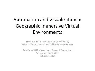
Automation and Visualization in Geographic Immersive Virtual Environments. Thomas J. Pingel , Northern Illinois University Keith C. Clarke, University of California Santa Barbara AutoCarto 2012 International Research Symposium September 16-20, 2012 Columbus, Ohio.

Automation and Visualization in Geographic Immersive Virtual Environments
E N D
Presentation Transcript
Automation and Visualization in Geographic Immersive Virtual Environments Thomas J. Pingel, Northern Illinois University Keith C. Clarke, University of California Santa Barbara AutoCarto 2012 International Research Symposium September 16-20, 2012 Columbus, Ohio
Central Research Question: How can we, in an automatable way, produce an immersive geographic virtual environment that will assist in the interpretation, analysis, and understanding of specific, local events?
Outline • Project overview • Code base • Terrain generation from LiDAR • Acquisition for of audio and video for model overlay
Immersive Geographic Virtual Environments • Immersive: “any virtual reality representation in which the user views her or her environment from a perspective view, and can freely move around in that environment” • Multiple Psychologies of Space (Montello, 1993) • Figural , Vista, Environmental, Geographical • Representing Environmental (or Geographical) spaces as Figural (or Vista) Objects while retaining some of the cognitive elements of each. • Emphasis on representing places in a model that can both be manipulated as an object or experienced as a place.
Related Work • Google’s Earth and Street View • Microsoft & Apple • No ability to alter the terrain • Universality • Virtual Tübingen • Designed for spatial cognition testing • 200 structures, .5 x .15 km • Our study area • 3.25 x 1.6 km • ~2000 structures Image from Virtual Tübingen
Video Game Community • Immense budgets and revenues • $65 billion annually • Many perspectives • First Person Shooters • World of Warcraft • But few environment & object perspectives • Highly structured environments
Code Base – X3D • XML successor to VRML (and GeoVRML) • Native Geo support • Native video texturing and spatialized audio • Royalty free • Browsers can typically read other 3D formats (e.g., COLLADA) • Good input device integration • Space M ouse • Microsoft Kinect • Wiimotes
X3D DevelopmentAvalon & X3DOM • Integration of next-gen specs in Avalon • Instantreality.org • Integration with HTML5 with X3DOM • X3dom.org • Full rendering within browser • No-add ins required
Terrain generation • LiDAR • Cheap • Highly accurate • Portable • But needs processing • Assumption of little available geodata • Ground cues can be very valuable in street network ID
Terrain Extraction is Important Davidson Library sits approximately 6 meters above the ground due to a terrain layer error.
Terrain Extraction: The Simple Morphological Filter (SMRF) • Emphasizes reducing Earth-as-Object error • Still very good at reducing Object-as-Earth error • Lowest total error rate of any published algorithm tested against ISPRS dataset • tpingel.org/code
LiDAR Visualization (Bonemaps) • Image-like visualization of Digital Surface Model • No registration errors • Slope-based intensity mapping, w/ compensation for “cognitive slope” • Higher contrast than hillshade • Appropriate for mixed environments
SMRF + Bonemaps at El Pilar, Guatemala Digital Surface Model
SMRF + Bonemaps at El Pilar, Guatemala SMRF-derived terrain layer
Video Overlay • Aerostat-based video capture • Smartphone capture and relay • Native video texturing in X3D
Acknowledgements • IC Postdoc for funding the project. • Alan Glennon and Kitty Courier for kite photography expertise. • William McBride for SRMF algorithm development and aerostat design.