Download
1 / 16
160 likes | 276 Vues
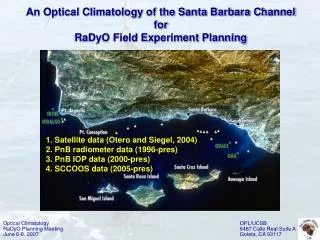
Optical Climatology RaDyO Planning Meeting June 6-8, 2007. OPL/UCSB 6487 Calle Real Suite A Goleta, CA 93117. An Optical Climatology of the Santa Barbara Channel for RaDyO Field Experiment Planning. 1. Satellite data (Otero and Siegel, 2004) 2. PnB radiometer data (1996-pres)

E N D
Optical Climatology RaDyO Planning Meeting June 6-8, 2007 OPL/UCSB 6487 Calle Real Suite A Goleta, CA 93117 An Optical Climatology of the Santa Barbara Channel for RaDyO Field Experiment Planning 1. Satellite data (Otero and Siegel, 2004) 2. PnB radiometer data (1996-pres) 3. PnB IOP data (2000-pres) 4. SCCOOS data (2005-pres)
Monthly Chl (SeaWiFS) composites: Oct. 1997 - Jun. 2001 (From Otero and Siegel, 2004) Optical Climatology RaDyO Planning Meeting June 6-8, 2007 OPL/UCSB 6487 Calle Real Suite A Goleta, CA 93117 Chl low is 0.5 - 1.0 mg m-3 in September Chl decreases in the eastern Channel, then in the west Chl peaks at 3 mg m-3 in April and May near Santa Rosa Is. Nearshore patterns not consistent - affected by runoff
Frequency and Spatial Coverage of Plumes and Blooms Bloom = Chl > 2 mg m-3, Plume = Lwn(555) > 1.3 mW cm-2mm-1 sr-1 (From Otero and Siegel, 2004) Optical Climatology RaDyO Planning Meeting June 6-8, 2007 OPL/UCSB 6487 Calle Real Suite A Goleta, CA 93117 • Blooms occur: • 60-80% of the time around Santa Clara River mouth and north of Pt. Arguello • 25% of the time in the western Channel, less in the east • Extensively (> 50% of the Channel) during spring, lasting 1 month • Plumes occur: • Coincidentally with Santa Clara River discharge episodically and seasonally • Extensively during single day events in February and March
35o00’N N = CODAR Sites = LTER Moorings = SCCOOS Mooring = NDBC Buoy 46053 = PnB Stations = Shipping Lanes Santa Barbara Channel Point Conception 34o30’N 50 Santa Barbara 100 1 Santa Clara River 300 2 500 3 500 50 4 5 Ventura 100 6 300 7 100 100 San Miguel Island 50 Santa Cruz Island Anacapa Island 34o00’N Santa Rosa Island 120o30’W 120o00’W 119o30’W Optical Climatology RaDyO Planning Meeting June 6-8, 2007 OPL/UCSB 6487 Calle Real Suite A Goleta, CA 93117
#3 #6 #4 #5 (n = 27) (n = 26) (n = 28) (n = 31) (n = 31) (n = 33) (n = 35) (n = 37) (n = 16) (n = 16) (n = 16) (n = 18) (n = 36) (n = 37) (n = 31) (n = 37) Optical Climatology RaDyO Planning Meeting June 6-8, 2007 OPL/UCSB 6487 Calle Real Suite A Goleta, CA 93117
Summer Winter Fall (n = 37) (n = 37) (n = 37) (n = 26) (n = 35) (n = 36) (n = 28) (n = 36) (n = 37) (n = 31) (n = 37) (n = 33) (n = 31) (n = 31) (n = 31) (n = 27) 34.251ºN, 119.905ºW 515 m 34.251ºN, 119.905ºW 515 m 34.251ºN, 119.905ºW 515 m 34.251ºN, 119.905ºW 515 m 34.204ºN, 119.926ºW 530 m 34.204ºN, 119.926ºW 530 m 34.204ºN, 119.926ºW 530 m 34.204ºN, 119.926ºW 530 m 34.156ºN, 119.952ºW 515 m 34.156ºN, 119.952ºW 515 m 34.156ºN, 119.952ºW 515 m 34.156ºN, 119.952ºW 515 m 34.298ºN, 119.881ºW 420 m 34.298ºN, 119.881ºW 420 m 34.298ºN, 119.881ºW 420 m 34.298ºN, 119.881ºW 420 m Spring Optical Climatology RaDyO Planning Meeting June 6-8, 2007 OPL/UCSB 6487 Calle Real Suite A Goleta, CA 93117
Optical Climatology RaDyO Planning Meeting June 6-8, 2007 OPL/UCSB 6487 Calle Real Suite A Goleta, CA 93117 Summary of PnB Radiometer Data • Incident irradiance highest in spring and summer • Radiance highest in summer • Kd highest in spring and lowest in fall • Winter conditions are virtually horizontally homogeneous • Spring and summer Ed, Kd, and Lu higher at Station #3, decreasing with increasing Station # • Fall Ed and Kd lowest at Station #4 (515 m).
#3 #4 #6 #5 (n = 29) (n = 19) (n = 25) (n = 22) (n = 22) (n = 20) (n = 16) (n = 19) (n = 18) (n = 16) (n = 17) (n = 15) (n = 11) (n = 12) (n = 12) (n = 12) Optical Climatology RaDyO Planning Meeting June 6-8, 2007 OPL/UCSB 6487 Calle Real Suite A Goleta, CA 93117
Spring Summer Winter Fall (n = 12) (n = 18) (n = 20) (n = 25) (n = 22) (n = 12) (n = 15) (n = 22) (n = 11) (n = 17) (n = 19) (n = 16) (n = 16) (n = 12) (n = 19) (n = 29) 515 m 515 m 515 m 515 m 530 m 530 m 530 m 530 m 515 m 515 m 515 m 515 m 420 m 420 m 420 m 420 m Optical Climatology RaDyO Planning Meeting June 6-8, 2007 OPL/UCSB 6487 Calle Real Suite A Goleta, CA 93117
Optical Climatology RaDyO Planning Meeting June 6-8, 2007 OPL/UCSB 6487 Calle Real Suite A Goleta, CA 93117 Summary of PnB ac-9 Data • Winter b and c values are lowest, followed by fall • Spring a values are generally highest, exhibiting strong phytoplankton signatures • Summer b and c values are generally highest • Winter a (c) values increase (decrease) with increasing Station # • Spring a, b, and c values increase with increasing Station # • Summer IOPs lowest at Station #3, highest at Station #4, and decreasing toward Station #6 • Fall IOPs lowest at Station #3, virtually horizontally homogeneous between Stations #4 and #6. • Winter IOPs more vertically mixed • Spring and summer IOPs highest near the surface (1-10 m) • Chl-a max deeper during fall (10-20 m) at Stations #3-#5.
#3 #4 #6 #5 (n = 21) (n = 17) (n = 20) (n = 20) (n = 14) (n = 14) (n = 12) (n = 14) (n = 14) (n = 13) (n = 13) (n = 12) (n = 9) (n = 9) (n = 10) (n = 9) Optical Climatology RaDyO Planning Meeting June 6-8, 2007 OPL/UCSB 6487 Calle Real Suite A Goleta, CA 93117
Summer Winter Fall Spring (n = 10) (n = 13) (n = 21) (n = 14) (n = 9) (n = 14) (n = 20) (n = 14) (n = 14) (n = 12) (n = 9) (n = 20) (n = 17) (n = 9) (n = 13) (n = 12) 515 m 515 m 515 m 515 m 530 m 530 m 530 m 530 m 515 m 515 m 515 m 515 m 420 m 420 m 420 m 420 m Optical Climatology RaDyO Planning Meeting June 6-8, 2007 OPL/UCSB 6487 Calle Real Suite A Goleta, CA 93117
Optical Climatology RaDyO Planning Meeting June 6-8, 2007 OPL/UCSB 6487 Calle Real Suite A Goleta, CA 93117 Summary of PnB HS-6 Data • bb values consistent throughout seasons at Stations #4-#6 • Station #3 bb higher during spring and summer and lower in winter • bb well-mixed between 0 and 20 m at Stations #4-#6. • bbp/bp generally higher during winter and fall and lowest during summer except… • Station #3 bbp/bp generally consistent throughout seasons • bbp/bp highest at 40-50 m, decreasing with decreasing depth except during winter at Station #5 • bbp/bp generally horizontally homogeneous during spring, summer, and fall • Chl-a highest during spring and lowest during winter • Summer and fall blooms do occur.
Optical Climatology RaDyO Planning Meeting June 6-8, 2007 OPL/UCSB 6487 Calle Real Suite A Goleta, CA 93117 SCCOOS Chlorophyll a Fall Fall Winter Spring Winter Spring Winter Summer Summer • Nearshore patterns different from mid-Channel • Fall blooms more common.
Optical Climatology RaDyO Planning Meeting June 6-8, 2007 OPL/UCSB 6487 Calle Real Suite A Goleta, CA 93117 Optical Climatology Summary • Clearest waters are found on the eastern end of the Channel at depths of > 300 m. • Clearest conditions occur between 1 Sept and 31 Oct. • Avoid periods between 1 Mar and 31 May - spring upwelling causes high Kd, apg, bp, cpg, and Chl-a values. • 1 Nov and 28 Feb brings high values of bbp/bp. • Magnitude of optical properties are also quite high between 1 Jun and 31 Aug. • Best location, optically-speaking, would be east of the NDBC buoy, north of the northbound shipping lane, >300 m • Best time of year for sampling, optically-speaking, would be: • 1 September - 31 October
N Optical Climatology RaDyO Planning Meeting June 6-8, 2007 OPL/UCSB 6487 Calle Real Suite A Goleta, CA 93117 35o00’N Santa Barbara Channel Point Conception 34o30’N 50 Santa Barbara 100 1 Santa Clara River 300 2 500 3 500 50 4 5 Ventura 100 6 300 7 100 100 San Miguel Island 50 Santa Cruz Island Anacapa Island 34o00’N Santa Rosa Island 120o30’W 120o00’W 119o30’W