Download
1 / 3
30 likes | 187 Vues
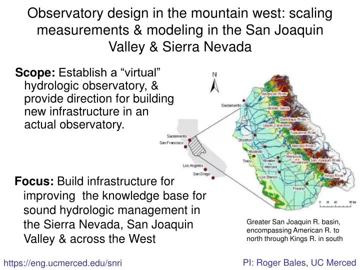
Observatory design in the mountain west: scaling measurements & modeling in the San Joaquin Valley & Sierra Nevada. Scope: Establish a “virtual” hydrologic observatory, & provide direction for building new infrastructure in an actual observatory.

E N D
Observatory design in the mountain west: scaling measurements & modeling in the San Joaquin Valley & Sierra Nevada Scope: Establish a “virtual” hydrologic observatory, & provide direction for building new infrastructure in an actual observatory. Focus: Build infrastructure for improving the knowledge base for sound hydrologic management in the Sierra Nevada, San Joaquin Valley & across the West Greater San Joaquin R. basin, encompassing American R. to north through Kings R. in south PI: Roger Bales, UC Merced https://eng.ucmerced.edu/snri
Embedded sensor network for spatial snow & meteorology NIMS payload of sensors deployed in San Joaquin R. San Joaquin virtual observatory Observatory design concept: Establish intensive measurements at ground-based instrument clusters, integrated with broad coverage offered by satellite remote sensing, plus operational networks. Science challenge: Scaling between instrument clusters is a major challenge. Basing an observatory on instrument clusters at representative points across the landscape recognizes that it is logistically infeasible to measure everything, everywhere, all the time. Instrument clusters co-locate key measurements, in order to illuminate linkages among processes within each cluster's relatively small footprint.
Specific aims Formulate basin-scale measurement & modeling strategies for priority research, through analysis of existing operational & research data Assess different instrument cluster designs to provide the ground-based measurements needed for hydrologic process research Example data Daily satellite snowpack products Streamflow, weather & snow data from operational & research networks Soil moisture & water quality data from research networks Topography, vegetation characteristics & other spatial data San Joaquin virtual observatory Merced & Tuolumne R. sub-basins are the focus for this project