No Adverse Impact Floodplain Management
400 likes | 650 Vues
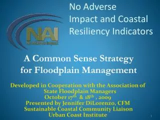
No Adverse Impact Floodplain Management. November 12, 2013 Janet Thigpen, CFM. No Adverse Impact. Developed by Association of State Floodplain Managers Purposes: Address the shortcomings of typical local floodplain management programs Provide a higher level of protection for citizens

No Adverse Impact Floodplain Management
E N D
Presentation Transcript
No Adverse ImpactFloodplain Management November 12, 2013 Janet Thigpen, CFM
No Adverse Impact • Developed by Association of State Floodplain Managers • Purposes: • Address the shortcomings of typical local floodplain management programs • Provide a higher level of protection for citizens • Prevent increased flood damage • Goes beyond federal and state programs
Central Message Even if we perfectly implement current standards, damages will increase.
No Adverse Impact Explained NAI is a concept/policy/strategy that broadens one's focus to include how changes to the built environment potentially impact other properties. • NAI broadens property rights by protecting • the property rights of those that would be • adversely impacted by the actions of others. 9
No Adverse Impact Defined Activities that could adversely impact flood damage to another property or community will be allowed only to the extent that the impacts are mitigated or have been accounted for within an adopted community-based plan. 10
Community Activities that Can Incorporate NAI: • Hazard identification • Education and outreach • Planning • Regulations and standards • Mitigation actions • Infrastructure • Emergency services
1. Hazard Identification Basic • Flood Insurance Rate Maps (FIRM) Better • Fill the data gaps • Map hazards not mapped by FEMA • Stream bank erosion • Ice jams • Debris and sediment blockage • Active River Areas • Levee-protected areas • Areas flooded if dams fail • Areas that have flooded in the past • Localized drainage problems
2. Education and Outreach Basic • Reactive - Answer questions about flood zones and development requirements Better • Proactive - Outreach projects targeting specific audiences • Key messages: • Know your flood hazards • Understand how your actions could adversely affect others • Protect your property and your neighbors’ property
3. Planning Basic Identify mapped flood zones in comprehensive plans Identify natural areas (e.g., steep slopes, wildlife habitat, forests, drinking water source areas) Identify key natural resource areas for protection in municipality's parks and open space plan.
Planning Starts with Fact-Finding Mapped flood hazard areas (and any hydrologic/hydraulic analyses) Local drainage problems Historic flooding problems Past, present, and future land use Slope of the land Rainfall amounts Creek characteristics Drainage structures (culverts, bridges, stormwater practices) Flood control structures (levees, dams)
Write Specific Policy Statements To strengthen the comprehensive plan’s role in promoting public safety, preventing flood damages, and conserving the environment, the community can include explicit statements that highlight these issues and specify what the community wants to accomplish.
Better • Coordinate with Surrounding Communities • Joint Planning or Studies • Address Watershed Functions • Characterization of water and land resources • An inventory of stresses or threats to the natural resources • Conservation and management strategies to improve or protect the watershed
Green Infrastructure Planning • Green infrastructure planning and management • Centralized Hubs • Protected open space areas • Connecting Corridors • Trail Systems • Riparian buffers
Riparian Buffers • Vegetated buffers • Stream setbacks • Native vegetation • Allowable uses • Overlay districts
Best • Floodplain management or multi-hazard mitigation plans • Plan must be adopted by the municipality in order to obtain funding under certain FEMA programs. • In adopting the hazard mitigation plan a community is committing itself to incorporating hazard mitigation activities into their comprehensive plan, zoning, capital expenditure plans, and other local land use activities.
Multi-Objective Planning • Housing • Transportation • Open Space • Utilities • Community Facilities • Economic Development • Water Supply • Stormwater Other Planning Opportunities • SEQRA and local environmental review laws • Conservation or Environmental Boards • Critical Environmental Areas
4. Regulations and Standards Basic • Local Flood Damage Prevention laws • Floodplain development requirements in Residential and Building Codes Better • Higher standards for floodplain development • Address flood hazards in land use regulations
Basic - Floodplain Development Standards Local Law for Flood Damage Prevention • References Flood Insurance Rate Maps (FIRMs) • Local permit • Proposed development must be reasonably safe from flood damage • Proposed development shall not result in physical damage to any other property
Shortcomings: Flood Hazard Maps Maps don’t account for • Increased developmentin the watershed • Ditches • Debris blockage • Larger and more frequent storms
Shortcomings: What Is the Design Storm? The northeastern US has experienced a 67% increase in very heavy precipitation events.* *National Climatic Data Center
Shortcomings: Minimum Standards Standards don’t account for • Erosion • Sediment • Safety
Better – Higher Standards for Floodplain Development • Freeboard – require higher elevation • Fill – prohibit or restrict the amount of fill • Compensatory storage – new fill must be offset by excavating floodable area • Critical facilities – prohibit or higher standards • Hazardous materials – restrict or implement standards for use, storage, and disposal • Substantial improvement – lower threshold from 50% to 30%
Better – Higher Standards for Floodplain Development • Floodways (areas where engineer must certify that project will not increase flood elevations) • Regulate entire 100-year floodplain as floodway • Require floodway analysis for large projects in “approximate floodplains” • Prohibit or limit development and re-development
Better – Higher Standards for Floodplain Development • Map additional flood hazard areas • Map dam failure inundation areas, levee-protected areas, or locations with historic flooding problems • Reference map in definition of “areas of special flood hazard” • Regulate areas beyond flood zone boundary • Apply building elevation requirements to areas where the ground elevation is within two feet above the Base Flood Elevation (100-year flood level)
Better - Land Use Regulations Zoning Requirements • Restrictions in mapped floodplain / floodway • Low density zoning • Define “appropriate uses” • Protect sensitive natural areas • Stream and shore setbacks for buildings • Require site plan review within stream buffer • Conservation zone • Overlay district for floodplain, stream corridor, erosion hazard area, or buffer zone
Better - Land Use Regulations Site Plan Review and/or Special Use Permits • Show flood zones and all existing structures • Show protection of stream corridors • Private stream crossings • Require engineering analysis • Every lot must have a building site above the flood level • Show emergency vehicle access route during a flood
Better - Land Use Regulations Subdivision Standards • Flood zones must be shown on plat • Compensatory storage must offset the loss of flood storage capacity due to fill • Protect stream corridors, wetlands, etc. • Cluster development/Conservation subdivisions
Better - Land Use Regulations Other Opportunities • Stream dumping regulations • Prohibit dumping or storage in and near streams • Stormwater management • Promote compliance with state standards • Enact higher local standards • Timber harvesting regulations • Driveway standards
5. Mitigation Actions Basic • Flood Insurance • Structural projects – levees, dams • Stormwater management • County Hazard Mitigation Plans Better • Restore natural floodplain functions • Protect individual structures • Elevation • Acquisition • Floodproofing
6. Infrastructure Basic • Repair after each flood Better • Inspect and maintain drainage systems • Improve drainage systems without transferring the problems elsewhere • Protect critical facilities • Don’t put water or sewer lines in the floodplain • Green infrastructure: streamside forests, native vegetation, grass swales, natural sheet flow, wetlands, etc.
7. Emergency Services • Flood warnings • Emergency response • Flood safety • Pre-planning of emergency operations • Inundation maps
Legal Research Defense of sovereign immunity has been greatly reduced Communities most apt to have to pay: not when they deny permit, but when development they permit causes damage to others, damage is easily predictable (which is easier to do with better computer models and technology) 41
ActionsYour Community Can Take • Evaluate your hazards and programs • Identify existing adverse impacts in the floodplain and throughout the watershed • Require adverse impacts to be mitigated when development occurs 42
CONCLUSION Current Approaches Create Future Disasters If we continue to encourage at-risk development and ignore the impact to others, can we accept the consequences… … and, are you willing to pay for it? 43
Discussion? Janet Thigpen Southern Tier Central Regional Planning & Development Board (607) 737-5271 jthigpen@co.chemung.ny.us Chelsea Robertson Southern Tier Central Regional Planning & Development Board (607) 962-5092 plan@stny.rr.com