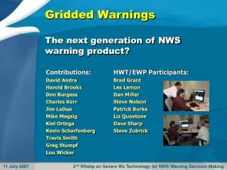
Case Study: Using GIS to Analyze NWS Warnings
Case Study: Using GIS to Analyze NWS Warnings . Ken Waters NWS Phoenix June 5, 2008. Outline. Background Process Used Applications. Background---the issue . Warngen-created warnings used in NWS offices since late 1990’s Included polygon definition latitude/longitude pairs

Case Study: Using GIS to Analyze NWS Warnings
E N D
Presentation Transcript
Case Study: Using GIS to Analyze NWS Warnings Ken Waters NWS Phoenix June 5, 2008
Outline • Background • Process Used • Applications
Background---the issue • Warngen-created warnings used in NWS offices since late 1990’s • Included polygon definition latitude/longitude pairs • Polygon information largely ignored by the agency • Polygon very often simply replicated the county boundary(ies) for the affected counties • The Challenge: begin collecting these polygons and use the information within a GIS
Background • Feb 2003: began collecting text weather warnings • Jan 2004: AMS poster session in Seattle • First display of NWS warning polygons in historical context (11 months of warnings overlayed) • Jun 2004: NWS Polygon Warning Team formed to implement polygon warnings • Late 2004: Set up real-time system to ingest warnings and create GIS shapefiles of warnings and post on PRH website
Background • 2005: Project submitted as an NWS experimental project • 2005: Experimental ArcIMS project started using Internet to dynamically display warnings with LSRs • Had problems, though, as ArcIMS wasn’t able to handle the rapidly changing shapefiles without the use of ArcSDE ($$$$)
Background • Oct 2005: Polygon Team meeting with first look at polygon warning verification • 2006: Shapefile server application migrated to national server • Oct 2007: Storm-Based Warnings (aka “Polygon Warnings”) became operational • 2008: Project to be declared operational by OCWWS (decision made in April)
Polygon Warnings -- 2008 7 days’ worth of all NWS Warngen warnings, May 29-June 4, 2008
Process • Run on a Linux server; all code done in Perl with freeware • Text warnings delivered to NWS HQ Server • Each minute warnings are collected and database updated (new warnings added, expired warnings removed)
Process • Employ the open source “Shapelib” library available for a number of operating systems Has advantage of being able to create GIS (ESRI) Shapefiles without having to purchase any proprietary software Step 1: Create polygon from lat/lon points Step 2: Load data attribute information
Process • Create Web graphics using another public domain library, “GD”
Applications---Database of historical warnings • Historical “Climatology” of Warngen warnings and official StormData reports Warning files composed of separate shapefiles for TOR, FFW, SVR, SMW, and EWW
Applications---Local Storm Reports • Processing of the Local Storm Reports (caveat emptor!) • Preliminary reports • Potential errors in time and space • Multiple reports for same phenomenon
Applications---LSR Processing • Allows quick analysis of event shortly after it occurs • Cautions: potential pitfalls with using LSRs Source: http://www.weather.gov/regsci/gis/06Apr02_Event.jpg
Applications---Polygon Verification • CAR: County Area Reduction (aka, reduction in falsely alarmed area) • Ranges from 0 to 1 with high values indicating huge reduction in area, near 0 indicating nearly same area as aggregate county area Early studies indicate a typical CAR of 0.7, or 70% reduction in area Calculated using a VBA custom code which looks up the county area for each affected county(ies) in a CSV table and compares with polygon area Source: http://www.weather.gov/regsci/gis/CAR.pdf
Applications---Polygon Verification • Initial studies of 2005 warnings and Storm Data used to estimate potential GPRA numbers for legacy verification statistics (PoD, LT, FAR) and further to set 2008+ standards for these measures Source: http://www.weather.gov/regsci/gis/2005_tor_pod.jpg
Applications---Polygon Verification • Use of Visual Basic for Applications (VBA) custom code to compute equivalent • Allowed batch processing of warnings and Storm Data reports and computing PoD by WFO Important Note: Bringing these data into a GIS and doing geoprocessing operations uncovered interesting errors in the existing official Storm Data database. For example, tornadoes reported in one county and CWA actually occurring (and scored for) another forecast office’s CWA
Applications---Monitoring Individual Polygon Warning Shapes • 7-day running archive of all individual warning shapes Warngen modifying polygon to follow land/water boundary using coarse AWIPS shapefiles (including “illegal” polygons crossing over itself) Polygon contorted due to Warngen rule not allowing SVR over water Source: http://www.weather.gov/regsci/gis/latest
Applications---Vertex Tracking • Number of vertices of warnings can vary from 3 up to the recently-imposed limit of 20 • Tracking numbers of vertices allows analysis of trends in polygon shapes
Questions? WEBSITE: http://weather.gov/regsci/gis Ken Waters Phoenix WCM Ken.waters@noaa.gov