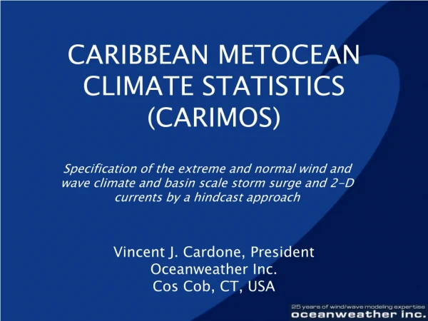
CARIBBEAN METOCEAN CLIMATE STATISTICS (CARIMOS)
630 likes | 1.06k Vues
CARIBBEAN METOCEAN CLIMATE STATISTICS (CARIMOS). Specification of the extreme and normal wind and wave climate and basin scale storm surge and 2-D currents by a hindcast approach. Vincent J. Cardone, President Oceanweather Inc. Cos Cob, CT, USA. CARIMOS Hindcast Approach.

CARIBBEAN METOCEAN CLIMATE STATISTICS (CARIMOS)
E N D
Presentation Transcript
CARIBBEAN METOCEAN CLIMATE STATISTICS (CARIMOS) Specification of the extreme and normal wind and wave climate and basin scale storm surge and 2-D currents by a hindcast approach Vincent J. Cardone, President Oceanweather Inc. Cos Cob, CT, USA
CARIMOS Hindcast Approach • Hindcast 109 tropical cyclones 1921 – 1999 • Hindcast 15-continuous years 1981 – 1995 • Winds and waves: triple nested approach to account for North Atlantic swell input, complex basin morphology, shallow water and island sheltering: 1.25°/.25°/.065° • Basin storm surge with 2D hydro model: .25°
Tropical Cyclones • NOAA National Hurricane Center HURDAT Tape. • Tropical Cyclone Deck • Aircraft Reconnaissance Data. • Annual Tropical Storm Reports and Summaries. • Published Accounts of Caribbean Storms. • Continuous Wind Fields • Northern Hemisphere Surface Analysis Final Analysis Series • NOAA Tropical Strip surface analyses • NOAA NCDC TDF-11 format ship report files • Climatological summaries • Gridded pressure fields (NCDC Global Historical Fields CD) • Global so-called WMO 1000-mb wind fields • Gridded digital products of the new NOAA NCEP Global Reanalysis Project, specifically the 6-hourly 1000 mb and 10m surface wind fields.
Hindcast Model Attributes Swell Grid GRID SWELL
Coarse Grid GRID COARSE
Fine Grid GRID FINE
Tropical Wind Model (TC96) • Diagnostic PE PBL Model • Wind field “snapshots” • Buoy/Rig comparisons show accuracy of +/- 20º in wind direction and +/- 2 m/s in wind speed • Applied in worldwide tropical basins
Tropical Model Snapshot Inputs • Speed and direction of vortex motion • Equivalent geostrophic flow of the ambient PBL pressure field in which the vortex propagates • Central Pressure • Scale radius of exponential radial pressure profile • Holland’s profile peakedness parameter
Wind WorkStation (WWS) • Graphical analysis tool for the analysis of marine surface wind fields • Blending tropical wind field into synoptic scale • Direct analysis of tropical winds
Tropical Wind Field Methodology Model Inputs Tropical Model WWS Wave Model
Aircraft Reconnaissance • North Atlantic1944 – present • Western North Pacific 1944-1986 Image Courtesy of TPC
35/50 Knot Radii Image Courtesy of JTWC
Tropical Cyclone Snap Database Input Output • Dp: 2 to 120 mb every 2 mb • Rp 5 to 120 Nmi every 4 Nmi • B 1 to 2.5 every .1 • Maximum Surface Wind • Radius of Maximum Wind • Azimuthally Averaged Wind Speed in 5 Nmi Bins • Radius of 35/50 Knots
HWind vs. Tropical Model Winds HWind TC96 Winds on Sept 15th, 2000 15GMT HWind: 37.3 m/s NHC: 45.4 m/s TC96/QuikScat: 43.3 m/s
Continuous Wind Fields • NOAA NCEP Reanalysis 10-m winds • First iteration revealed biases • Interactive Objective Kinematic Analysis(IOKA)
Validation • Tropical Cyclones – rely on extensive prior validation in tropical regimes such as Gulf of Mexico, South China Sea… • Continuous – utilize buoy and satellite altimeter measured winds and sea states
Wind and Wave Statistics for CARIMOS Operational Hindcast vs. Buoy 41018
Wind and Wave Statistics for CARIMOS Operational Hindcast vs. Altimeter Data
CARIMOS Derivative Products • Continuous Hindcast - site specific • Time series 15 years, 3-hourly • Bivariate distributions (HS-TP, HS-VMD, WS-WD) Duration/persistence distributions • Extremes • Time series in storms, hourly • Return period extremes of WS, HS, HM, HC, TP, Va, Sh 1 year to 100 years
First Spectral Moment Following Haring and Heideman (OTC 3280, 1978) the first and second moments contain powers of = 2f; thus: where dS is a variance component and the double sum extend over 552 bins. Second Spectral Moment Following Haring and Heideman (OTC 3280, 1978) the first and second moments contain powers of = 2f; thus: where dS is a variance component and the double sum extend over 552 bins. Dominant Direction Following Haring and Heideman, the dominant direction is the solution of the equations The angle is determined only to within 180 degrees. Haring and Heideman choose from the pair (, +180) the value closer to the peak direction.