Download
1 / 17
180 likes | 371 Vues
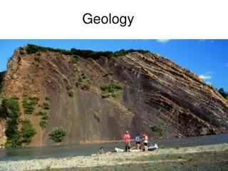
How can geology & geophysics improve brownfield recovery?. Malcolm Pye, DTI Oil & Gas Office, Aberdeen. Are the existing wells draining the field?. Where are the barriers in the field behind which oil could be trapped?. Horizontal barriers within the reservoir.

E N D
How can geology & geophysics improve brownfield recovery? Malcolm Pye, DTI Oil & Gas Office, Aberdeen
Are the existing wells draining the field? Where are the barriers in the field behind which oil could be trapped?
Horizontal barriers within the reservoir. The reservoir subdivision will have been drawn up from the static appraisal data. Review it against the dynamic data.
Massive Sands Do post-production logs and pressures show that the massive sands behave as a single flow unit?
Channel Sands Do the sands communicate between wells? What is the channel orientation?
Review the reservoir succession using sequence stratigraphy Gamma ray spikes Prograding sands Incised channels
Gamma ray spikes – are they flooding surfaces? – could they be horizontal barriers?
Prograding sands • - not a layer cake stratigraphy • - can the prograding surfaces be recognised?
Incised channels - can occur at sequence boundaries - at a scale less thanthe well spacing Downcutting Ness channels into the Etive are seen in Tern and NW Hutton
Vertical barriers in the reservoir Faults Unrecognised faults in wells may result in undrained sands.
The mapping of faults from seismic • has improved • - Higher frequency content seismic • Coherency • Pre-stack depth migration
Mapping sand bodies from seismic • using seismic attributes • - using seismic inversion
Mapping hydrocarbons from seismic • direct hydrocarbon indicators (DHIs) • - 4D seismic
Combining all this G&G data to build static 3D geological models which can be upscaled to 3D reservoir models
However, even if data is sparse geological intuition can still locate infill locations.
Possible infill locations • - attics • fault shadows • undrained compartments
So hopefully…. this talk has demonstrated how geology & geophysics can improve brownfield recovery. Now go and design some exciting new wells to recover this oil ! Thank you for listening.