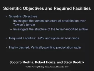
Scientific Objectives and Required Facilities
80 likes | 163 Vues
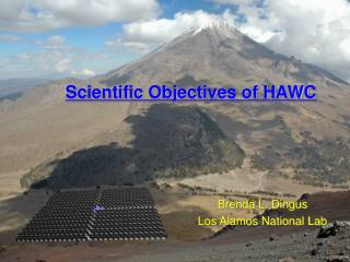
Explore the vertical precipitation structure over Taiwan's terrain & terrain-modified airflow, with required facilities S-Pol & upper-air soundings. Socorro Medina, Robert Houze, and Stacy Brodzik share insights at the TIMREX Planning Meeting in Tainan, Taiwan, on November 9, 2007, using previous field experiment results from MAP and IMPROVE-2. The study includes cross-barrier distribution of reflectivity and radar data from S-Pol sectors, offering valuable insights into the atmospheric conditions. Additional requirements include desk space for operation center personnel and internet access.

Scientific Objectives and Required Facilities
E N D
Presentation Transcript
Scientific Objectives • Investigate the vertical structure of precipitation over Taiwan’s terrain • Investigate the structure of the terrain-modified airflow • Required Facilities: S-Pol and upper-air soundings • Highly desired: Vertically-pointing precipitation radar Scientific Objectives and Required Facilities Socorro Medina, Robert Houze, and Stacy Brodzik TIMREX Planning Meeting, Tainan, Taiwan, 9 November 2007
Results from previous field experiments (MAP and IMPROVE-2) to illustrate how S-Pol sectors of RHI scans were used to accomplish similar objectives
Oregon Cascades Distance from the radar (km) Pacific Coastal R. Valley Cascades Cross-barrier distribution of time-averaged reflectivity as a function of height 3-hour mean S-Pol reflectivity (1400-1700 UTC 28 Nov 2001 ) Medina et al. (2007)
Cross-barrier distribution of S-Pol reflectivity aloft as a function of time - Maximum reflectivity (between 3-10 km) dBZ 09 30 06 20 03 10 00 0 21 -10 18 28 Nov 29 Nov Time (UTC) -20 15 12 -30 09 06 03 00 1.8 1.4 1.0 Terrain elevation (km) 0.6 Oregon Cascades 0.2 Western Oregon terrain -150 -100 50 0 50 100 150 Distance from radar (km) Pacific Coastal R. Valley Cascades Medina et al. (2007)
Alps Graupel Dry snow Wet snow S-Pol NNW Distance from the radar (km) PBL flow adjacent to the terrain and embedded convection (S-Pol data) Radial velocity (m/s) Low-level flow rising over terrain Reflectivity (dBZ) Maximum echo on top 1st peak of terrain Particle Type (frequency of occurrence) Stratiform background punctuated by graupel 07-10 UTC 20 Sep 1999 mean Rotunno and Houze (2007)
Alps S-Pol NW Distance from radar (km) Evaluation of terrain-modified PBL flows simulated by numerical mesoscale models Time-averaged observed radial velocity (m/s) (S-Pol) Time-averaged simulated radial velocity (m/s) (MESO-NH) Alps Alps Alps S-Pol NW Distance from radar (km) 08-11 UTC 21 Oct 1999 mean
Vertically pointing radar data Reflectivity (dBZ) Radial velocity (m/s) Time Houze and Medina (2005)
Other requirements • Desk space for two people in the Operation Center (OPS) or for one person at the OPS and one person at the S-Pol site (depending on how much data can be transmitted from S-Pol to OPS) • Internet access