Download
1 / 23

E N D
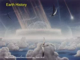
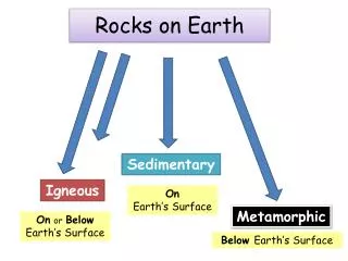
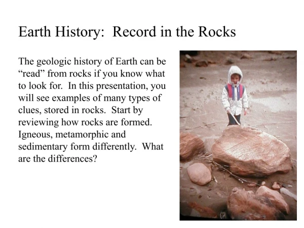
Earth History: Record in the Rocks The geologic history of Earth can be “read” from rocks if you know what to look for. In this presentation, you will see examples of many types of clues, stored in rocks. Start by reviewing how rocks are formed. Igneous, metamorphic and sedimentary form differently. What are the differences?
Sedimentary rocks form from layers of sediment that collect in horizontal layers. Over time, with pressure and chemical cementing, rocks form. Sometimes, the layers are exposed by erosion, like these canyon walls in Dinosaur National Park.
These layers near Denver, Colorado show how horizontal layers can be altered by uplift. In this case, the Rocky Mountains rose and changed these layers. Can you tell which layer is oldest? The layer that is on the far left is oldest. Rockies are over here.
Sometimes layers of sedimentary rock are twisted by earthquake faults. Split Mountain, Dinosaur National Monument
This picture shows Becks Spur which is in North Salt Lake City. The cliff is the Wasatch fault it was not made by people. When the Wasatch Fault slips the mountain rises and the valley falls. Lets walk closer: Scratches that formed as the rocks slipped by each other.
Sedimentary rocks have clues to past climates and ecosystems. These rocks were ancient sand dunes, with layers that formed at different times, at different angles, depending on which direction the wind was blowing. This is called cross-bedding and can be found all over Southern Utah.
If you have gone bike riding on the Slickrock trail in Moab, you have ridden on ancient sand dunes. What type of climate do sand dunes suggest? Desert or dry climate The trail is marked with white dots:
We can see examples of ripple marks in the sand near a river: Sam really likes ripple marks! And, fossilized ripple marks from a river long ago.
What formed these marks in an environment long ago? Worms burrowing through soft sand or mud.
What might conditions like these form? This is the edge of a river in Dinosaur National Monument.
Dinosaur footprint Did you say dinosaur footprints or other preserved remains of plants or animals? Fossils are direct clues to the past. This one was part of a series of footprints near Denver, Colorado and the circle around it is where someone attempted to cut it out of the rock and steal it. This is selfish.
Utah has lots of dinosaur fossils. These fossil skeletons are displayed at Dinosaur National Monument and show dinosaur legs a head and neck and other bones. The person has been placed in for a size comparison.
Can you find ribs, vertebrae, carbon remains from a tree trunk, a shoulder blade, and thigh bone? Tree outline Vertebrae thigh rib Shoulder blade
Igneous rocks sometimes flow upwards into cracks in other rocks. The igneous rock in this picture is light colored and has intruded into darker rock. It has a Y shape. Igneous intrusion near Denver, CO.
Can you see igneous rock in these rocks? Sometimes as the igneous rock cools, valuable minerals like gold and silver collect around the edges. They are said to form veins. Its here
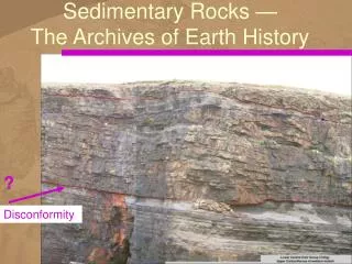
An unconformity occurs when erosion removes the top surface of land and the surface is then reburied. Can you find the unconformity in this picture? Its right here!
To interpret Earth history, a diagram called a stratigraphy is sometimes used. It uses symbols to stand for rock types and can be “decoded” if you know your Earth history. Take a look at this one and see if you can see the order that events happened. Use this key to identify the rocks: Conglomerate Sandstone Limestone Shale The limestone formed first, then sandstone, then shale. Then an earthquake faulted the rocks. The earthquake fault occurred last because the rocks had to all be there before they could be offset.
Let’s try a harder one. There are 10 steps, including the events that happened to the rocks. Do you see the unconformity? Conglomerate Sandstone Limestone Shale unconformity They are conglomerate, sandstone, limestone, sandstone, shale, erosion, limestone, sandstone, shale, erosion.
Igneous rocks “intrude” into other rocks. Because they are hot, they affect the rocks that are near them. What type of rocks are heated but not melted? Metamorphic Look at this stratigraphy and see if you can list the steps. The dark lines show contact metamorphism. Conglomerate Sandstone Limestone Shale Igneous Limestone, sandstone, igneous (volcano)
Erosion Can you label the geologic events in this picture? Shale Conglomerate Erosion Shale
Landscapes can tell us about Earth. Can you walk out of your school and see landscapes? What history do they tell?
The End. Pictures and text by Barbara Gentry