Download
1 / 35
350 likes | 429 Vues
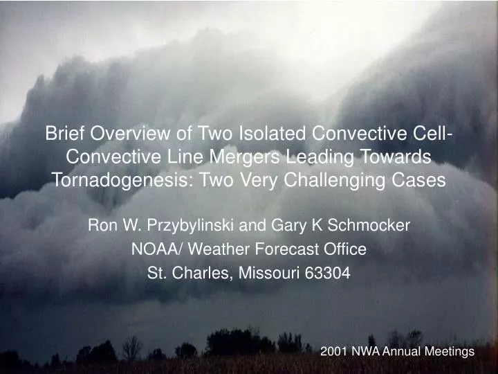
Brief Overview of Two Isolated Convective Cell-Convective Line Mergers Leading Towards Tornadogenesis: Two Very Challenging Cases. Ron W. Przybylinski and Gary K Schmocker NOAA/ Weather Forecast Office St. Charles, Missouri 63304. 2001 NWA Annual Meetings. Introduction.

E N D
Brief Overview of Two Isolated Convective Cell-Convective Line Mergers Leading Towards Tornadogenesis: Two Very Challenging Cases Ron W. Przybylinski and Gary K Schmocker NOAA/ Weather Forecast Office St. Charles, Missouri 63304 2001 NWA Annual Meetings
Introduction • Schaefer and Edwards (1999) showed that in recent years the majority of tornadoes reported across the U.S reported fall into F0 – F1 damage category.- These events are often the most difficult to warn for due to their short lifetime. • However, there are a number of efforts in the NWS to improve the forecasting and warning of tornadoes, including the weak tornadic events which cause (F0 – F1 damage). - The overall goal today is to improve our detection capabilities of those circulations which may spawn tornadoes.
- A number of studies have shown that tornadoes which cause (F0 – F1) damage are associated with either: - supercell (including mini-supercells) - or convective lines (including bowing segments embedded within a large squall line or bow echoes). - Our presentation will focus on two non-supercell tornado events which occurred across the Mid-Mississippi Valley Region (2000 spring-summer convective season). - May 26, 2000 event – 2 non-supercell tornadoes (eastern Pike - Scott counties in Illinois)- June 24, 2000 event – 1 non-supercell tornado (southwest St. Clair county Illinois) - Detail damage surveys were conducted for both events.
Both tornadic events: were quite challenging in many respects: 1. Forecasters were not expecting tornadoes to occur in either event. 2. Rapid vortex evolution was observed in both events 3. Difficulty in observing the tornadic circulations (particularly the May case) 4. Signals in the vertical wind shear, location of synoptic-scale fronts (boundaries) and overall reflectivity pattern suggested the possibility for tornadic development
Past Studies- Forbes and Wakimoto (1983) examined tornadogenesis along the leading edge of outflows associated with a bow echo over central Illinois. • Using WSR-88D radar, Przybylinski et al. 1997 and Funk et al. 1997 showed that non-supercell tornadoes occurred: 1) near the intersection of an outflow boundary – and northern part of a bowing segment 2) near or north of the apex of bowing segments. • In central Alabama, Pence et al. 1998 showed that tornadoes occurred near the southern part of the comma-head of a bow echo.
- Recently, Przybylinski et al. 2000 showed four conceptual models of the ‘Intensifying Stage’ of MCS evolution. Non-supercell tornadoes occurred in half of the events of three of the conceptual models. Tornadoes occurred near the intersection of old outflow boundaries and the larger convective line. - Trapp and Weisman 2000 were successful in simulating non-supercell tornadoes associated with Quasi-Linear Convective Systems (QLCS).
The two events: May 26, 2000 Squall line – bow echo event Surface Analysis (0200 UTC) 27 May 2000 - Warm front draped from surface low center (NW MO) southeastward into south-central Illinois. - Surface dewpoints reaching the mid 70s pooling near the warm front.
Skew-T Log-P KSGF 0000 UTC 27 May 2000 Surface-based CAPE 2512 J/Kg 0-3 km Bulk Shear = 14 m/s (Moderate Shear)Mid-level region – relatively dry – supportive of damaging winds.
WSR-88D Archive Level II Imagery from KLSX (St. Louis) - Mature squall line entering northeast and central Missouri at 0217 UTC. - Several smaller bowing segments were embedded within the larger convective line. - Band of smaller convective cells extended between Columbia and Mexico Missouri – just north of the warm front.
KLSX Reflectivity Image 0328 UTC - We focused our attention in the region of isolated cells – convective line mergers (eastern Audrain county). - Mergers occurred 20 – 30 km north of the warm frontal boundary.
KLSX Reflectivity / SRM 0333 UTC / 0.5° slice - Isolated cells intensify just prior to merger- TVS occurred in the vicinity of the merger.- Strong low-level reflectivity gradients along the western flank of the isolated cells suggest region of enhanced updrafts.
KLSX Reflectivity / SRM for 0338 UTC / 0.5° slice - Second isolated cell intensified just prior to merger. - Small vortex (Circ 1a) formed near southwest flank of the larger isolated cell. Second TVS trips. Yet no tornado or damage was noted in the vicinity of either TVS. Does the shallow stable layer north of warm front play a role?
KLSX Reflectivity / SRM 0344 UTC / 0.5° slice - Merger is completed. - However Circ 1a continued to be evident. A TVS trips a third time near the southern flank of the isolated cell – convective line merger.
KLSX 4 panel Reflectivity / SRM for 0344 UTC (Left panels 0.5° slice / right panels 1.5° slice) SRM velocity data at the lowest two slices revealedDelta-V magnitudes of Circ 1a for 0.5° slice(36 m/s) and 1.5° slice (28 m/s) respectively.
Rotational Velocity Time-Height Trace for Circ 1 - Circ 1a initially formed as a tornadocyclone- Strongest gate-to-gate shears were detected at 0344 UTC at the lowest 2 elevation slices. - Yet NO tornadic or wind damage was discovered with this vortex. (AV – aliased velocities)
KLSX Reflectivity / SRM for 0354 UTC / 1.5° slice - Band of weaker cells from southern Pike Co IL through northern Green Co IL is nearly orthogonal to the larger line.- An isolated cell within the band intensified just prior to merger.- Circ 1a, becomes a broad vortex and is located in the vicinity of the comma-head (eastern Pike Co MO). - YET - no wind damage was reported with this segment.
KLSX Reflectivity / SRM for 0359 UTC / 0.5° slice - A second (northern) bowing segment formed northeast of the first - original (southern) bow echo. - Merger is nearly complete between the isolated cell–northern BE. - A very small vortex (Circ 2) formed just southeast of the this merger (white arrow – SRM). - Wind damage occurred with the northern BE, and not the first.
KLSX Reflectivity / SRM at 0404 UTC / 0.5° slice - Northern BE showed slight acceleration compared to the southern BE. - Circ 2 intensified along the southern flank of the Northern BE. (Arrow). Core diameter remains very small (< 1.0 km)- Wind damage continued with the northern BE and not the southern BE. Yet, southern BE - more distinctive characteristics
KLSX Reflectivity / SRM at 0410 UTC / 1.5° slice - Northern BE continues to accelerate eastward. - Circ 2 located just south of the apex maintains a very small core diameter (<1.0 km) (Tornadocyclone) (Delta-V - 51 m/s ).- Circ 2 spawns a weak tornado at 0412 UTC.- A third new small vortex formed near the intersection of isolated cells and larger convective line (white arrow reflectivity).
KLSX Reflectivity / SRM at 0415 UTC / 1.5° slice - Northern bowing segment continues to mature while the southern segment looses definition.- Circ 2 remains as a tornadocyclone (Delta V - 46 m/s) - Circ 3 spawns a weak tornado at 0414 UTC. (Delta V – 43 m/s)- Circ 4 formed in the vicinity of the developing comma-head.- Very Difficult to detect C2 and C3 in real-time (core diameters)
Rotational Velocity Time-Height Trace – Circ 2 - Circ 2 initially formed as a tornadocyclone exhibiting ‘non-descending characteristics.- Gate-to-gate shears were detected throughout the circulation’s lifespan. - Tornadogenesis occurred just after period of strongest gate-to-gate shears and upward vortex growth.
Rotational Velocity Time-Height Trace - Circ 3 • Gate-to-gate shears were detected throughout much of Circulation’s 3 lifespan. - Tornadogenesis occurred near the time of strongest gate-to-gate shears (Delta V - 59 m/s - 0414 UTC).
Damage map shows the tracks of the two weak tornadoesover far eastern Pike county and western Scott countyIllinois. Squall line positions are every 30 minutes.
June 24, 2000 Tornadic Event Surface analysis for 2000 UTC 24 June 00(Closest to time to tornado occurrence) - Weak surface trough extended south from a surface low over west-central Illinois through south-central Missouri.- Surface dewpoints ranged from the low to mid 70s across the Mid-Mississippi Valley.
KLSX VWP for 1930 UTC 24 June 2000 - 0 - 3 km SR Helicity - 127 m2/s2
KLSX Reflectivity at 1900 UTC / 0.5° slice - Small convective cells were scattered across much of the St. Louis area. - The strongest storms were located just south of KLSX radar site over southwest St. Louis and northern Jefferson counties.
KLSX Reflectivity / SRM at 1910 UTC / 0.5° slice - Dashed lines (reflectivity) show location of probable outflow boundaries generated by weaker convection over SW Illinois.- Outbound velocities southeast of KLSX (dashed line – SRM) show the leading edge of the small MCS’s outflow.- Several small weak vortices observed near northern and southern parts of convective cluster (Circ’s 1 and 3).
KLSX Reflectivity / SRM for 1915 UTC / 0.5° slice - Small MCS developed into a bow echo- Small isolated cell, probably anchored to the outflow boundary, formed rapidly east of the small bowing segment.Difficult to identify in real time with other nearby convection.- SRM velocity continued to show the leading edge of the convective-scale outflow and zone of convergence.
KLSX Reflectivity / SRM for 1926 UTC / 1.5° slice • Merger is nearly completed. - Circ 3 begins to deepen and intensify near the southern flank of the merger. - Circ 3 exhibited a nearly symmetrical velocity structure at low-levels.
KLSX Reflectivity / SRM for 1936 UTC / 1.5° slice - Circ 3 further intensifies, deepens and redistributes the reflectivity field creating an inflow notch (white arrow – reflectivity). Rotational Velocities at 1.5° - 16 m/s.- Circ 3 spawns a tornado at this time over far southwest St. Clair county.
KLSX Reflectivity / SRM for 1941 UTC / 1.5° slice - The tornado remains embedded along the eastern flank of line segment’s 50 dBZ reflectivity core.- The overall tornadic vortex exhibited a symmetric structure with the strongest cyclonic shears below 3 km. - Rotational Velocities at 1.5° - 16 m/s
Rotational Velocity (Vr) Time-Height trace for Circ 3 - Circ 3’s Vr trace initially showed weak rotation.- The vortex rapidly intensified within the lowest 2 km just after isolated cell – convective line merger (1921 UTC).- Circ 3 revealed ‘non-descending characteristics’ (upward growth) til the time of tornado touchdown. - The strong rotation remained with the lowest 3.5 km during the time of tornado – very consistent with previous observations.
Conclusions:- Two challenging tornadic cases which occurred during the spring 2000 convective season were shown. - May 26, 2000 case showed that tornadocyclones formed after the time of isolated cell convective line merger 30 to 50 km north of a synoptic warm frontal boundary.- Due to the very small core diameters, forecasters experienced difficulty in identifying these tornadic vortices. - However, the overall reflectivity pattern (isolated cell convective line mergers) gave forecasters clues to the to the location of potential circulation development.
Conclusions cont’- June 24, 2000 case showed that a weak circulation rapidly intensified after an isolated cell merged with a small bow echo. - Tornadic vortices revealed non-descending characteristics prior to tornado touchdown in both cases. - Schaefer and Edwards have shown that F0 and F1 tornado events are the majority of events observed today.- We need to investigate more MCS events like the cases shown if we are to improve our scores for tornado warnings. Check us out at: www.crh.noaa.gov/lsx/science.htm