Download
1 / 24
240 likes | 395 Vues
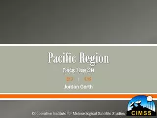
Pacific Region Tuesday, 3 June 2014. Jordan Gerth. Cooperative Institute for Meteorological Satellite Studies. Background of Satellite Liaison Position. Where is the Satellite Liaison located? CIMSS, University of Wisconsin Supports NWS Alaska Region and NWS Pacific Region

E N D
Pacific RegionTuesday, 3 June 2014 Jordan Gerth Cooperative Institute for Meteorological Satellite Studies
Background of Satellite Liaison Position • Where is the Satellite Liaison located? • CIMSS, University of Wisconsin • Supports NWS Alaska Region and NWS Pacific Region • How long has the Satellite Liaison been in current position? • 5 months (unofficial) • Which NWS forecasters does the Satellite Liaison work with? • NWS Milwaukee, NWS Fairbanks, NWS Anchorage, NWS Honolulu
Satellite Liaison Training Part I
What formal/informal training has the satellite liaison received since they have been in the position? • None • All liaisons should have the opportunity to participate in DLOC within the first year of their employment.
Share Best Practices Part II
How has the satellite liaison prepared/trained their specific users for GOES-R/JPSS imagery/products? From the training provided, what worked well and what did not work well? • Formal training should: • Be presented in person or have associated audio • Contain regionally-relevant examples • Focus on the strengths and weaknesses as to how it would be used in operations • Emphasize “how the product is useful in an operational setting” instead of “how the product is created” • Articulate how the new capability/product improves from what is available currently for the forecast challenge • Formal training should be supplemented with: • One page summary with “need to know” information • “Just in time” training containing examples of recent events • Blogs
How does the satellite liaison feel the user community should prepare and train for GOES-R/JPSS? • ABI WES case • COMET courses • DLOC-style course • Identification of satellite focal point at each office
How has the satellite liaison worked with product/algorithm developers to ensure the O2R-R2O loop is created/closed? • Visits from product/algorithm developers are critical to the success of the Pacific Region Visiting Scientist Program • The success of the VSP depends on: • Adequate planning • Products and algorithms which add value • Focused, one-on-one interactions with willing forecasters so that the VSP participant identifies forecast challenges and understands how the forecaster will use the demonstrated product/algorithm • Assuring that the forecaster understands the product and how to adequately apply it in an operational setting • The product/algorithm must be consistent and reliable • Ensuring that an adequate in-house test period exists before the product/algorithm developer transitions the product/algorithm to a field demonstration, and that the operational software displays it accurately • A follow-up visit or subsequent communication following changes to the product/algorithm
What is the biggest success/accomplishment that the satellite liaison has had to date? Please explain. • First VSP participants in May 2014 from SPoRT successfully introduced QPE to forecasters • AWIPS II enhancements • Multi-source RGB imagery (e.g., gridded, satellite) • NUCAPS plan view imagery (under development) • Contributed to ProbSevere plug-in development demonstrated in the 2014 Hazardous Weather Testbed • Planning for 2014 JPSS OCONUS meeting in Honolulu • Developing one-page fact sheets for each of the ABI bands (one band per month starting this fall) • Engaged with Tim Schmit and the NOAT on a number of issues related to Mode 3 vs. Mode 4 and CONUS sector position • Working on scheduling exploratory scan strategies
AWIPS II Gridded RGB ExampleDeveloped capability for gridded data display as an RGB
AWIPS II Gridded RGB ExampleDeveloped capability for gridded data display as an RGB
AWIPS II Gridded RGB ExampleSimulated imagery project with Brad Pierce, Kaba Bah
AWIPS II NUCAPS SoundingsClick to load capability exists for individual points
AWIPS II NUCAPS SoundingsPlan to render individual soundings into plan view
What is the biggest challenge that the satellite liaison has had to date? Please explain. • Coping with distance between CIMSS and OCONUS • Travel considerations • Flights between Madison and Honolulu are over 12 hours one way • Two days “lost” to travel with every trip • Based on current schedule, I will “lose” over two weeks to travel in a year • Inability to quickly visit OCONUS • Staggered work hours to better interact with NWS Pacific Region • Overcoming barriers to access AWIPS II training, support, and baseline code releases (including contributing code to the baseline) • Obtaining and retaining Common Access Card for access to operational AWIPS workstations and supporting remote sites
Should the satellite liaison position be transitioned into SMEs, and if so, why? • Part of the satellite liaison role should be to serve as a subject-matter expert or focal point for operational satellite meteorology, but that should not be the only role. • Satellite liaisons should be well-rounded, with these four primary qualities: • Advocacy (promoting the use of the satellites amongst forecasters and NWS management in solving specific forecast challenges) • Expertise(educating forecasters about satellite meteorology and advising the NOAT about their experiences with the forecast staff) • Scientific thought (envisioning the evolution of the forecast process and the capabilities of the next-generation satellites in contributing to that process) • Technical skill (understanding the antenna ingest systems and operational software packages to support their host organization and partnering cooperative institutes) • Satellite liaisons should engage in organic techniques development based on the evolving satellite requirements of their host organization.
How can the satellite liaison position build beyond the current responsibilities of organizing algorithms, providing training, and supporting the development/refinement of products/algorithms? • Satellite liaisons should: • Build a core satellite meteorology competency among the forecasters at their host organization, or participating in their testbed, though various training methods previously identified by the NOAT • Coordinate and demonstrate utility of new products resulting from risk reduction proposals • Facilitate and prioritize the transition of products to operations following a successful demonstration period • Conduct research and develop satellite products that enhance the service quality of their host organization • Serve as a technical point of contact for antenna ingest systems and operational software packages (e.g., AWIPS) • Routinely collect feedback and interact with forecasters about satellite imagery and products • Assist with planning subsequent satellite missions or changes to the existing mission (e.g., scan sectors, strategies, etc.)
How can the satellite liaison positions be maintained and retained in order to avoid turnover? • Closer management of individual liaisons • A new federal hire with a strong satellite meteorology background and leadership qualities to interface between the NOAT, program management, and liaisons • Clearly identified annual objectives for liaisons, and an annual review of liaison efforts in accomplishing those objectives • Transition toward federal positions • Two primary benefits: • Decrease concerns about lack of funding • Progressive compensation structure consummate with experience • Identify opportunities for advancement • No clear path for a liaison to climb the career ladder without a lateral into federal service • Supplemental funding to conduct independent research • Could compensate collaborating scientists
STAR metrics • Possible application to satellite liaisons: • New or improved products developed • Products or techniques transitioned from research to operational environment • # of training sessions in satellite applications • # of new satellite training courses • # of Interactions with Minority Serving Institutions • # of jointly funded projects with NOAA CI personnel • Publications
Questions? Comments? Logo coming soon Jordan.Gerth@noaa.gov