Download
1 / 23
250 likes | 291 Vues
This paper analyzes methods for estimating yields, watershed models, and generalities of hydrological concepts. Key topics include water resources, environmental management, climate, and weather conditions.

E N D
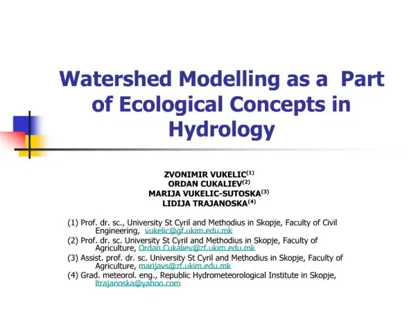
Watershed Modelling as a Part of Ecological Concepts in Hydrology ZVONIMIR VUKELIC(1) ORDAN CUKALIEV(2) MARIJA VUKELIC-SUTOSKA(3) LIDIJA TRAJANOSKA(4) (1) Prof. dr. sc., University St Cyril and Methodius in Skopje, Faculty of Civil Engineering, vukelic@gf.ukim.edu.mk (2) Prof. dr. sc. University St Cyril and Methodius in Skopje, Faculty of Agriculture, Ordan.Cukaliev@zf.ukim.edu.mk (3) Assist. prof. dr. sc. University St Cyril and Methodius in Skopje, Faculty of Agriculture, marijavs@zf.ukim.edu.mk (4) Grad. meteorol. eng., Republic Hydrometeorological Institute in Skopje, ltrajanoska@yahoo.com
In this paper are analysed methods for estimating yields, event versus continuous models (empirical model, linear system transfer functions, explicit moisture accounting model-conceptual, physical process model) and generalities of watershed models (hydrodynamics and water quality of land surface runoff, groundwater and freshwater hydrodynamics and water). Key words: ecological concepts, geologic investigations, information systems, watershed modeling, watershed yield
1. WATER TENTATIVE LIST OF TOPICS 1.1 Water and energy resources 1.1.1 Future projections of demands and challenges to technological management 1.2 Physical and chemical properties 1.3 The hydrologic cycle as a natural water purification process 1.4 The energy balans/hydrometeorology 1.5 Hydrological and meteorological parameters monitoring
1. WATER (cont…)TENTATIVE LIST OF TOPICS 1.6 General circulation of the atmosphere 1.7 Climatology and weather 1.7.1 Forecasting of climate and weather conditions 1.7.2 Regional and global weather information system 1.7.3 Extreme events: droughts and severity, etc. 1.7.4 Regional and international organizations and their activities 1.7.5 Operational GIS for resource inventories, weather and early warning forecasting of extremities, which affect food production
2. WATER RESOURCES AND ENVIRONMENTAL MANAGEMENT 2.1 Definitions 2.2 The holistic integrated approach in defining the system 2.3 The conventional approach in development and management 2.4 Integrated water resources and environmental systems planning 2.5 Issues and problems in holistic planning and management
2. WATER RESOURCES AND ENVIRONMENTAL MANAGEMENT (cont…) 2.6 Water resources and environmental policies and legislation 2.6.1 Monitoring and data management 2.6.2 Public education and awareness 2.6.3 Empowerment of people 2.6.4 Enforcement of legislative and policy provisions 2.6.5 Remediation and treatment of wastes in water and soils 2.6.6 Recycling
2. WATER RESOURCES AND ENVIRONMENTAL MANAGEMENT (cont…) 2.7 Institutional frame work for policy implementation 2.7.1 Water law, legislation, cultural attributes and rights 2.7.2 Regulatory systems and enforcement provisions 2.7,3 Public awareness and education 2.7.4 Role of the private sector, government and NGO’s 2.7.5 Endowments for research and development 2.7.6 Administrative structure and mandates 2.7.7 Shared resources, protection from degradation and dispute resolution
3. PARTICULAR PROCESSES IN THE WATERSHED The problem of hydrologic evaluation calls for an understanding of the particular processes which are operating in the watershed. Physical watershed characteristics or meteorological processes, which affect runoff, vary by sections of one country and even by the seasons of the year. For example, when direct runoff from general rainfall in the flood-producing factor, the Soil Conservation Service’s (SCS) Hydrology Handbook describes a procedure which may be used.
3. PARTICULAR PROCESSES IN THE WATERSHED (cont…) The following steps may be taken as a part of the work plan hydrologic investigations: • Analysis of available meteorological and hydrologic data, • Surveyers to collect information of stream reaches, channel capacities, and other hydraulic characteristics including structural data for evaluation purposes, • Determination of the hydrologic conditions of the water shed taking into consideration soils, land use, topography, cover, geology, and erosion, • Determination of rainfall-runoff relationships and frequency of occurances of hydrologic events, • Determination of peak discharges under conditions which will exist due to: land-treatment measures, floodwater-retarding structures, etc., agricultural water development, etc.
Estimates of storm runoff volume, for example, are used as a point of departure in the prediction of storm flow peaks. This task is a frequent endeavor in hydrologic engineering and watershed management. A standardized procedure for the estimation of storm runoff volume as a function of storm volume and land condition has been established by the U. S. Department of Agriculture. 3. PARTICULAR PROCESSES IN THE WATERSHED (cont…)
During the International Workshop held in Washington, DC, USA, 1993, one of the Work Group Recommendations were: Group for Minimum data Elements for an International Data Bank that Would Meet Local and Multinational Needs ( Jea-Marc Faures, Sung Wong, Jung Sung Kim, Peter Gravesen, Frank Hodgson, Charles Morgan, Zelda Chapmen Bailey) and the Group gave the corresponding recommendations. 4. DEVELOPMENT OF WATER-RELATED INFORMATION SYSTEMS
The Group for Mechanism Such as an International Clearinghouse of Hydrogeological Information and How Should Such a Clearinghouse Be Implemented and Administrated (Ed Ongley, Zvonimir Vukelic, Jan-Anne Boswinkel, P. Nieuwenhuysen, Alan Hustard, Jane Thurman, Ashok Shahane) gave also some recommendations. The recommendations of groups are in the paper. 4. DEVELOPMENT OF WATER-RELATED INFORMATION SYSTEMS (cont…)
Purpose and scope are in procedures and methods for conducting geologic investigations related to sedimentation, engineering geology, and ground water for work plan development. Nature and occurrence of sediment and erosion damage implies the processes of erosion, entrainment, transportation, and deposition of sediment Water erosion is of most concern in watershed planning work. 5. GEOLOGIC INVESTIGATIONS FOR WATERSHED PLANNING
5. GEOLOGIC INVESTIGATIONS FOR WATERSHED PLANNING (cont…) Regarding the sedimentation it is of interest to analyse the following topics: • Sediment damage • Erosion damage • Flood plain damage surveys • Types of deposits • Association of the genetic types of deposits • Field procedure for determining flood-plain damages • Detailed sedimentation investigations • Deposition on flood plains
5. GEOLOGIC INVESTIGATIONS FOR WATERSHED PLANNING (cont…) In Figure (1) is shown one case of flood plain damage survey. Groundwater investigations in work plan development deal with the occurrence, development, replenishment and management of groundwater. Regarding the Geological Investigations for Structural Works of Improvement, the geologist also conducts investigations to obtain geologic information needed for the design and construction of structural improvements: site selection, preliminary site investigation, detailed site investigation, geologic investigations for channel improvements, geologic investigations of other Engineering works of improvement, intensity of investigations
6. WATERSHED YIELD AND WATERSHED MODELLING The water yield of a watershed, by years or seasons or months, is used in the planning and design of some watershed projects, especially those involving irrigation. The hydrologist supplies estimates of these yields, as required, or supplies methods adapted to specific local conditions by which others may make the estimates. In practice, the primary factors that can ordinarily be considered for ungaged streams are: (1) streamflow on nearby watersheds, (2) precipitation, (3) hydrologic soil-cover complexes, (4) evapotranspiration, (5) temperature, (6) transmission losses, and (7) base flow accretions.
6. WATERSHED YIELD AND WATERSHED MODELLING (cont…) Methods for Estimating Yields are: (a) Regional analysis (b) Water accounting (c) Direct runoff method, and (d) Climatic and geographic factors. Hydrologic simulation models use mathematical equations to calculate results like runoff volume or peak flow. These models can be classified as either theoretical or empirical models. A theoretical model includes a set of general laws or theoretical principles. A simplified spectrum of mathematical watershed models is shown in Figure (2).
6. WATERSHED YIELD AND WATERSHED MODELLING (cont…) For simulation with the HSPF, the basin has to be represented in terms of land segments and reaches/reservoirs. The SHE model from the Danish Hydraulic Institute is a deterministic, distributed and physically based modeling system for simulation of all the major hydrological processes of the land phase of the hydrological cycle. HEC-1 can stimulate the hydrologic processes during flood events. While primarily for looking at unsteady flow in riverine system, the preceding hydrologic studies also include it as a program capable of watershed modeling. Other programs commonly used for this purpose include: MITCAT, SWMM, ILLUDAD, STORM, USGS, DWOPER, etc., for which information is available from NTIS (US National Technical Information Services) or the US EPA.
CONCLUSION The problem of hydrologic evaluation calls for an understanding of the particular hydrologic processes which are operating in the watershed under study. Since so many factors enter into the estimating of watershed yields, and since both the relative importance and quantitative influences of some factors are nearly always unknown, estimates of yield should be conservative, according to the use they will have. The planners and designers who will use the yield estimates will be best able to state the direction and degree of conservative required. Regarding the generalities of watershed models catchment models may include all or some of the following capabilities: model the hydrodynamics and water quality of land surface runoff, model the groundwater, and model the freshwater hydrodynamics and water quality. The first step is to define the problem and determine what information is needed and what questions need to be answered, use the simplest method that will yield adequate accuracy, and do not forget the assumption underlying the model used and do not read more significance into the simulation results than is actually there.
ACKNOWLEDGEMENTS The comments of Chadwick, J., M., Hawkins, R., Kiely, G., Srebrenovic, D., Vukovic, Z. and ladies, gentlemen and colleagues from Agricultural Research Service in Washington, D.C., Croatian Waters in Zagreb, Geological Survey (USDI) in Washington, D.C., Handbook on Methods of Hydrologic Analysis in Washington, D.C., International Hydrological Programme, IAH, PIANC, Program Aqua and Natura, SCS, and UNESCO on earlier draft of this paper are gratefully acknowledged.