Download
1 / 11
110 likes | 298 Vues
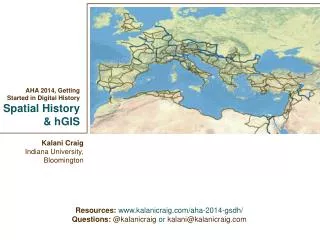
AHA 2014, Getting Started in Digital History Spatial History & hGIS. Kalani Craig Indiana University, Bloomington. Resources: www.kalanicraig.com /aha-2014-gsdh / Questions: @ kalanicraig or kalani@kalanicraig.com. The “spatial turn”. Geographic Information Systems

E N D
AHA 2014, Getting Started in Digital HistorySpatial History & hGIS Kalani Craig Indiana University, Bloomington Resources:www.kalanicraig.com/aha-2014-gsdh/ Questions: @kalanicraigorkalani@kalanicraig.com
The “spatial turn” • Geographic Information Systems • the gathering, communicating and analysis of information that is created when you put attributes (population, etc.) into a geospatially referenced space (“onto a map”) • The “h” in hGIS • Axis 1: Attribute • Axis 2: Georeference • Axis 3: Time • The “I” in hGIS • Insights into, and links to, the information BEHIND the map. • The “S” in hGIS • Where are you getting your data? Where are you storing it? How will you present it?
hGIS concerns • Neogeography& webmappingvs GIS • Maps vs cartograms • Modern maps vs historical maps
GIS technical vocabulary • Vector data • points, lines and areas • Attribute data • statistical & other information mapped to vector data • Shapefiles & KML • Formats in which vector data and attribute data combine to create map overlays • Shapefile: single vector data type per file • KML: multiple vector data types per file • Layers • Which KML/shapefiles are showing and in what order?
Spatial history in the classroom The Object • Provide context for—and a better understanding of—medieval sources by recalibrating perceptions of distance and geography in the medieval Mediterranean A classroom example • IbnShaddad’s Third-Crusade world Digital tool • Stanford ORBIS • Rejected tools: Digital Atlas of Roman Civilization, Google maps
Curating & researching with spatial history • US Census bureau • http://www.census.gov/history/www/reference/maps/population_distribution_over_time.html • New York City GIS project • http://www.nypl.org/blog/2012/06/13/nyc-historical-gis-project • I am it, and it is I (Lovecraft in Providence) • http://lovecraft.neatline.org/neatline-exhibits/show/lovecraft-in-providence/fullscreen • The Age of Exploration: Digital Maps Collection • http://exploration.uoregon.edu • Property Values & Tinker Locations • http://www.stanford.edu/group/spatialhistory/cgi-bin/site/viz.php?id=15&