Download
1 / 48
480 likes | 659 Vues
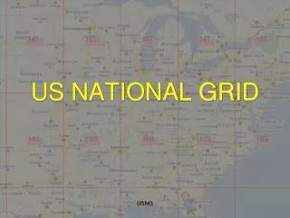
Incorporating the US National Grid into Map Products. Randy Knippel Dakota County. United States National Grid (USNG). National standard since 2001 Adopted by federal agencies FEMA, DHS, NGA, USGS Adopted by several states Florida, Missouri, North Carolina, others

E N D
Incorporating the US National Grid into Map Products Randy Knippel Dakota County
United States National Grid(USNG) • National standard since 2001 • Adopted by federal agencies • FEMA, DHS, NGA, USGS • Adopted by several states • Florida, Missouri, North Carolina, others • Minnesota (March 25, 2009) • Military Grid Referencing System • Interoperable with UTM
10 Km Squares USNG:15T VK 75 UTM: Zone 15 N 470,000 E 4,950,000 N
1 Km Squares USNG:15T VK 7857 UTM: Zone 15 N 478,000 E 4,957,000 N
Why? • Multiple grids • Needed one for everyone • Need efficient location referencing • Need interoperability • Across jurisdictions • Local, state, federal, military
What about Lat / Long? • Not intuitive • Degrees, minutes, seconds • Several formats • DMS, DMS.sss, DM.mmm, D.ddd • Longitude • + / - • West / east • Increases right to left
What about Lat / Long? • How big is a degree? • It varies • 69 miles at the equator • Longitude gets smaller toward poles • 50 miles in Dakota County • Distance calculations are difficult
Scalable National Regional Local
Precision and Truncation • 18SUJ2337106519 • 18S UJ 23371 06519 • 1 meter precision, full USNG designation • UJ2306 • Assume GZD (18S) • UJ – 100,000 m precision (100 km square) • 23 06 – 1000 m precision (1 km square) • 2337 0651 • 10 m precision • Assume GZD and 100 km square
Truncating GZD • USNG:15T VK (100Km square) • VK is unique for 800 miles in any direction
Critical Infrastructure Key Resources Vulnerable Population
GIS For Emergency Management • Status • Resource deployment • Damage assessment Recovery Response Mitigation Preparation • Analysis • Planning
Street Index Dana Dr.
MapVK75 7456
Map7456(15T VK 74 56) 741565(15T VK 741 565)
Deployment • Maps and map books on the web • Printed maps and map books • Strategic distribution • Train the trainer • Training • Dispatch
Red River Flood 100K 10K 1K
Statewide Effort • Create 10K maps for entire state • FGDC CAP grant • Structures & data stewardship • Engage locals to verify data • Develop data, templates, procedures • File naming convention
Merge PDF’s • For each USNG pdf file in the overlay directory: • Find the corresponding USNG pdf file in the basemap directory • Merge the overlay pdf and legend pdf file into the basemap pdf • Write the output pdf to a new directory using a date / time stamp
Merge PDF’s • Adobe Acrobat – Standard Edition • Watermark (with transparency!) • Adobe Acrobat – Pro Edition • Scripting • Python Scripting • PyPDF • Batch processing • Others…
Python Script Using PyPDF from pyPdf import PdfFileWriter, PdfFileReader output = PdfFileWriter() basemap = PdfFileReader(file("basemap\15TVK85.pdf", "rb")) overlay = PdfFileReader(file("event1\15TVK85.pdf", "rb")) legend = PdfFileReader(file("event1\legend.pdf", "rb")) result = input1.getPage(0) result.mergePage(overlay.getPage(0)) result.mergePage(legend.getPage(0)) output.addPage(result) output.write(file("200912081322\15TVK85.pdf", "wb")) outputStream.close()
We Need Your Help! • Study USNG standard and materials • Provide peer review • USNG data • Field names • Template MXD’s • 10K maps • Develop standard procedures & scripts • Sell it!